Four days of potentially violent storms for eastern Australia
Dangerously stormy days lie ahead for eastern Australia throughout much of the working week, with the potential for some storms to bring damaging wind gusts and possible flash flooding.
The coming stormy weather follows a weekend during which many parts of eastern Australia experienced widespread heavy rainfall totals over a short time period, including:
- 72.2mm at Mt Ginini in the ACT, the heaviest fall at the weather station at the crest of the Brindabella Range on the NSW/ACT border since 2021. Most of the rain fell in an intense two-hour burst around twilight on Saturday
- Melbourne had 31mm to 9 am Monday, with around 20mm of that falling within a space of about 15 minutes just after midday on Sunday.
- Parts of northeastern Tasmania saw between 50mm and 100mm to 9am Monday, with the rain falling in a series of heavy downpours throughout Sunday morning and afternoon.
- The Gold Coast copped 100mm to 9am Monday at the Gold Coast Seaway weather station, and while rain fell quite steadily throughout the day, there were periods of intense downpours, such as when 31.6mm fell in the half hour after 10am Sunday.
- Tweed Heads (Duranbah), on the NSW side of the Qld/NSW border, also topped the century mark to 9am Monday, with 102mm.

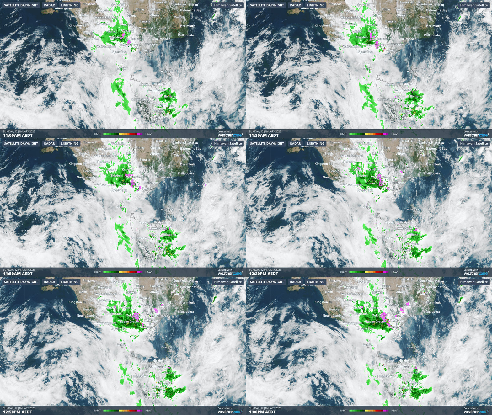
Image: Two-hour loop of rain and storms over Victoria and Tasmania from 11 am to 1 pm AEDT Sunday, January 12, 2025.
While the weekend’s storms and heavy rainfall were caused by troughs associated with a broad area of low pressure across southeastern Australia, this week's coming storms will have another meteorological element added to the mix: stronger steering winds.
- Steering winds are winds at an elevation of about 3000 metres which direct the movement of weather systems.
- As steering winds from the west pick up at mid-levels of the atmosphere this week, the extra energy and wind shear will likely make storms more severe as the next trough moves through.
Storms are possible across a broad area of the southeast from Monday onwards, but the period from Wednesday afternoon into Thursday morning looks like the most dangerous period – including large population centres like Sydney, Melbourne and Canberra.

Image: The stormiest time in the east will likely be Wednesday afternoon into Thursday morning.
We'll keep you updated as the week unfolds and please check our warnings page for the latest.