
Flurry of cold fronts slamming WA
A wintry mix of rain, thunderstorms, blustery winds and low temperatures will affect southwestern Australia during the next 2-3 days.
A complex area of low pressure passing to the south of WA will cause a series of cold fronts to barrel across the state’s southwestern districts during the first half of this week.
The sequence of satellite images below shows two cold fronts approaching and then passing over southwestern Australia on Sunday and Monday.
These systems delivered widespread falls of 30-50mm across the state’s Lower West and South West districts, including 44.6mm at Perth and 50mm at Bickley during the 24 hours to 9am on Monday. This was Perth’s second wettest day so far this year and its wettest July day in 20 years.
Damaging winds were also recorded in the southwest on Monday morning, with gusts reaching 120 km/h at Cape Leeuwin, 96 km/h at Busselton Jetty and 95 km/h at Cape Naturaliste between 1am and 4am.
Showers will continue to pepper WA’s Southwest Land Division on Monday, with dangerous winds and waves also affecting some areas in the wake of the front.
As of 11am WST on Monday, a severe weather warning was in place for damaging winds and damaging surf along the southwest coast between about Bunbury and Albany.
Conditions will then ease briefly on Monday night into Tuesday morning, before another strong cold front arrives on Tuesday afternoon and evening.
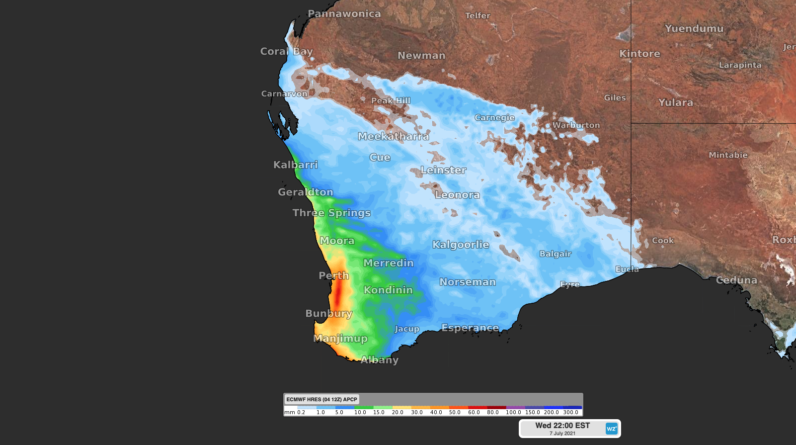
Image: Forecast three-day accumulated rain between Monday and Wednesday, according to the ECMWF model.
This front will bring another round of rain, storms, damaging winds and dangerous surf in the state’s west and southwest.
Check the latest severe weather warnings for the most up-to-date information over the next few days.