Floods and heatwave hitting Queensland
Queensland will experience a contrasting combination of flooding and a heatwave over the next few days as inland heat continues to bake the state’s west and a deep layer of tropical moisture dumps heavy rain in the east.
Heatwave in western Queensland
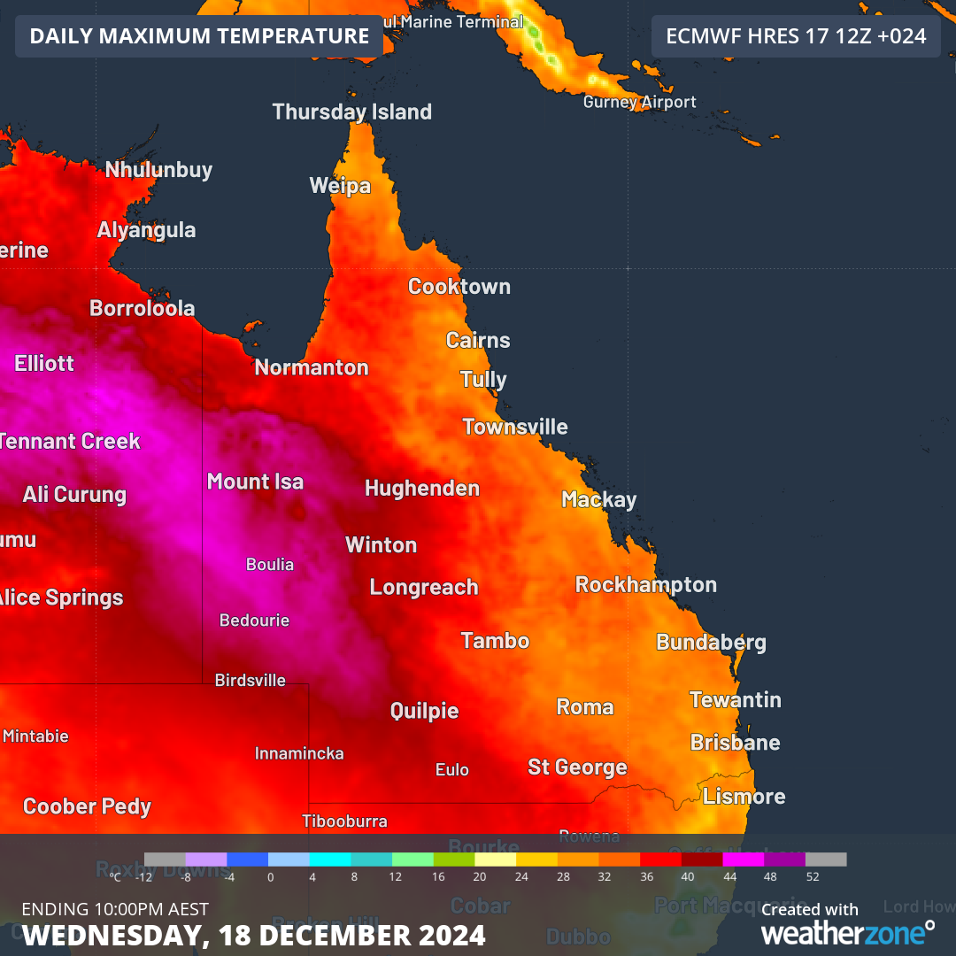
An intense burst of early-summer heat has sent temperatures soaring across western Qld over the last few days. Birdsville, Bedourie and Urandangi all hit 46°C on Monday and a few places in the west reached 45°C again on Tuesday. These were some of the highest temperatures observed in Qld during 2024.
While temperatures have now backed off from earlier in the week, the mercury is still expected to exceed 40°C in western Qld each day for the rest of this week.

Image: Forecast maximum temperature on Wednesday, December 18.
This lingering heat will allow heatwave conditions to persist over parts of western and southern Qld between now and at least Sunday. It will also contribute to high fire danger in some areas of western Qld from Wednesday to Friday.
Flooding in eastern Queensland
While western Qld has been enduring intense heat over the last few days, the state’s east has been much cooler and wetter.
Rain and thunderstorms have drenched eastern Qld throughout the first half of this week as onshore winds fed moisture into a low pressure system and associated trough. The heaviest falls from the past week have targeted the state’s southeast, where some places received more than 200mm.
With this onshore flow forecast to persist for the rest of this week, eastern Qld can expect to see more wet and stormy weather in the coming days.
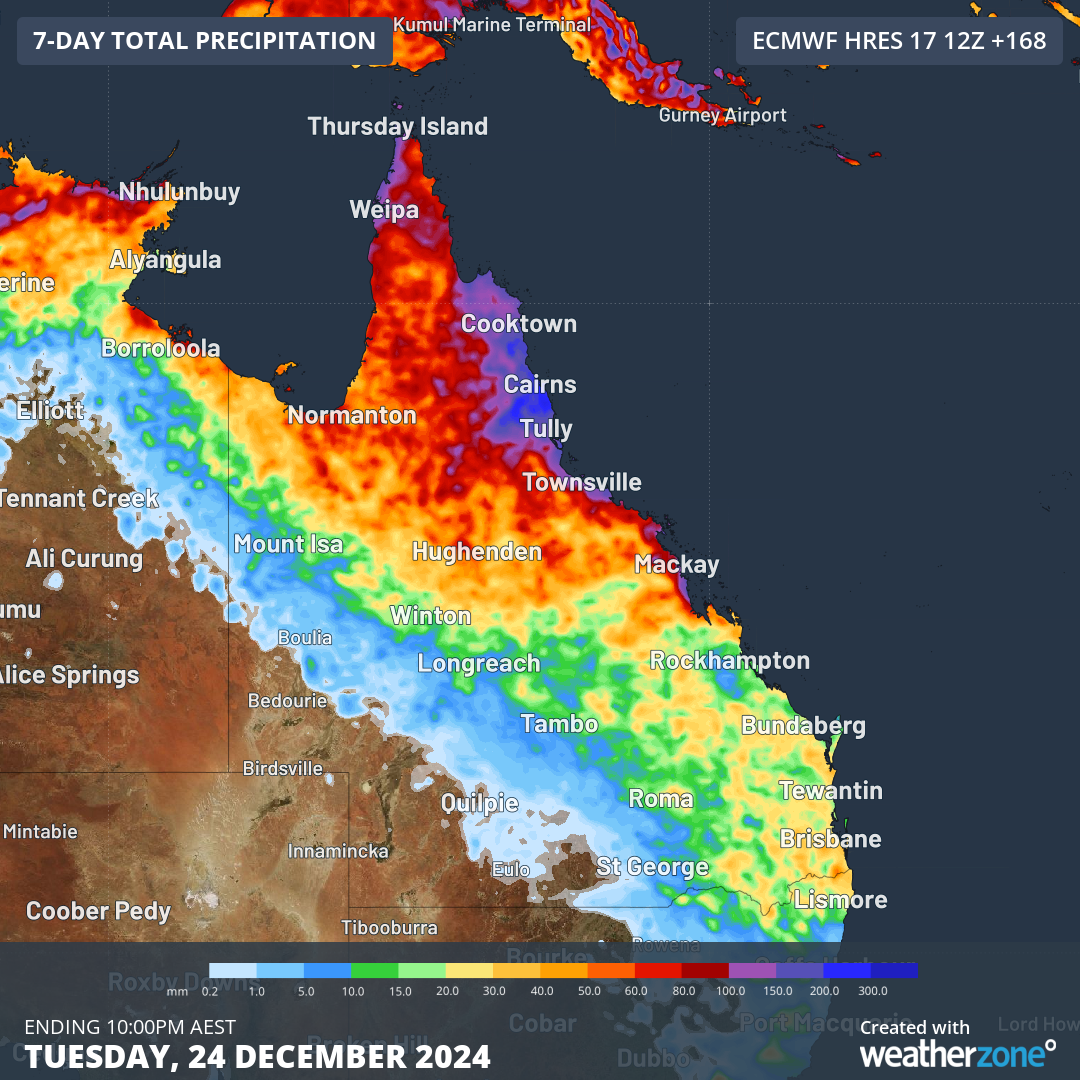
This rain will be enhanced by a low pressure trough moving from Cape York Peninsula towards the North Tropical Coast between Wednesday and Friday. Some models suggest that this trough could even spawn a low pressure system off the state’s northeast coast, which would further enhance rainfall in the region.
The map below shows how much rain is expected to fall over Qld during the next seven days, with the heaviest rain targeting the northern half of the state’s east coast.

Image: Forecast accumulated rain during the 7 days ending on Tuesday, December 24, 2024.
Numerous flood warnings have been issued in Qld and more are likely to follow in the coming days. Check the latest warnings for the most up to date information on the heat, fires and flooding in Qld.