Flooding rain from ex-Tropical Cyclone Kirrily spreads to NSW
The low pressure system formerly known as Tropical Cyclone Kirrily continues to cause heavy rain, thunderstorms and flooding over Australia’s eastern outback, more than 10 days after it made landfall.
Tropical Cyclone Kirrily crossed Qld’s North Tropical Coast on the night of Thursday, January 25, making landfall as a category two system just north of Townsville.
This coastal crossing commenced an 11-day journey that would see the remnants of Tropical Cyclone Kirrily meander over parts of Qld, the NT and SA before heading towards Northwest NSW.
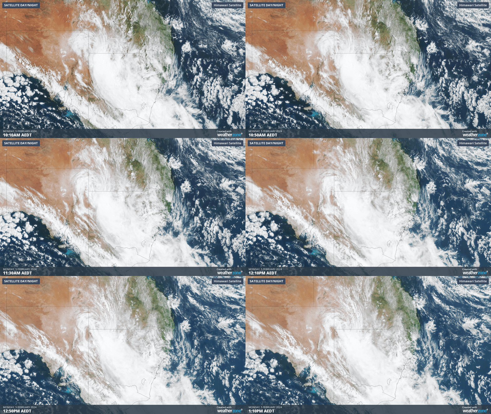
On Monday morning, satellite images revealed clouds swirling around Ex-Tropical Cyclone Kirrily as it tracked over Qld Channel Country towards the NSW border. These satellite images also showed that a large mass of thick clouds was already engulfing NSW ahead of the approaching low.

The copious moisture being dragged across Australia’s eastern inland by ex-Tropical Cyclone Kirrily caused 50 to 100 mm of rain in parts of Southwest Qld, Northeast SA and Northwest NSW during the 24 hours to 9am on Monday. Some of the standout totals in this period were:
- 113 mm at Bedourie in Qld, which was the Channel Country town’s highest daily total since 2011 and the wettest February day in 47 years.
- 62 mm at Moomba in SA, which was the highest daily total during February for 14 years
- 54 mm at Tibooburra, NSW, their heaviest February daily total in 27 years
Ex-Tropical Cyclone Kirrily will continue to drive clouds, heavy rain and thunderstorms across NSW on Monday into Tuesday morning, with some wet weather also affecting the ACT and eastern Vic.
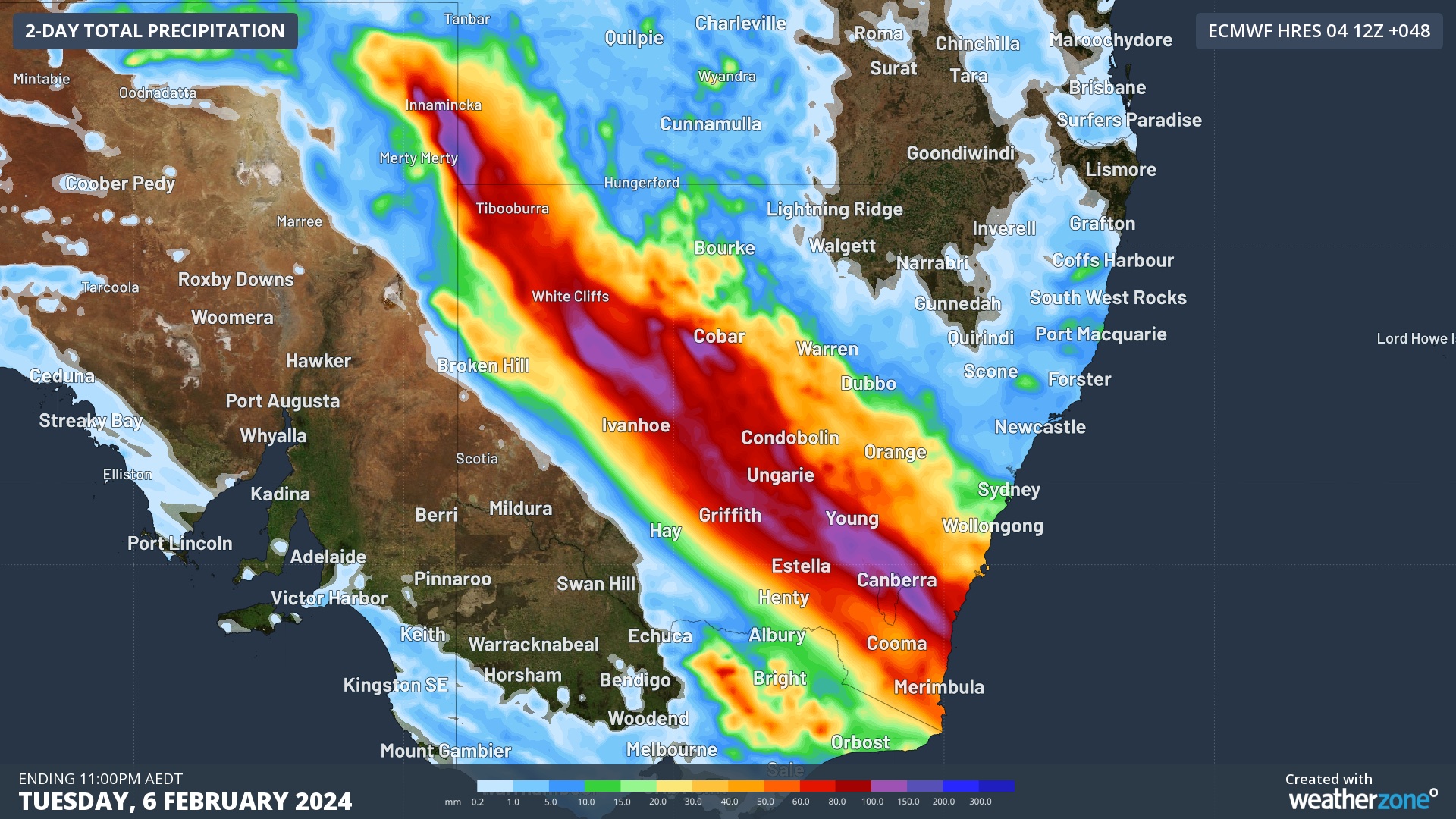
The map below shows how much rain one computer model is predicting over NSW and surrounding areas on Monday and Tuesday combined.

Image: Forecast accumulated rainfall during the 48 hours ending at 11pm AEDT on Tuesday, February 6, according to the ECMWF-HRES model.
As of 12:15pm AEDT on Monday, severe weather warnings were in place for heavy, locally intense rain and damaging winds from Southwest Qld to Southeast NSW, including parts of the ACT.
Some places within this warning area could see 50 to 150 mm of rain during the next 24 hours, with six-hourly rain rates potentially exceeding 100 mm in some locations. This is more than enough rain to cause flash and riverine flooding, particularly in the flat landscapes of far Western NSW and Southwest Qld.
Be sure to stay up to date with the latest severe weather, thunderstorm and flood warnings for the most up-to-date information in the coming days.