
Flooding rain and severe storms from NSW to TAS
Rain and potentially severe thunderstorms will continue to affect parts of NSW, VIC and TAS today, prompting flood warnings in each state and delaying play on Day 3 of the Ashes Test Match in Sydney.
Friday will be the third consecutive day of widespread showers and thunderstorms across southeastern Australia, fuelled by moisture being driven over the region by the remnants of Tropical Cyclone Seth.
Parts of eastern VIC received more than 100mm of rain during the 24 hours to 9am on Thursday, including 108.2mm at Mt Hotham Airport, which was its heaviest January rainfall in 45 years.
During the 24 hours to 9am on Friday, similar totals were recorded in southwestern NSW, where Muttama collected 119mm and Jindalee picked up 102mm. Burrinjuck Dam’s 96mm was its heaviest daily rainfall since 2012.
The atmosphere has been so unstable in southeastern Australia that thunderstorms persisted throughout Thursday night and into Friday morning. As the sun rose on Friday, lightning strikes were being detected above NSW, VIC and TAS by ground-based sensors in Weatherzone’s Total Lightning Network.
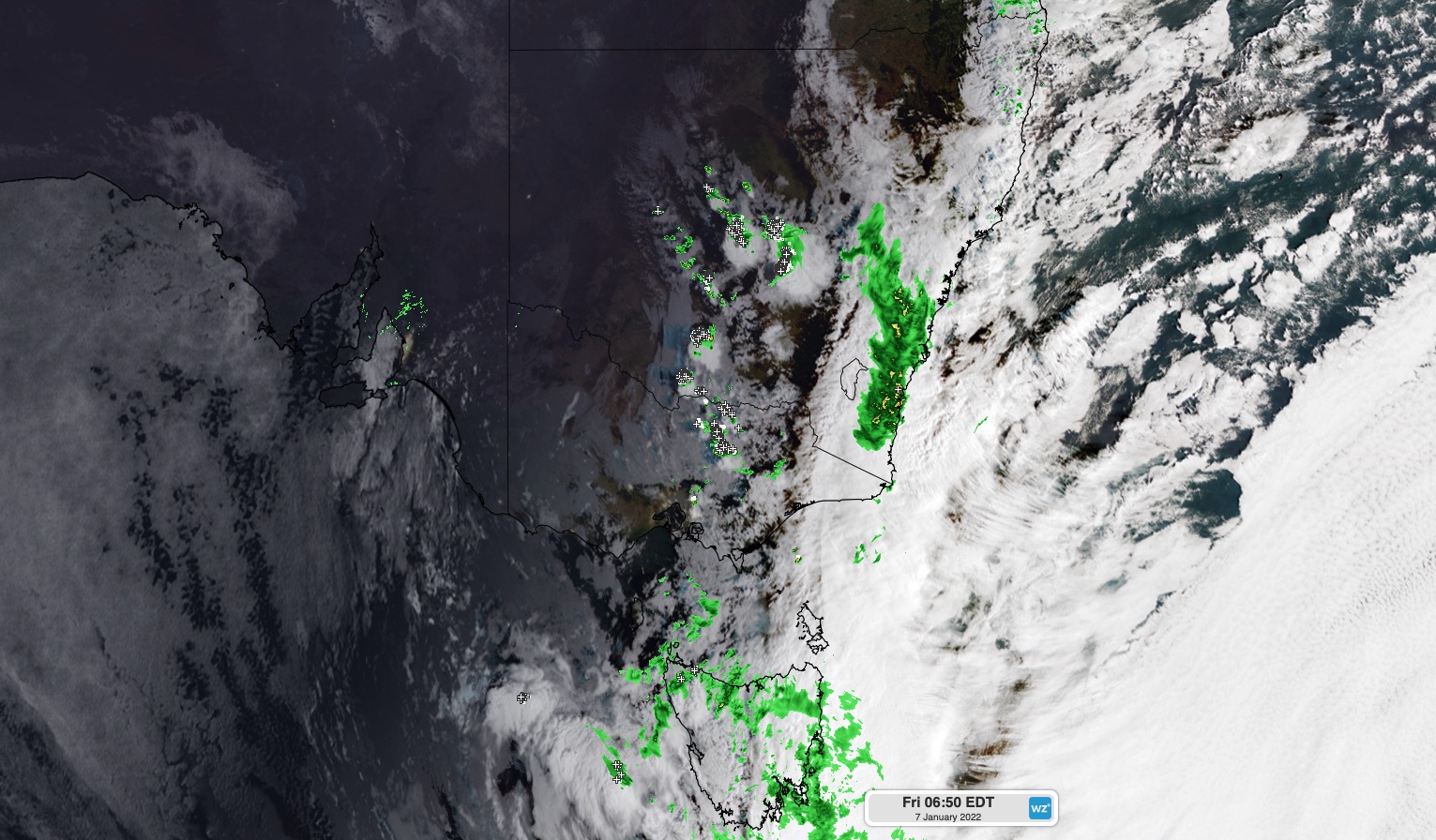
Image: Composite satellite, radar and lightning strike observations at sunrise on Friday morning.
Widespread showers and storms will continue to affect central and southern NSW, the ACT, central and eastern VIC and TAS on Friday. Some of these thunderstorms are likely to become severe, with heavy rain, damaging winds and large hail all possible.
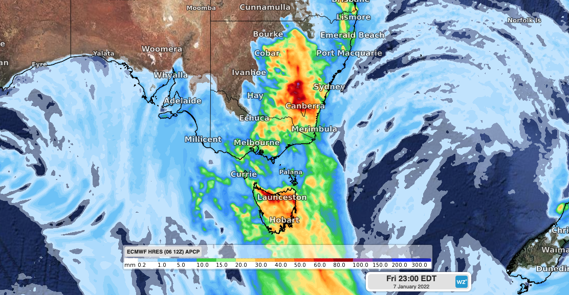
Image: Forecast accumulated rain on Friday, January 7, according to the ECMWF model.
The showers that disrupted play at the Ashes Test in Sydney on Friday morning should start to clear up in the afternoon. However, more rain and potentially severe thunderstorms are a chance in Sydney once again on Saturday.
Elsewhere, a broad area of central, eastern and northern NSW, the ACT and northeast VIC is likely to see more showers and thunderstorms on Saturday, with severe storms in the mix.

Image: Forecast accumulated rain on Saturday, January 8, according to the ECMWF model.
Flood warnings have been issued in parts of NSW, VIC and TAS in response to this week’s rainfall. Be sure to check the latest forecasts and warnings in your area over the next few days.