Flooding in outback Qld, NSW seen from space
Satellites have captured images of floodwaters filling rivers and lakes in southwest Qld and northwest NSW, following heavy rain from ex-Tropical Cyclone Kirrily.
Clouds, rain and thunderstorms have been a persistent feature over Australia’s eastern inland during the last fortnight. This late-summer soaking was caused by the overland journey of ex-Tropical Cyclone Kirrily, which made landfall near Townsville on January 25 before lingering over eastern Australia for around 12 days.
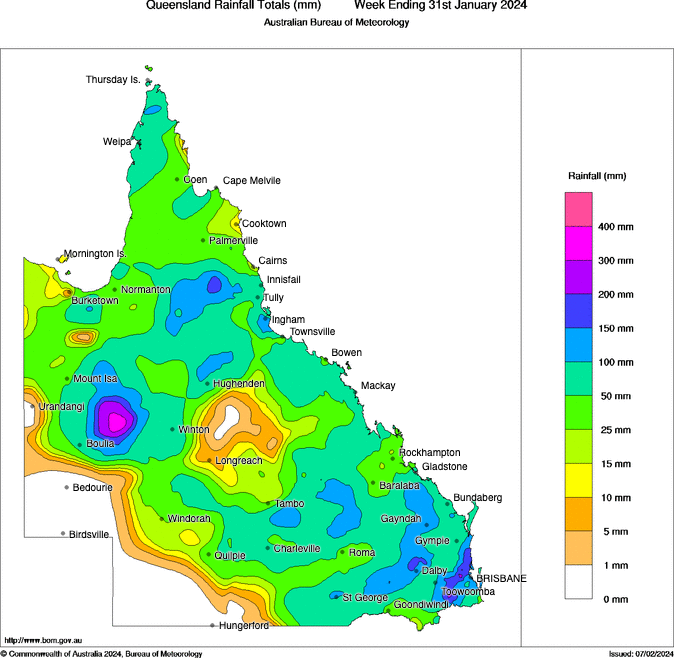
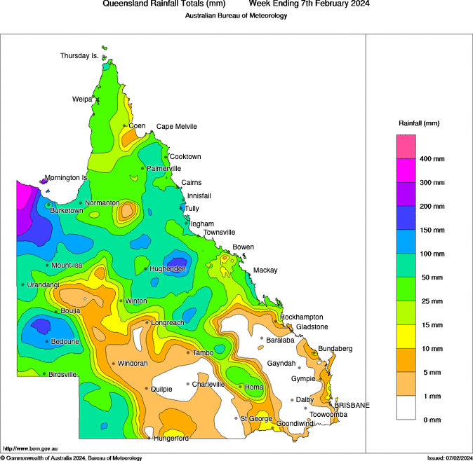
Images: Observed rainfall during the last week of January (top) and first week of February (bottom). Source: Bureau of Meteorology.
The rain delivered by Kirrily’s remnant low pressure system in the last couple of weeks has transformed the landscape across far western Qld and northwest NSW.
Once dry riverbeds are now flowing with water and large lakes have filled to produce what looks like inland oceans across the relatively flat landscape.
The satellite images below show the remarkable transformation that has occurred over the last couple of weeks.
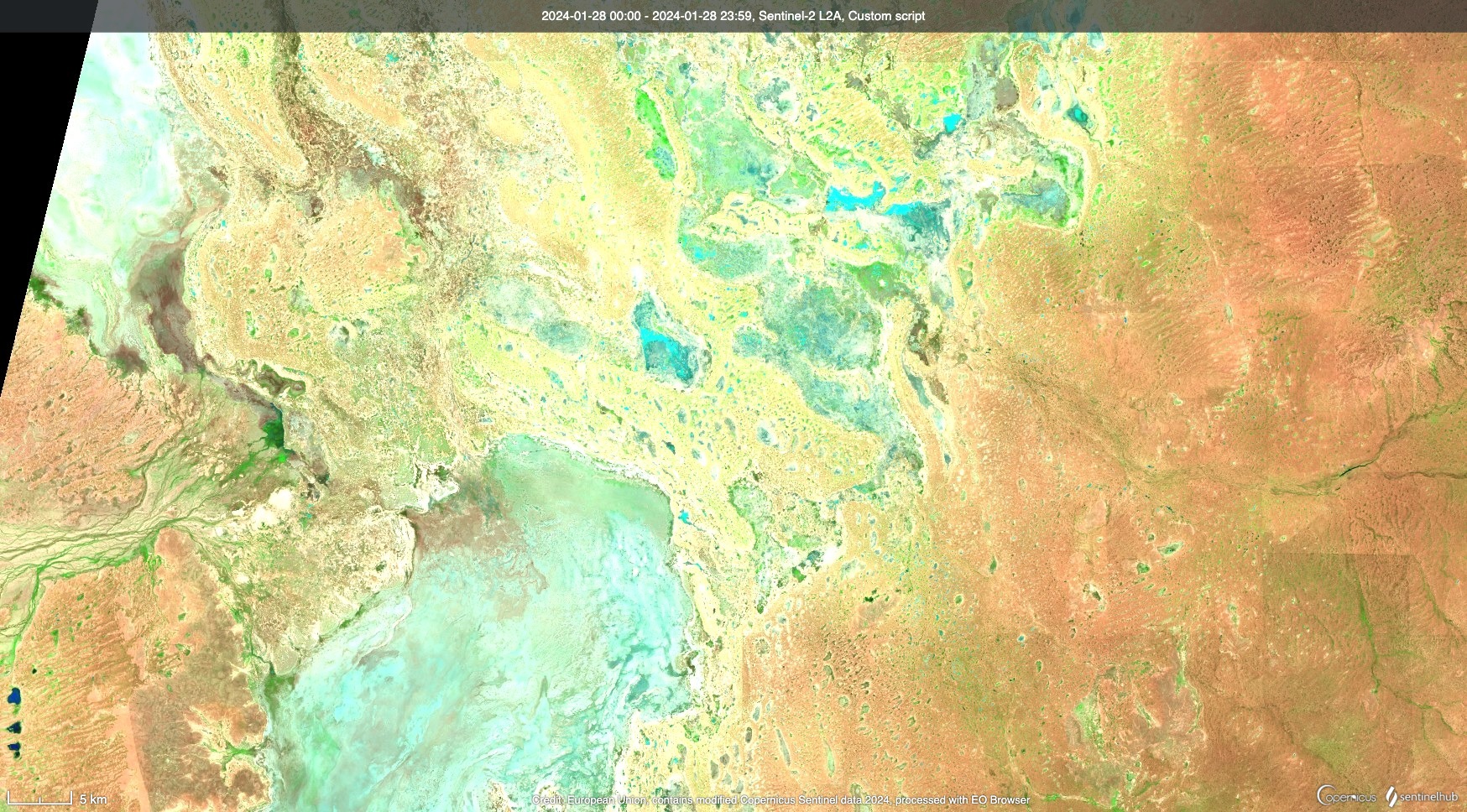
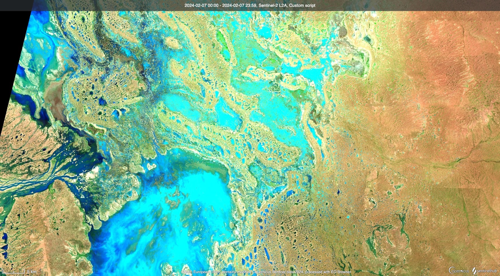
Images: Enhanced infrared satellite images showing the Narriearra Caryapundy Swamp National Park area to the east of Tibooburra and south of the Qld-NSW border. Top image captured on January 28, 2024, and bottom image on February 7, 2024. Source: Sentinel Hub EO Browser
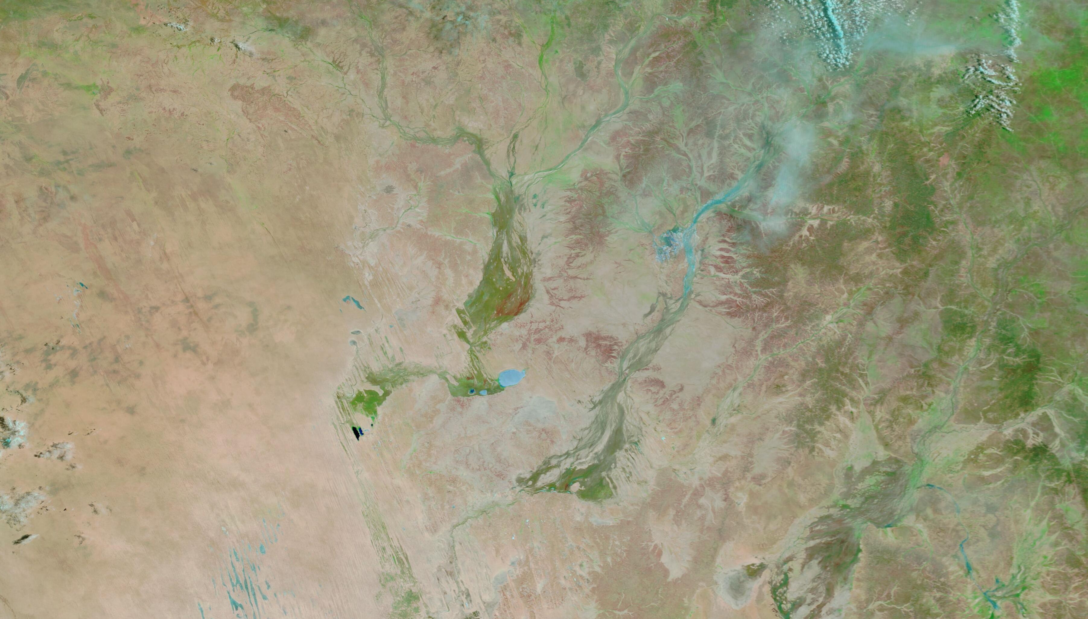

Images: Enhanced infrared satellite images showing the Diamantina River and Eyre Creek in southwest Qld. Top image captured on January 25, 2024, and bottom image on February 6, 2024. Source: NASA Worldview
You can check the latest flood warnings for the most up-to-date information on the ongoing flooding in Australia’s central and eastern interior.