
Flooding continues for the northeast Queensland coast
A slow-moving tropical low remains offshore from the Tropical Coast of Queensland as flooding continues.
A tropical low has remained nearly stationary offshore from Queensland's Tropical Coast during much of this week. Some astounding rainfall totals exceeding 900mm were observed during the three-day period from Tuesday to Thursday over parts of the Tropical Coast. While rainfall totals temporarily eased on Friday as the tropical low shifted a bit further away from the coastline, the heavy rain is back in earnest today.
Some impressive rainfall totals were observed in the Townsville area during the 24 hours to 9am today, including:
- 389mm at North Ward
- 340mm at Stony Creek
- 332mm at Saunders Creek
The Townsville area has experienced the heaviest rainfall during the last 24 hours and this trend is expected to continue. This is because the tropical low's centre is expected to remain just to the south of Cairns and the circulation about this asymmetric low is strongest in its southeast quadrant. Particularly strong east to northeast winds will continue to converge over the Townsville Coast today, delivering the greatest tropical moisture from the Coral Sea. As of this morning, there is already moderate to major flooding generally between Bowen and Cairns.
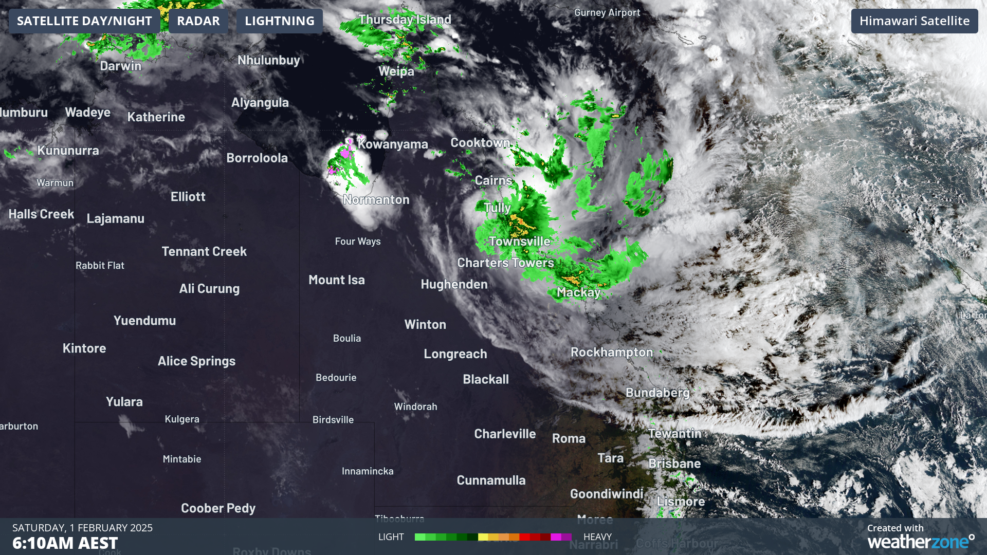
Image: Satellite and radar showing a tropical low to the south of Cairns and converging winds over the Townsville Coast.
The tropical low is expected to remain a slow-moving feature over the Tropical Coast into early next week, and the potential for this tropical low to develop into a tropical cyclone is rated as very low. With heavy rainfall expected to impact the same areas day after day, there will be a risk of continued flooding from Bowen to Cairns, with a focus for additional astounding rainfall totals in the Townsville area during the next few days. Indeed, some weather models indicate an additional 1,000mm of rainfall for parts of the Tropical Coast by Tuesday morning.