Flash flooding cuts Cooma in half
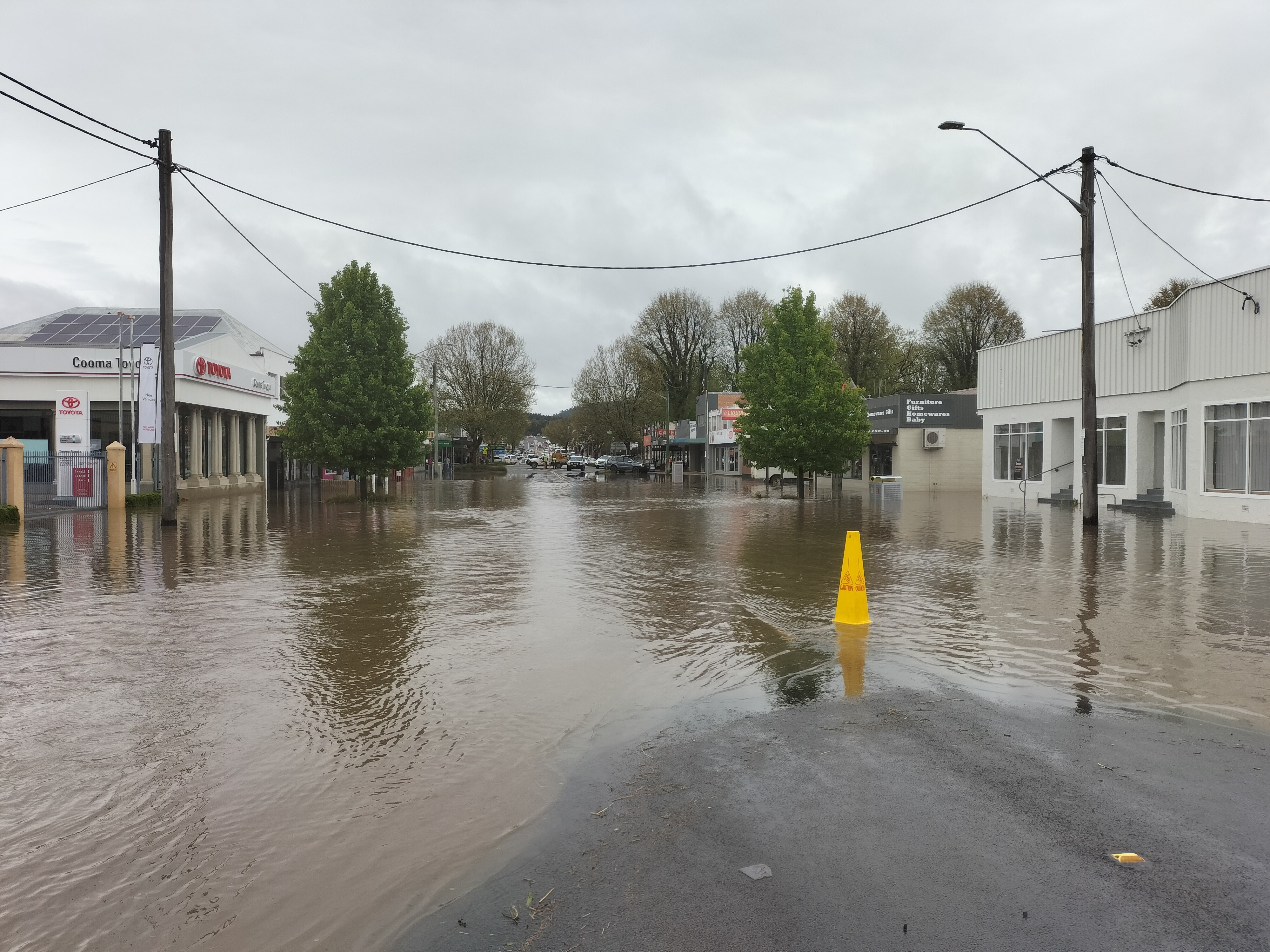
Anyone who has ever driven the main route to the NSW snowfields will have passed through Cooma, but the main road through town was closed to traffic on Tuesday morning after an overnight deluge.
Shops and business were inundated with water in low-lying parts of town, as Cooma's two main creeks (Cooma Creek and Cooma Back Creek) burst their banks.
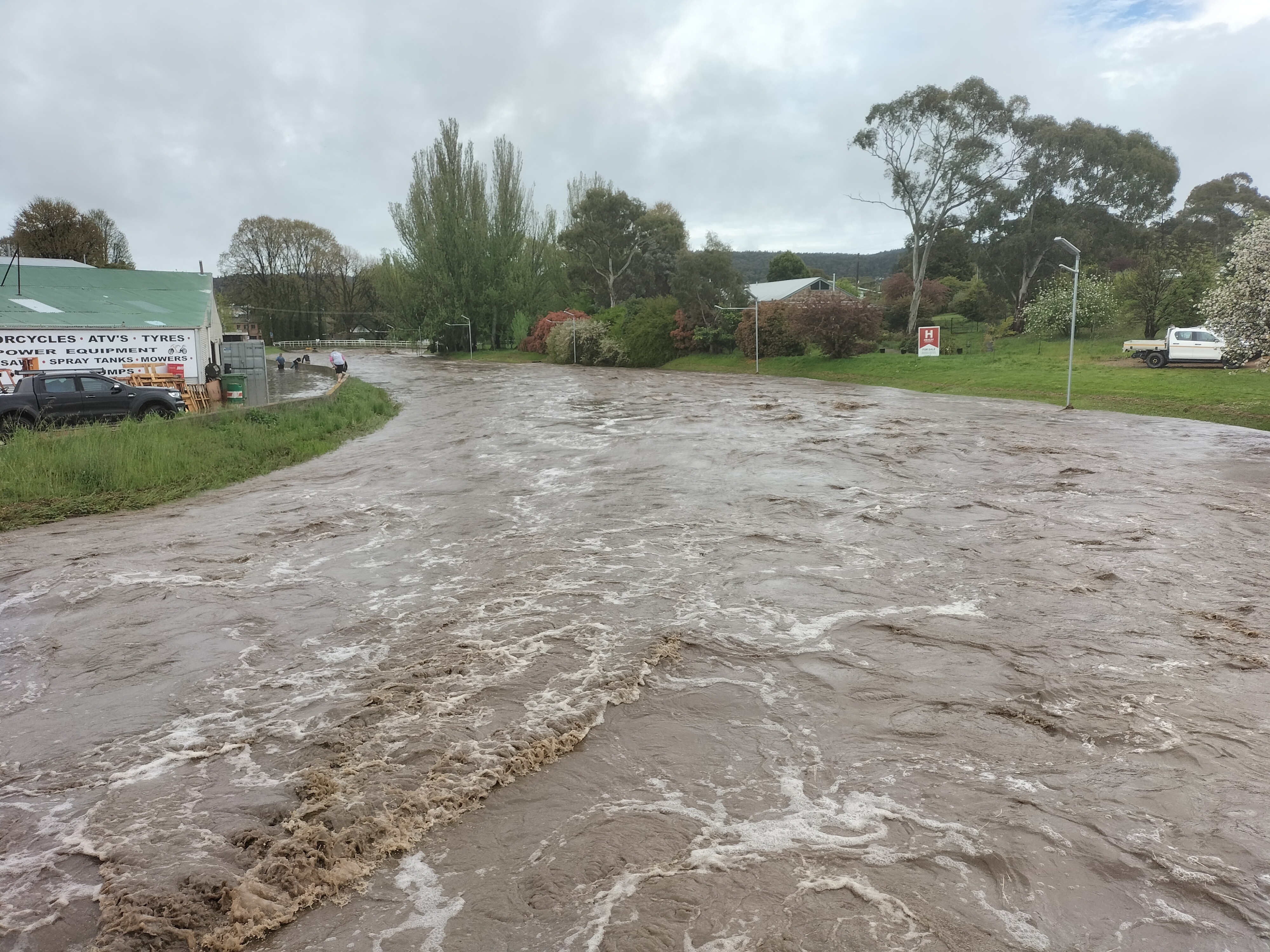
Richard Hocking works at local rural supplies store AgriWest Cooma and told Weatherzone that water in his workplace was shin deep.

Image: This is usually just a trickle. Source: Richard Hocking.
"Apparently this has never happened in the whole time the store has been here over 20-something years," he said.
Hocking drives into work from the nearby town of Berridale, about 20 minutes west of Cooma, and had no idea there would be so much rain in town. You can understand why when you see the overnight rainfall reading from Cooma Airport, which is about halfway between Berridale and Cooma.
- The airport received just 9.8 mm overnight, with only a very light sprinkle of 0.2 mm on Tuesday morning.

Image: No way through. Source: Richard Hocking.
So where did all the rain come from?
The answer lies in the graphic below.
Cooma's two creeks draw their water from south of town. Early this morning, a line of heavy showers and storms moved in a southwesterly direction mostly east and south of Cooma, just clipping the town itself. But in the catchment of the creeks, extremely heavy rain fell over a short period of time.
The NSW SES notified people about flash flooding in Cooma around 10:30 am on Tuesday.
Flash flooding in Cooma!!!
— NSW SES (@NSWSES) October 24, 2022
Our Cooma-Monaro Unit, Queanbeyan and Snowy River Unit are assisting the Cooma community with the flash flooding that suddenly hit during a localised storm this morning, which has resulted in isolated houses and main road closures. pic.twitter.com/wBM47ptwOc
Flash flooding, by its nature, tends to be short-lived. Indeed Richard Hocking reports that water around his workplace is now receding.
However there is still storm activity in the area, so further flash-flooding cannot be ruled out. As ever, please check our warnings page.
Meanwhile, some of the heaviest falls from this system were recorded further east, on the NSW South Coast and surrounds, with 104mm at Belowra and 162mm at Mt Darragh to 9 am Tuesday.
There's more info about the "hybrid cyclone" system delivering these heavy falls in this story.