Flash flooding as severe storm pounds Geelong
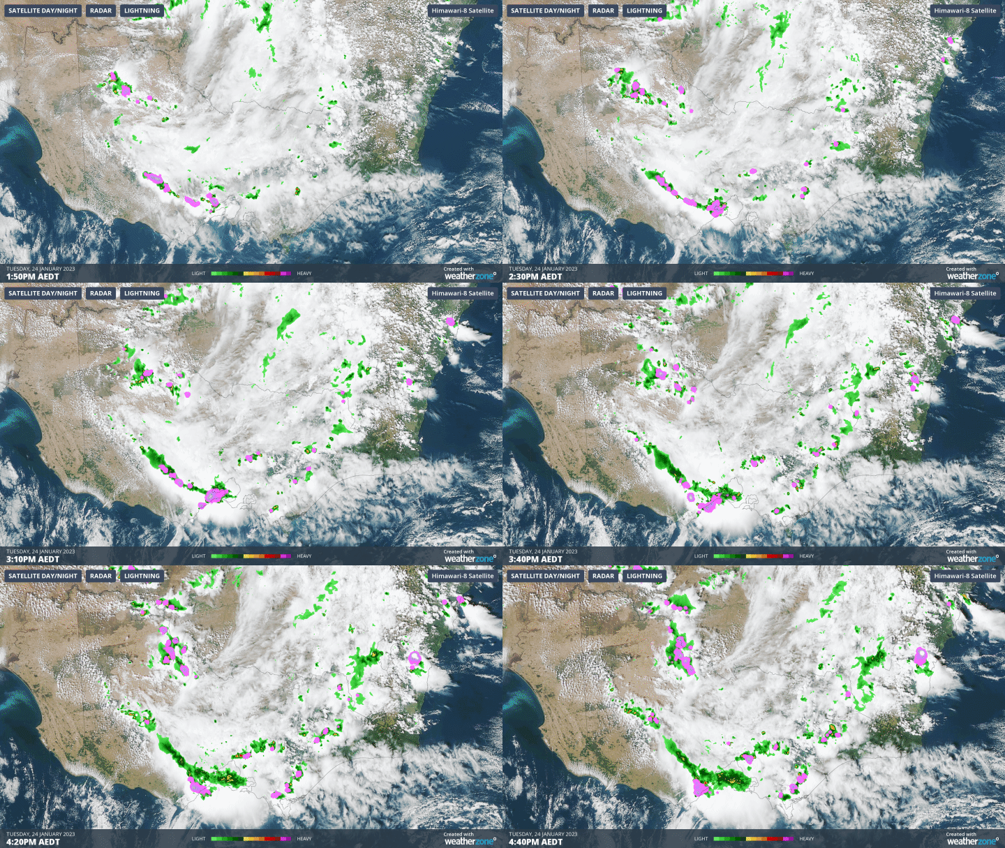
Severe storms struck the Geelong and Bellarine Peninsula area on Tuesday afternoon, causing flash flooding and leaving 3300 households without power.
The storms developed just after 2 pm and dumped 24.4 mm at Geelong Racecourse by 5:30 pm, most of which fell in a 90-minute period between 2 and 3:30 pm.
Heavy rain fall and hail have drenched the Geelong region, leaving roads and footpaths completely underwater.
— 10 News First Melbourne (@10NewsFirstMelb) January 24, 2023
What started out as a warm sunny day has taken a wet turn, with a storm cell sweeping across the bay from Geelong and heading towards the Mornington Peninsular. pic.twitter.com/oaB0EckWiD
You can see the Geelong storm developing on the radar loop below. (NOTE: THIS IS A GIF)

Storms have also lashed Melbourne's northern and eastern suburbs, with 32.4 mm recorded at Ferny Creek at the foot of the Dandenong Ranges. Again, most of that fell in a relatively short period.
To 5:30 pm, the Melbourne CBD area had recorded less than 2 mm.
As we write this story, two severe thunderstorm warnings have just been issued for people in parts of the Central, South West, North Central, West and South Gippsland, Wimmera and North East forecast districts, as well for parts of Melbourne's outer and inner eastern suburbs. Please check our warnings page here.
Warm temperatures in conjunction with a trough crossing Victoria are the cause of these storms, and while conditions should moderate in the state on Wednesday, storms remain possible across much of eastern Australia in coming days.
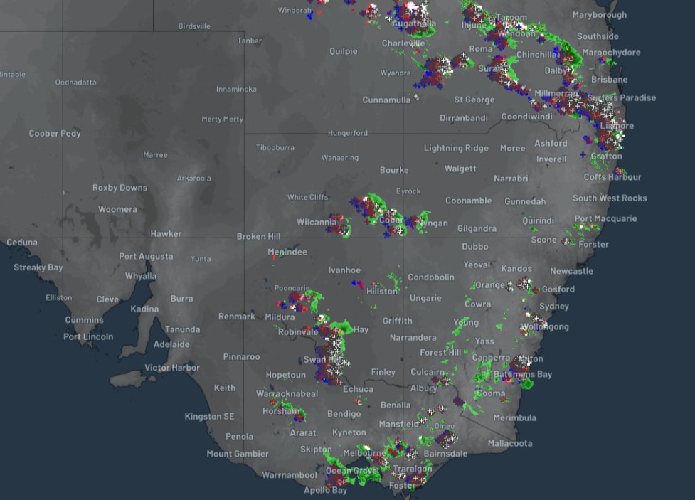
Storms are still active from western-central Queensland all the way down through inland NSW to southern Victoria early on Tuesday evening, as you can see on the latest weather radar image.
