
Five days of rain for parts of northwestern WA and SA
Parts of the Pilbara, Kimberley, WA’s interior, and inland SA are about to see a prolonged period of wet weather, as an upper-level trough moves over the region.
The image below shows the upper-level trough over the Pilbara region on Friday night, which will slowly progress further east into central Australia on the weekend.
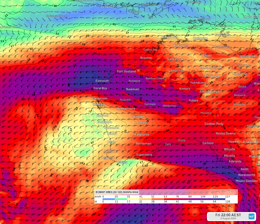
Images: 500 hPa wind forecast at 8pm AWST on Friday August 2, according to ECMWF.
The image below shows that widespread falls of 15 to 30mm is forecast in the next five days across the Pilbara, parts of the Kimberley, the WA interior and central SA, with more isolated totals of 30 to 60mm on the forecast.
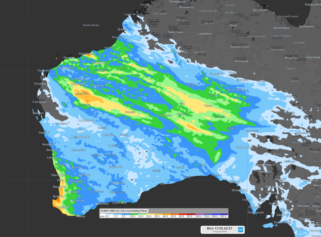
Image: Accumulated 5- day rain forecast leading up to 11am AWST on Monday, August 5, according to ECMWF.
While rain should begin across parts of the Pilbara and Kimberley regions on Wednesday evening in response to a surface trough, the rain should intensify over the weekend as the upper-level trough impacts the region.
Meanwhile a strong cold front is approaching southwest WA, bringing severe thunderstorms, ferocious winds and heavy rainfall to the region in the coming days.
The heaviest rain is likely in the Pilbara and Kimberley region later Thursday into Friday and again Friday night into Saturday as significant uplift occurs ahead of the trough. Falls of 10 to 15mm in three hours could fall over these areas during this period.
Looking ahead, rain should ease across much of WA later Sunday into Monday, as the rain focuses on central SA.