First tropical low of the season hits WA
The first tropical low to cross the Australian coastline in the 2020/21 tropical cyclone season has just brought over 200mm of rain to parts of the Kimberley.
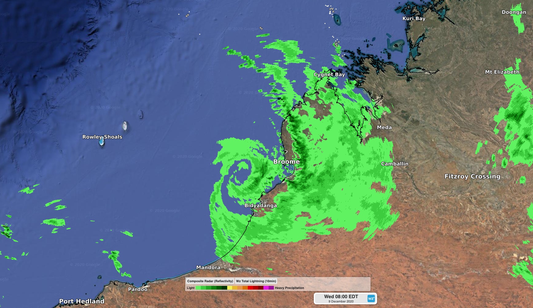
A tropical low pressure system crossed the west Kimberley coast between Bidyadanga and Broome at around 6am WST on Wednesday.

Image: Radar showing rain wrapping around the centre of the tropical low pressure system just before it made landfall on Wednesday morning.
This was the first time a tropical low, and the monsoon trough, has crossed the Australian coastline so far this tropical cyclone season.
Prior to the arrival of the low, rain had been falling steadily along parts of the Kimberley coast during the past three days.
Lombadina Airstrip near Cygnet Bay received 226mm of rain during the 72 hours to 9am on Wednesday. Further east, Broome picked up 102mm during the 48 hours to 9am Wednesday, which was its heaviest rain since January.
Rain will continue to spread over Kimberley and Interior of WA during the next couple of days as the remnants of the low move further inland. A severe weather warning, flood warnings and a flood watch have been issued for the region.
Later in the week, another low pressure system is likely to move over the Pilbara coast around Friday. This system will bring more heavy rain and may also cause gale force winds in some areas. There is a small chance that this second system will become a low end tropical cyclone before it reaches the coast.