Fire threat returns to NSW

Hot and windy weather will cause Severe to Extreme fire danger ratings in parts of NSW on Thursday.
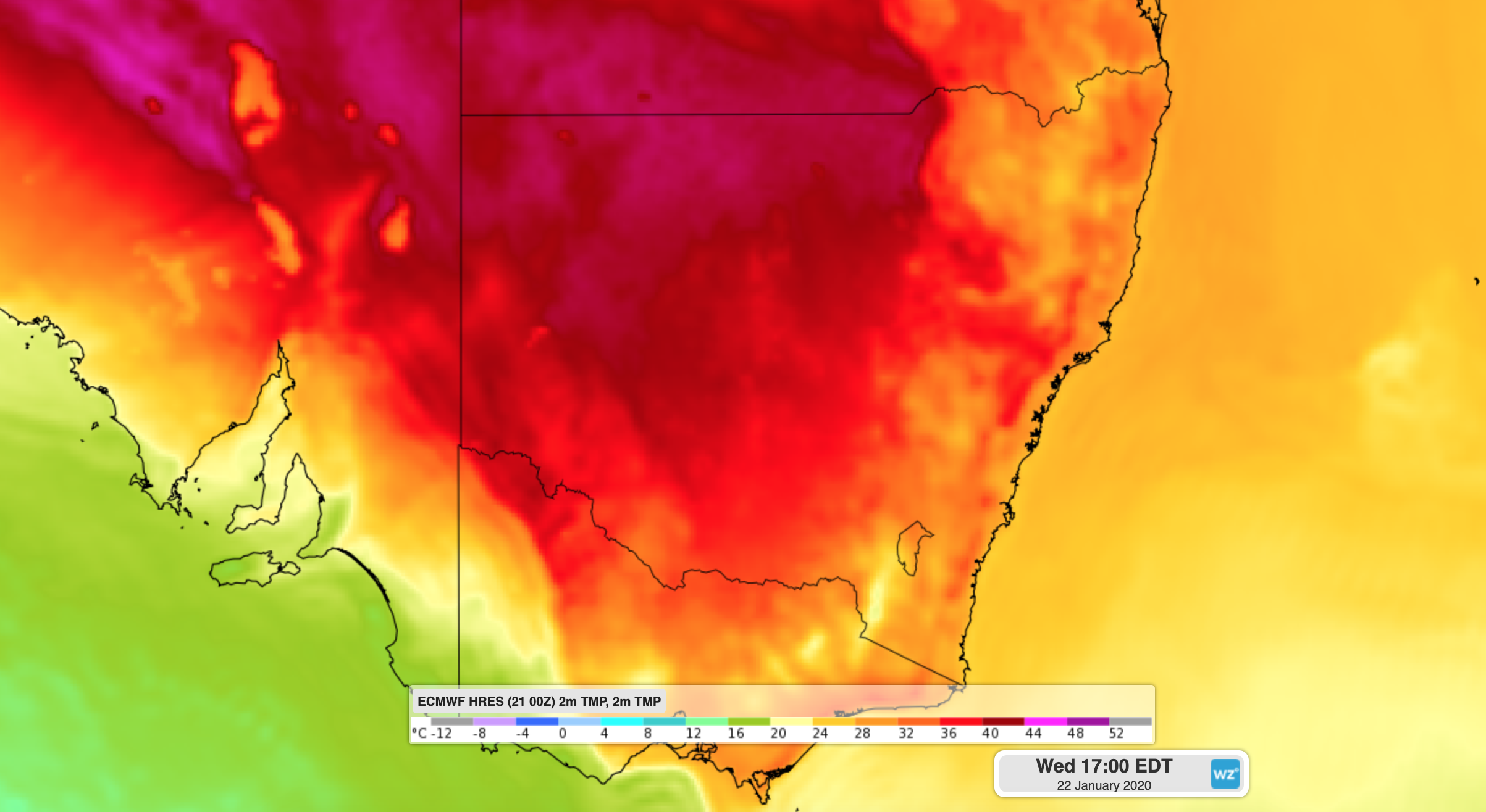
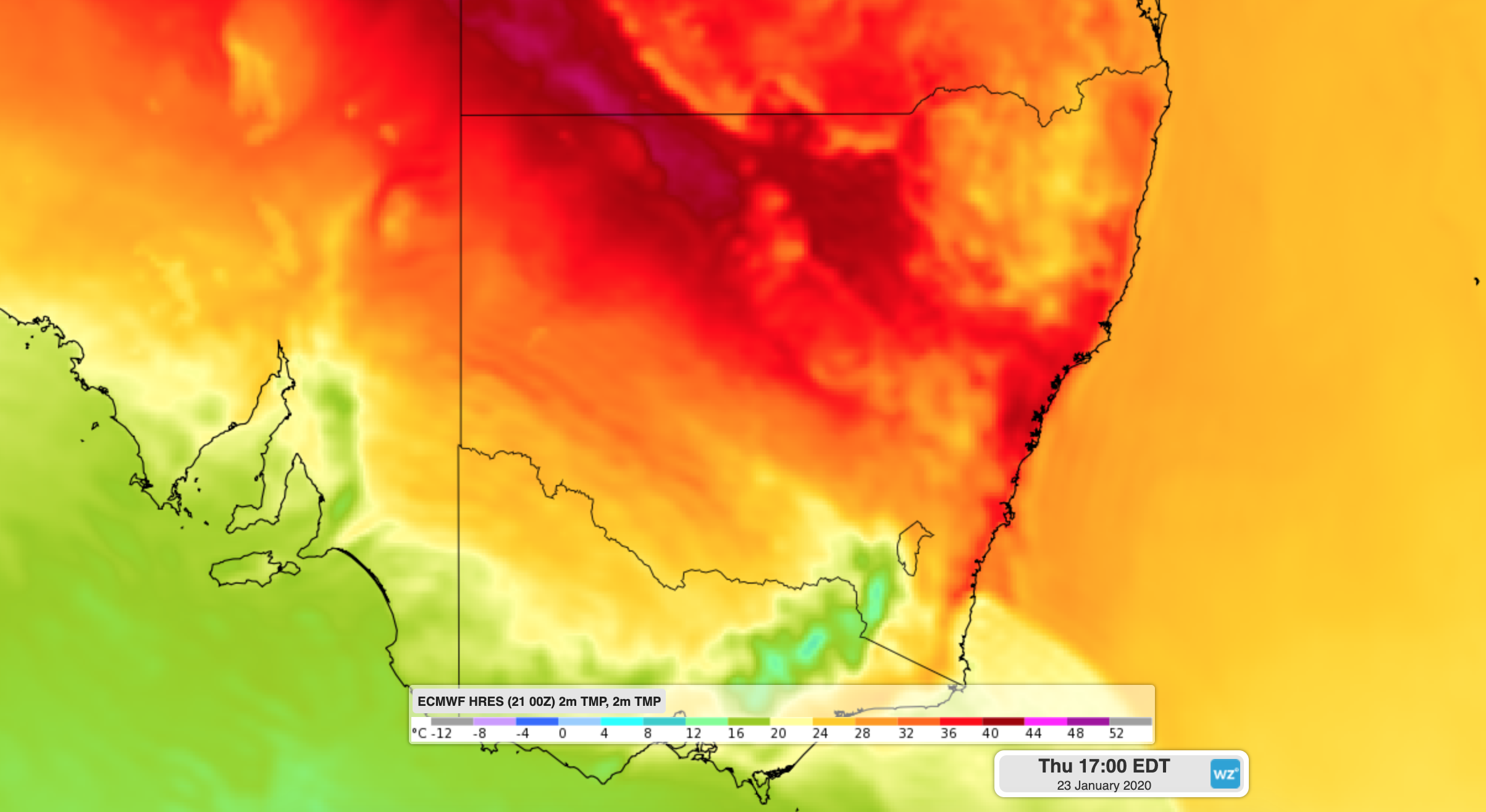
A burst of warm and gusty northwesterly winds will pass over NSW during the middle of this week ahead of an approaching cold front. Temperatures are forecast to reach the low forties over the state's far west on Wednesday and parts of the northern inland, central west and some areas along the coast and adjacent inland on Thursday. Sydney is forecast to reach 40 degrees in the city and 43 in some western suburbs on Thursday afternoon.

Image: Forecast surface temperature on Wednesday afternoon according to the ECMWF-HRES model.
The combination of hot, dry and gusty winds will cause elevated fire danger ratings across much of the state during the next two days.

Image: Forecast surface temperature on Thursday afternoon according to the ECMWF-HRES model.
Total fire bans are in place for the North Western, South Western and Far Western fire areas on Wednesday. On Thursday, the heat will spread east and cause Very High to Severe fire danger over much of the state. Parts of the Southern Ranges and Illawarra/Shoalhaven could experience Extreme fire danger on Thursday, including areas that have existing fires on the ground.
According to the Rural Fire Service, there were still 64 fires burning in NSW on Tuesday evening, 16 of which were uncontained at the time.
In addition to the heat, showers and thunderstorms will also develop over NSW on Thursday, most likely across the state's central and northern inland. Some of these storms are likely to become severe.
A relatively weak south to southwesterly change will help moderate temperatures and lower fire danger ratings across NSW from Friday. However, showers and storms will continue to develop over the state's northeast each day for the rest of this week.