
Ex-tropical cyclone over WA, a dusting of snow over Tassie
Severe Tropical Cyclone Zelia made landfall just east of Port Hedland on Friday at about 12:30pm WST. Its destructive winds felled trees, and its rainbands caused flooding rains.

Image: Himawari-9 satellite imagery, BOM radar and observed wind gusts (km/h) at 1:05pm WST Friday 14th. Source: Weatherzone
It reached Marble Bar as a tropical cyclone in the evening and dumped 203mm over the town in the 24 hours to 9am Saturday. It has now weakened to a tropical low and will continue to move southward and weaken. However, it can still bring heavy rainfall with it during Saturday and into Sunday.
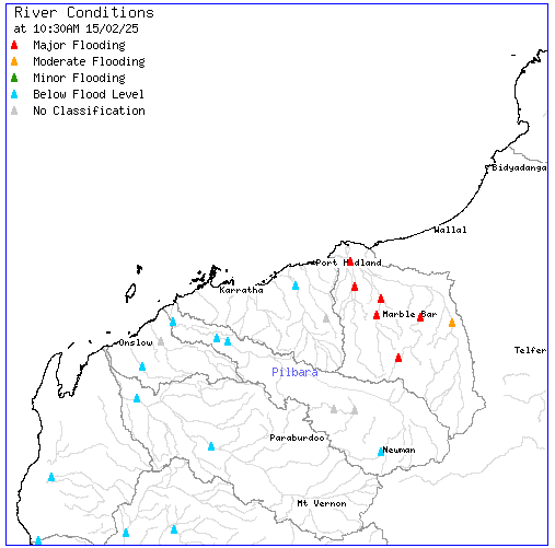
Image: River conditions for the Pilbara region as of 10:30 am WST Saturday 15th. Source: BOM Pilbara Rainfall and River Conditions
Over the past several days, Ex-Tropical Cyclone Zelia has caused several hundred millimetres of rainfall across the Pilbara region including the 555mm recorded at Pardoo Station in the 96 hours to 9am Saturday 15th. The De Grey River at Coolenar Pool has reached major flood levels (Flood Warning for De Grey River). Several feeder rivers to the De Grey River have also reached major flood levels including the Shaw, Coongan, and Nullagine Rivers.
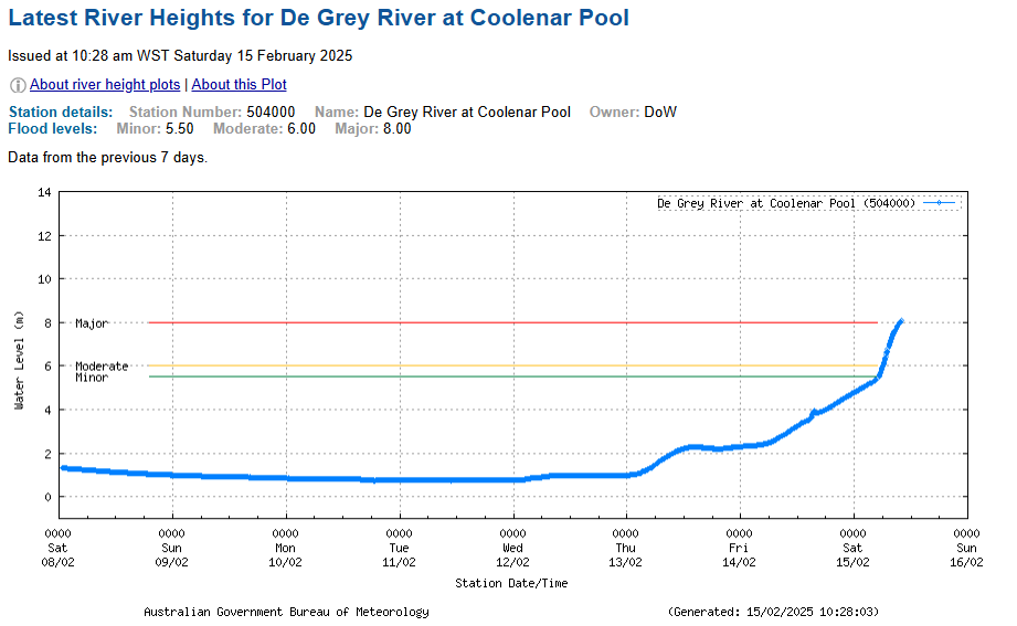
Image: River heights for the De Grey River at Coolenar Pool as of 10:28am WST Saturday 15th. Source: BOM River Height data for De Grey River at Coolenar Pool
Meanwhile, on the other side of the country, in total contrast, a blast of cold air behind a front is bringing a light dusting of snow to parts of Tasmania, as forecast yesterday: Summer snow in Tasmania this weekend.
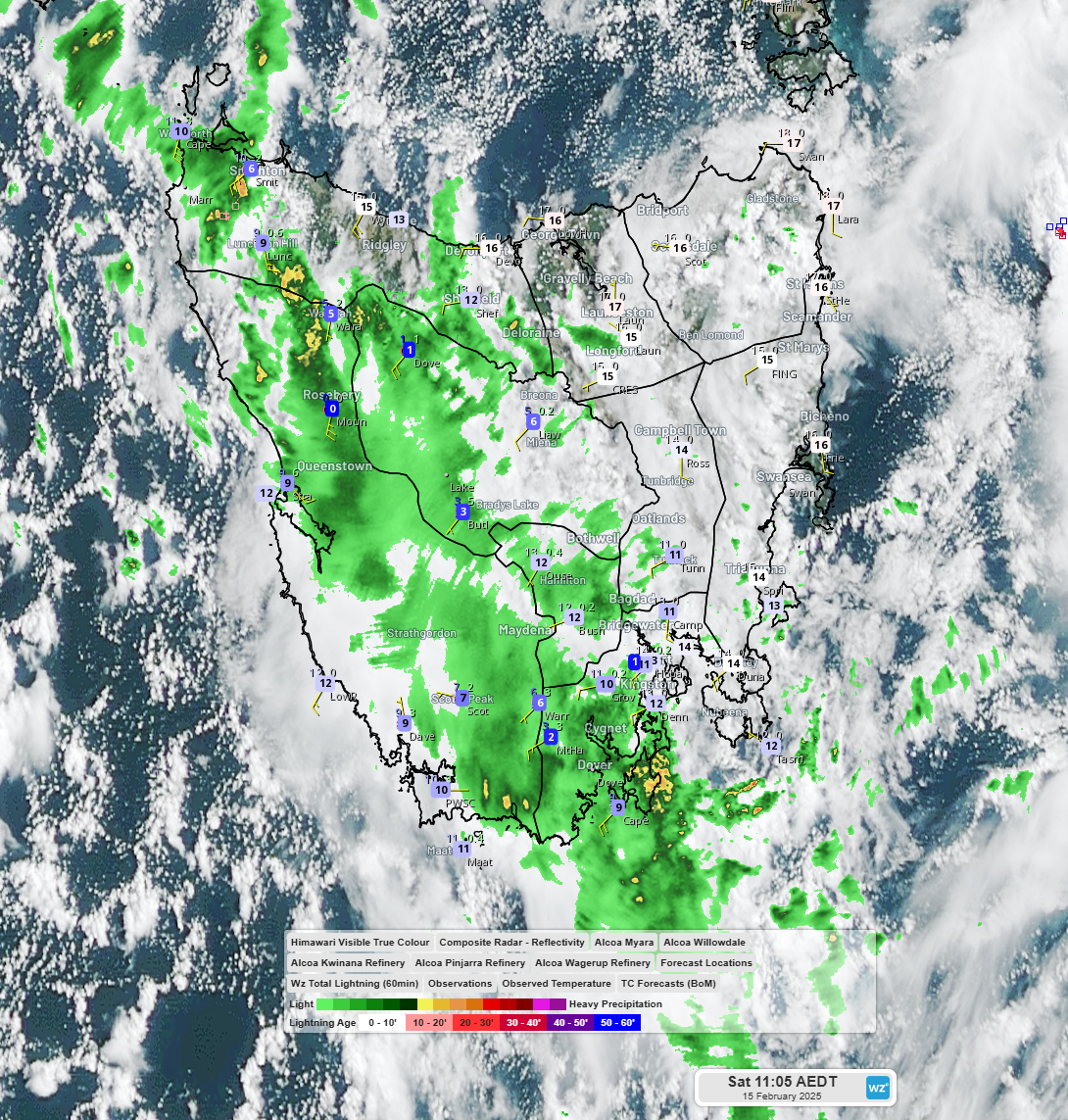
Image: Himawari-9 satellite imagery, BOM radar and observed temperature at 11:05am EST Saturday 15th. Source: Weatherzone
Mount Mawson ski field (elevation 1250m) has been dusted with light snow. Mount Reed (elevation 1120m) has likely received a light dusting too, with temperatures dropping to about 0°C for 3 hours this morning and recording some precipitation during this time. A bushwalkers alert is currently in place for snow as low as 1000m for Saturday and early Sunday (Bushwalkers Alert).
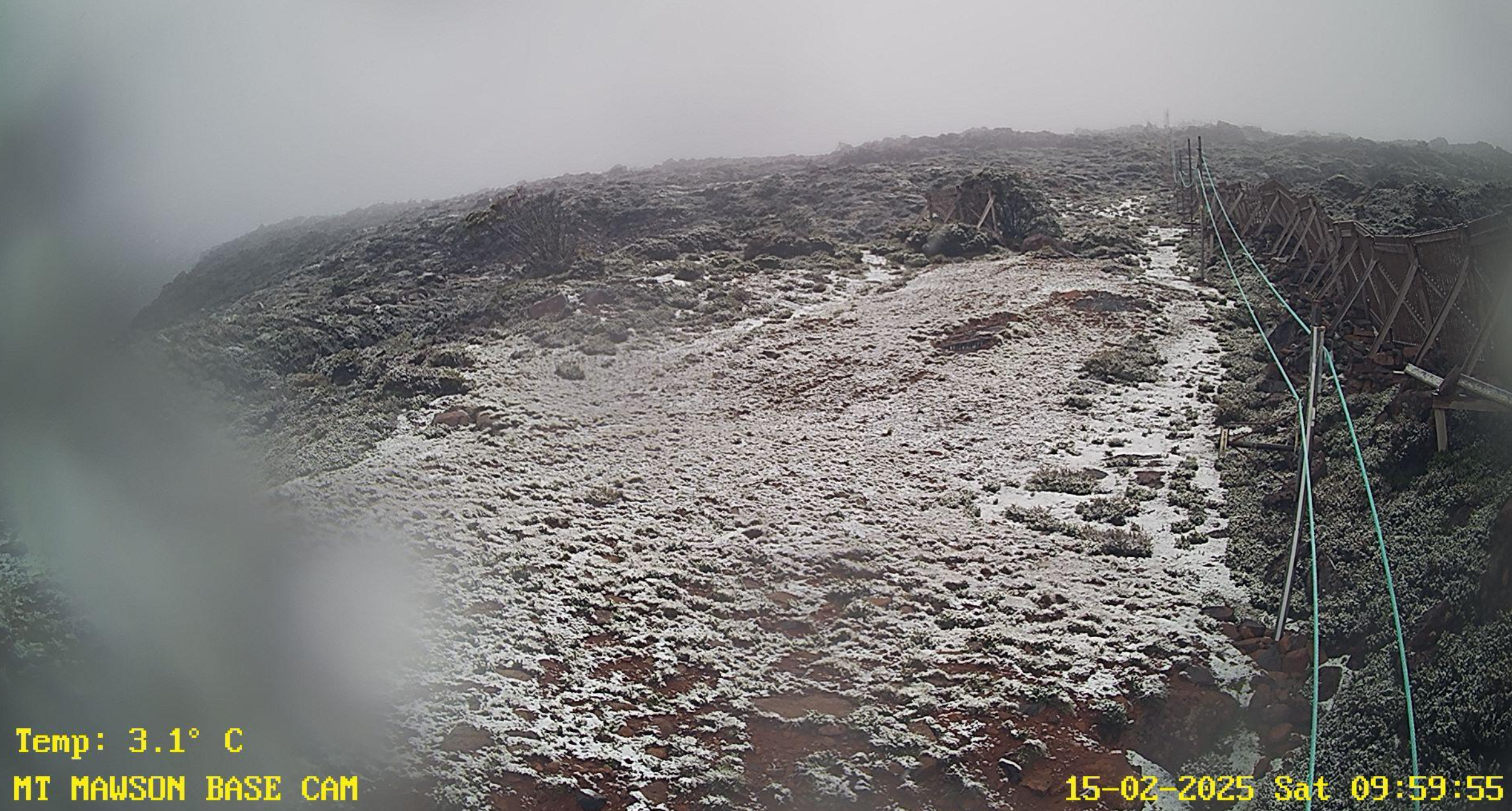
Image: A dusting of snow on Mount Mawson Skifield at 10am EDT. Source: mtmawson.info/snow-cam/
Wherever you are in Australia please stay up to date with the latest forecasts and warnings at weatherzone.com.au