Ex-Tropical Cyclone Kirrily ramps up threat of flooding in Australia's southeast
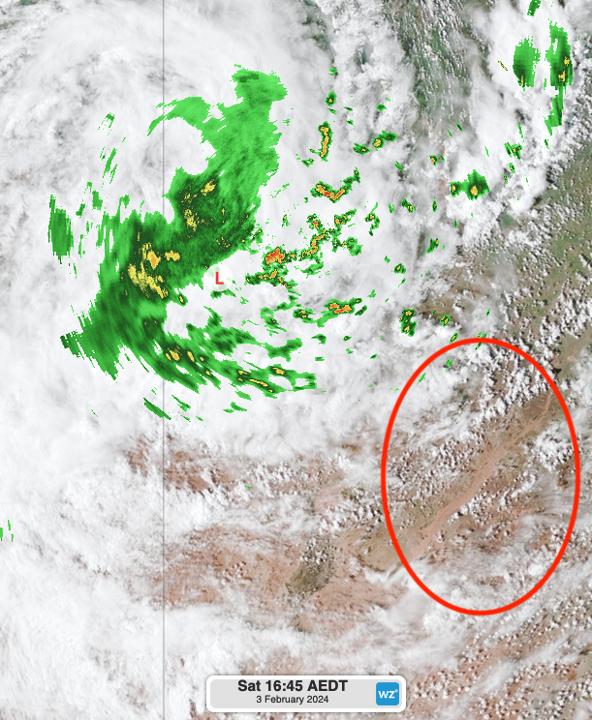
Ex-Tropical Cyclone Kirrily is unleashing its impact, triggering heavy rainfall and gusty winds across the nation's interior. Currently, the system is located near the NT/QLD and SA border, prompting severe weather warnings for southwest QLD, northwest NSW, and northeast SA. The potential for dangerous flash flooding and damaging wind gusts is high, with flood watches in place as the system heads southeast into NSW over the next 24 to 48 hours as the system tracks south-southeast.

Image: A glimpse of a full-flowing Diamantina River (red circle) taking the heavy precipitation of ex-TC Kirrily (centre-left) towards the northeastern corner of South Australia during Saturday afternoon (Himawari Satellite imagery).
Fuelled by abundant tropical moisture, Kirrily's trajectory is set to bring flooding rainfall to western, central, and southeastern parts of NSW and eastern VIC on Monday. The impact is expected to contract to southeastern NSW on Tuesday and Wednesday, posing a threat to the ACT, including Canberra, and densely populated areas south of Sydney.


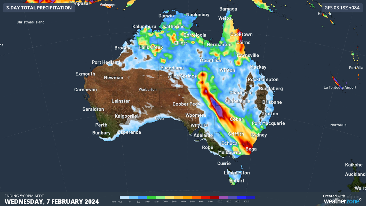
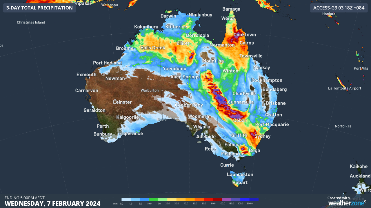
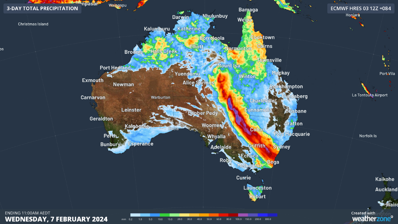
Figures. Accumulated rainfall to Wednesday 7th from three computer models, GFS (top), Access-G3 (middle) and ECWMF (bottom).
Computer models project widespread rainfall of 40 to 80mm between the NT/QLD/SA border and stretching across NSW, the ACT, and eastern VIC (Figures). Some areas in the NSW interior may witness accumulations exceeding 200mm by late Wednesday evening, with the bulk of the rainfall expected on Monday and Tuesday. Additionally, there is potential for 6-hourly accumulations to exceed 100mm in these regions.
As the system approaches, stay vigilant and stay updated with the latest warnings at https://www.weatherzone.com.au/warnings. Updates on this evolving weather system will be available soon.