Extremely heavy snowfalls just in time for school holidays
It's absolutely chucking down the snow in the Australian Alps on Monday morning, with the heaviest stuff still to come this afternoon.
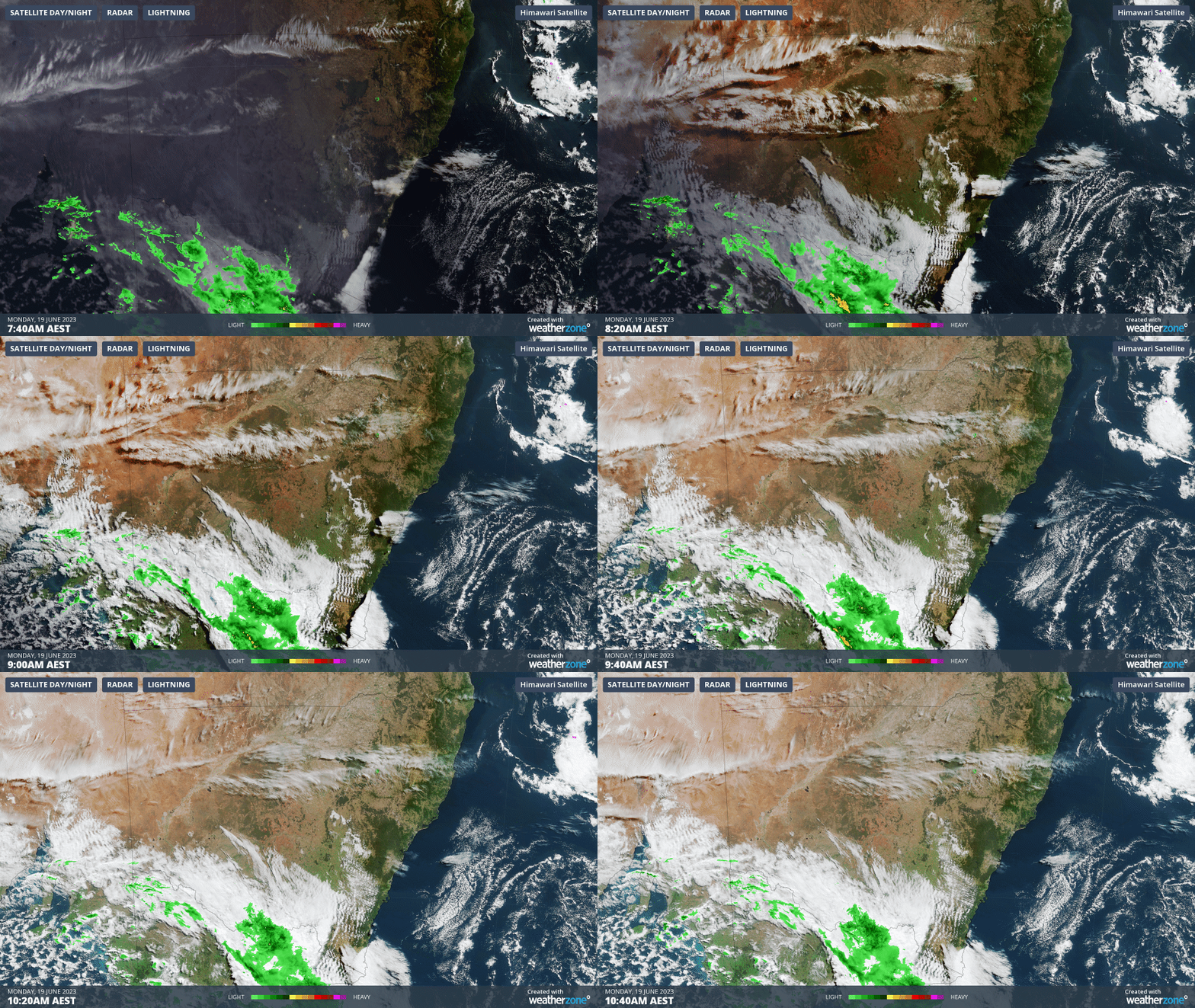
Check out this loop of the cold front crossing the southeast corner of the country as we write this story. The heavy blobs of moisture on the radar, plus the follow-up of even colder air surging from the southwest makes this a weather system with serious snow potential.

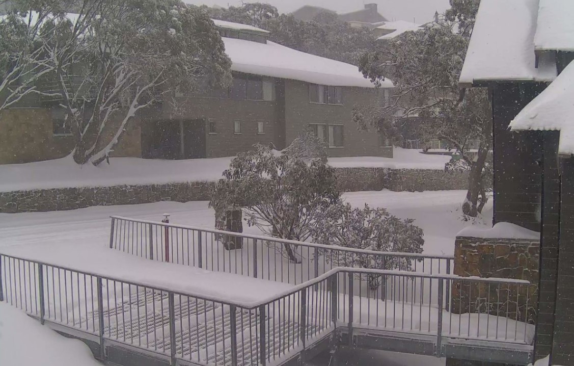
Late on Monday morning, locals at Victorian ski resorts were reporting snow falling extremely heavily and accumulating rapidly. You can see the evidence in the image below.

Image: Mt Buller village with snow falling on Monday morning. Source: Aussieskier.com.
The system is now reaching the Snowy Mountains of NSW, where this morning’s light snowfalls are also intensifying.
For all mainland ski resorts, this dump of white gold could not be more perfectly timed. After a disappointing almost snow-free June long weekend, a cold front a couple of days ago painted the slopes white with about 10 cm of snow. That was enough to get a few beginner lifts spinning on most hills, but nothing to get hard-core skiers and boarders excited.
But this Monday's snowfall is the real deal. Conceivably, it could deliver considerably more than 20 cm of fresh powder by Tuesday morning, which would enable many more lifts to open. If the trusty old table-o-meter at Falls Creek's Cedarwood Lodge is any guide, we may be nearing the 20 cm mark already.

Image: Bear in mind that the table wasn't cleared after the weekend’s lighter snowfall, so not all of that is today's fresh stuff. Source: Cedarwoodfallscreek.com. Falls Creek Accommodation at Cedarwood Apartments - Ski in Ski Out : (cedarwoodfallscreek.com)
After today's storm, a couple of mostly snowless days are in store for Tuesday and Wednesday, before another system arrives on Thursday with the potential for more snow.
With Victorian public school holidays starting this coming weekend and NSW public school holidays commencing the week after, this is very, very good news for businesses in the snowfields, as well as anyone who loves a snowy slide.
We'll keep you posted on Tuesday with reports and images from Monday’s big blizzard. And don't forget to check our snow page for the latest forecasts and much more.