
Extreme heat and heavy rain targeting Pilbara
A burst of record-challenging heat will be followed by heavy rain and thunderstorms in the Pilbara this week, as a tropical low drifts towards northwestern Australia.
A very hot air mass has been sitting over the north of WA for the past several weeks, pushing temperatures into the mid-to-high forties every day since the middle of December.
This relentless heat will intensify even further on Tuesday, possibly pushing the mercury close to 50ºC in parts of the Pilbara under the influence of a surge of southerly winds.
The images below shows that two global forecast models are picking temperatures over 50ºC in the Pilbara on Tuesday. If temperatures do get as high as these models are predicting, there is no guarantee that it will be observed at one of the Bureau of Meteorology’s weather stations in the region.
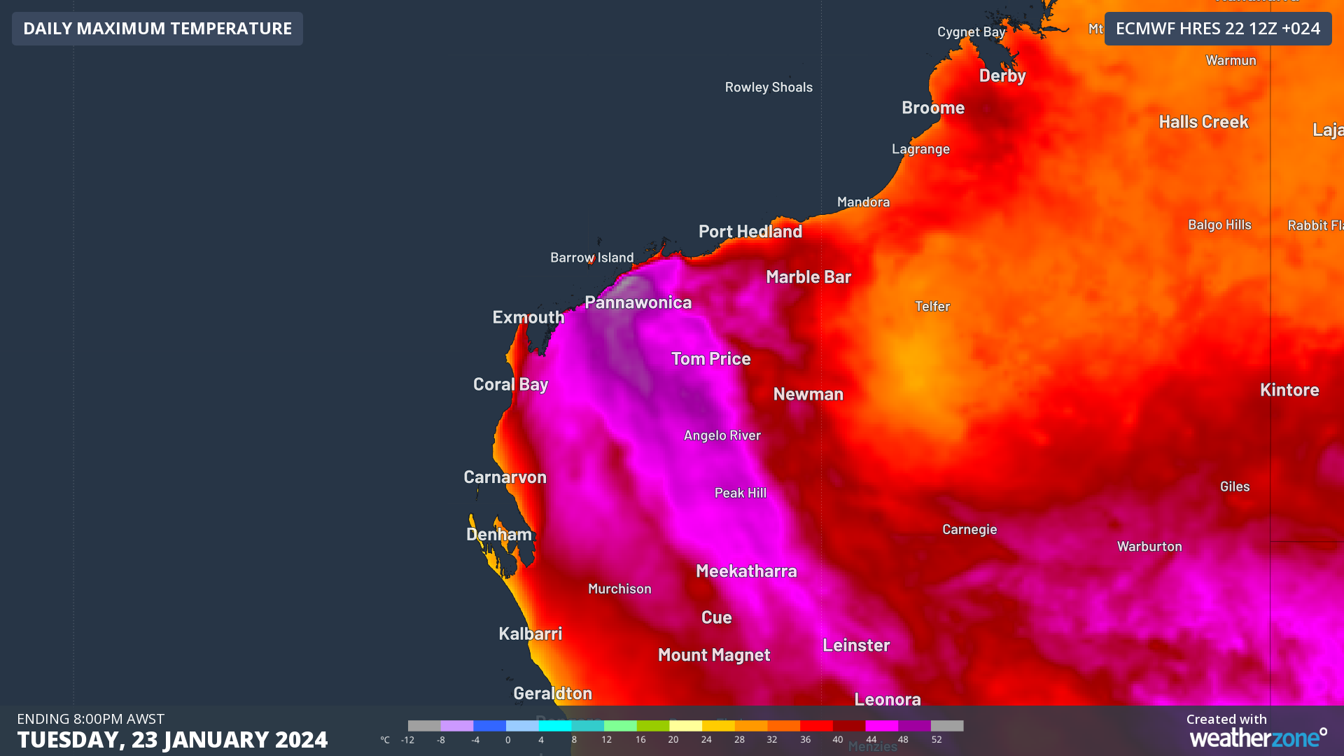
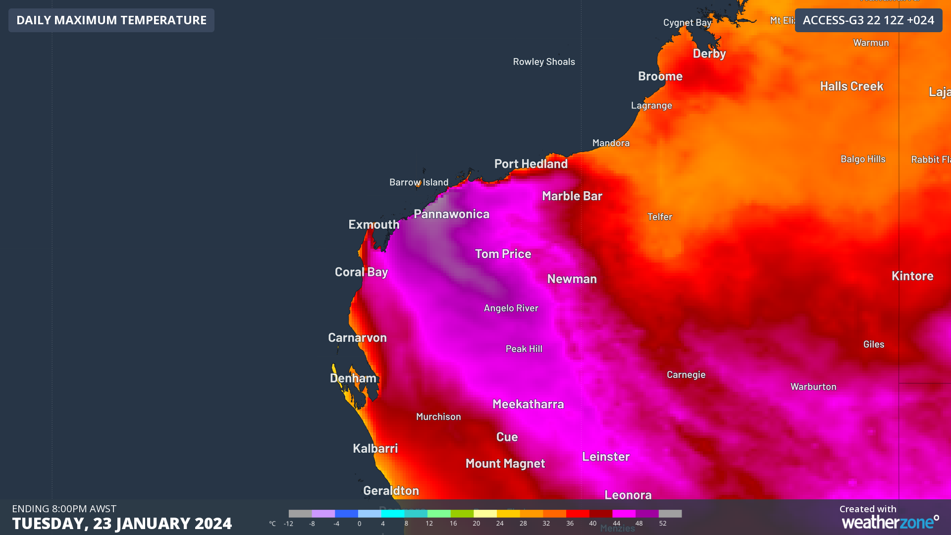
Images: Forecast maximum temperature on Tuesday, January 23, 2024, according to the ECMWF-HRES (top) and ACCESS-G (bottom) models.
The southerly winds that will drive hot air into the Pilbara on Tuesday are located on the western flank of a low pressure trough situated across the north of WA. Within this trough is a tropical low that has been causing heavy rain in the NT over the last one to two weeks.
Some areas of the NT have received several hundred millimetres of rain over the last fortnight, with Elliot’s 433 mm during the past 12 days amounting to three times its January monthly average.
This rain-bearing low pressure system has now moved across the border into WA and will continue to spread rain and storms across the state’s north over the next few days.
Most forecast models suggest the low will move towards the west and soak inland areas of the Pilbara and parts of the state’s Interior over the next few days.
Some models predict 50 to 100 mm of rain over a broad area stretching from the North Interior across to the Southern Pilbara between now and Thursday. Locally intense rainfall due to thunderstorms could produce six-hourly rain rates of up to 100 mm in this area.
However, there is some uncertainty regarding where and how much rain will fall, highlighted by images below.
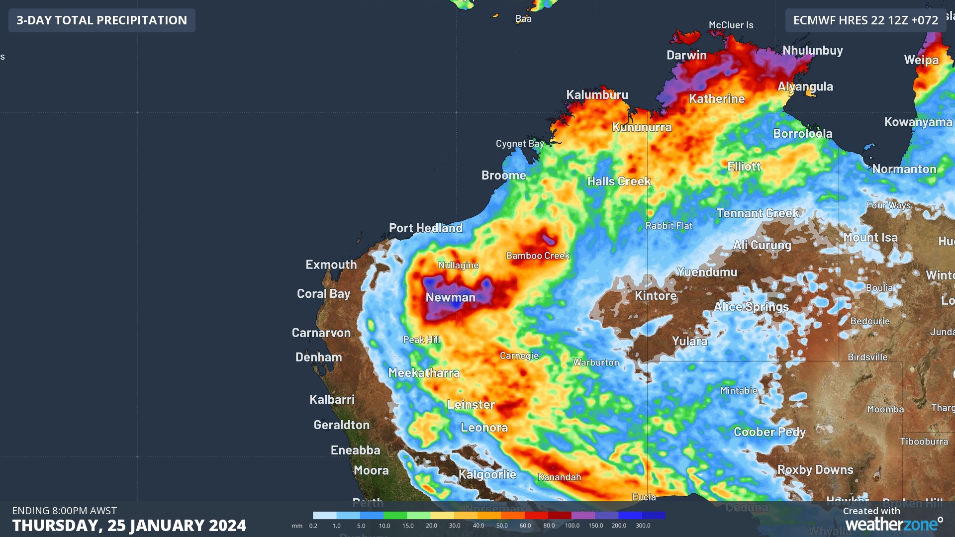
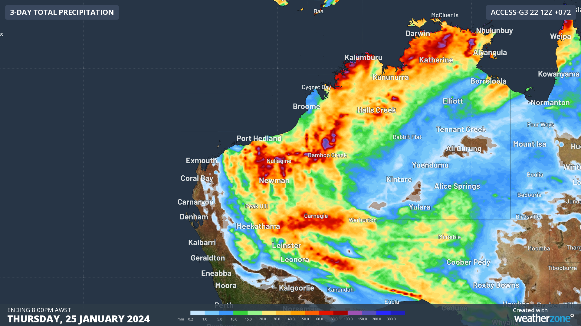
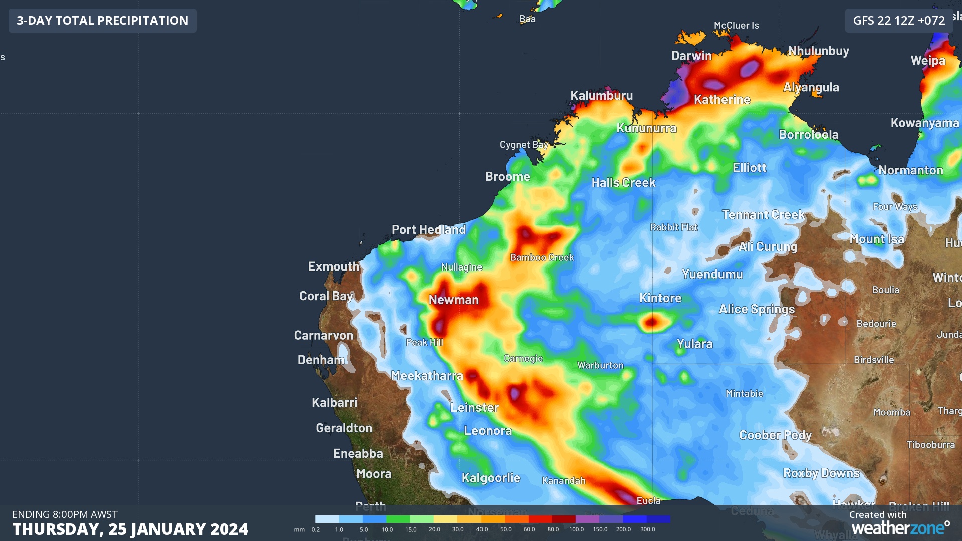
Images: Forecast accumulated rain during the 72 hours ending on Thursday night, according to the ECMWF-HRES model (top), ACCESS-G model (middle) and GFS model (bottom).
Showers and storms will extend further west into the Pilbara and Gascoyne from Friday, eroding the hot air mass that has gripped the regions for months.
A severe weather warning and flood watch have been issued for the northern inland of WA in response to this system. Be sure to stay up to date with the latest warnings for the most accurate information on this developing weather event.