Extreme fire danger returns to NSW, Qld
Firefighters in Qld and NSW will continue to face challenging conditions over the next two days amid another burst of hot, dry and windy weather.
A cold front crossing southeastern Australia on Monday and Tuesday will cause a tongue of hot and dry air to sweep across NSW and Qld. This heat will be accompanied by blustery northwesterly winds ahead of the front, before a dry westerly-to-southerly wind change sweeps through.
Temperatures are forecast to reach the low-to-mid 30s in central NSW, including the Sydney Basin, on Monday. The hottest air will then shift further north on Tuesday, with temperatures likely reaching the mid-to-high 30s in parts of northern NSW and southern Qld.
The air will be very dry ahead of and behind this cold front, which will cause the front to pass through without causing substantial rainfall. Unfortunately, this means firefighters will face a dry wind change as the front sweeps through, which will make some fires erratic and difficult to control.
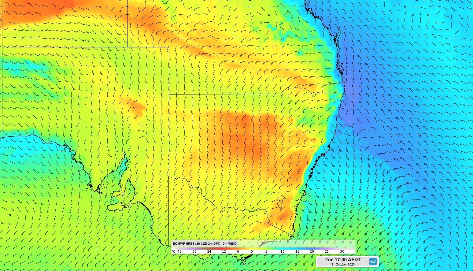
Image: Forecast dew point and wind at 5pm AEDT on Tuesday, according to the ECMWF-HRES model.
This combination of hot, dry and windy weather will help create High to Extreme fire danger ratings over a broad area of NSW and Qld on Monday and Tuesday.
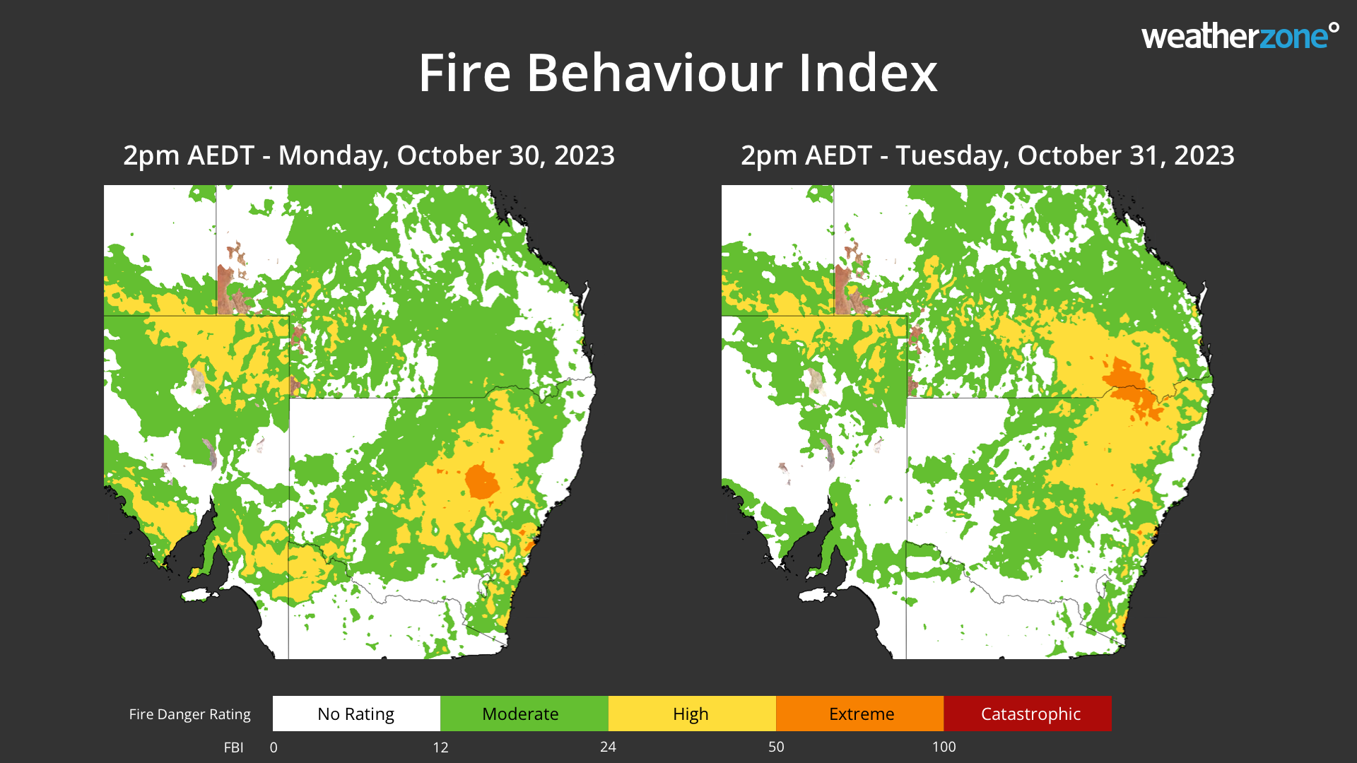
Image: Forecast fire danger ratings on Monday and Tuesday.
A large number of fires were actively burning across eastern Australia ahead of this week’s hot weather. According to the NSW Rural Fire Service, there were 75 fires burning in NSW at 9am AEDT on Monday, with 22 of these uncontained. In Qld, 78 fires were burning at 11am AEST on Monday, according to the Qld Fire and Emergency Services.
As of midday AEDT on Monday, a severe weather warning was in place for damaging winds over parts of southern NSW and a fire weather warning was current across central and northern parts of the state.