Ex-TC Kirrily just refuses to quit
Tropical Cyclone Kirrily was declared a week ago this Thursday, and its remnants are still delivering rainfall to northwestern Queensland.
You can see the low pressure system that used to be Kirrily in the NW corner of Queensland on the loop below, which was captured on Thursday morning

Apart from a few patches of rain off Queensland's east coast associated with a different low pressure system, the activity caused by ex-TC Kirrily is the main rain action across the whole of Australia today, with dry extremely hot conditions in southern WA set to extend eastwards.
And it's not over yet. Some models are predicting that ex-TC Kirrily will gather moisture from the Gulf of Carpentaria then move southwards roughly along the line of the NT/Qld border, bringing heavy rain to more southern parts of western Queensland.
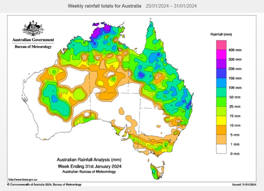
Take a look at the weekly rainfall chart for Queensland below. As you can see, the Sunshine State was a pretty rainy place in the last week of January – again largely thanks to ex-TC Kirrily – with only small sections of outback Qld missing out.

Image: Rainy one day, soggy the next. Source: BoM.
Weatherzone's Andrew Miskelly captured the flooding in the Diamantina River in Queensland’s Central West forecast district.
Ex-Tropical Cyclone Kirrily has drifted a little north, revealing the flooding in the Diamantina and Hamilton rivers. It's possible the system will return to the Channel Country later this week. pic.twitter.com/VACEMe833a
— Andrew Miskelly (@andrewmiskelly) January 31, 2024
Further downstream, the Diamantina becomes known as the Warburton, and in extremely wet periods, the Warburton flows all the way to Kati Thanda-Lake Eyre in South Australia, Australia's lowest point and our largest lake when it fills, which only happens occasionally.
It's not yet clear whether the current floodwaters in western Qld will make it all the way to South Australia. But if ex-TC Kirrily does make a U-turn and head south, it will boost the likelihood, as some parts of outback Qld have already seen up to 200 mm in the past week.