
Ex-Tropical Cyclone Dovi hits New Zealand
Ex-Severe Tropical Cyclone Dovi, initially formed in the Coral Sea, travelled hundreds of kilometres down, to finally make landfall this morning over the North Island of New Zealand, as a powerful extratropical low.
Heavy rainfall has been affecting parts of the North Island and the upper South Island as a thick band cloud extending from Ex-Tropical Cyclone Dovi approached the country over the past couple of days. Some rainfall totals in the past 24 hours include Wellington Airport (121mm), Ngawi (99mm), Farewell Spit (92.6mm), Kaikoura (92mm), Castle point (81mm).
Today, gale-to-storm-force winds affected the North Island and the upper South Island. This morning, Auckland registered wind gusts over 130 km/h, with maximum wind gusts over 150 km/h in more exposed coastal areas.
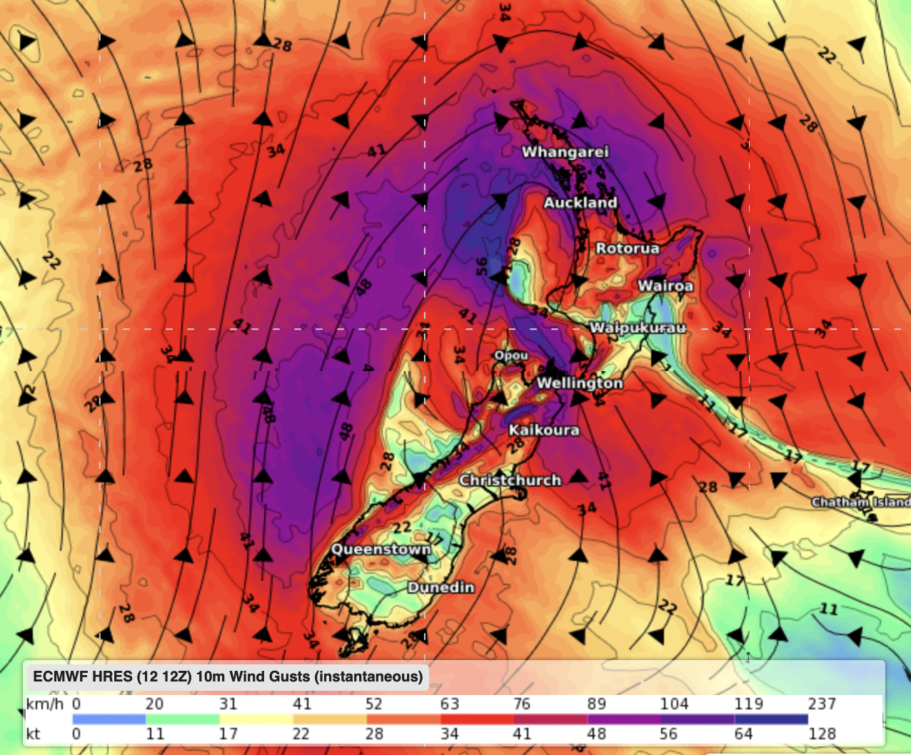
Wind gusts today Sunday 13th at 7am NZDT. ECMWF model.
As the system crosses the North Island today, damaging winds are possible until afternoon, while further maximum rainfall totals are expected to accumulate between 50-70mm over southwestern North Island (Taranaki area), 40-60mm about northeastern South Island (Malborough, Canterbury) and 30-50 in southeastern North Island (Wellington and Wairarapa), on top on what has already fallen.
The worst weather conditions should ease by this evening, when the system heads eastwards, away from the country.