East coast weather summary for the King's Birthday holiday
A high-pressure system has dominated over the east this past weekend, giving us chilly mornings over the weekend and clear skies over the past three nights, before a trough from the interior entered the scene this morning.
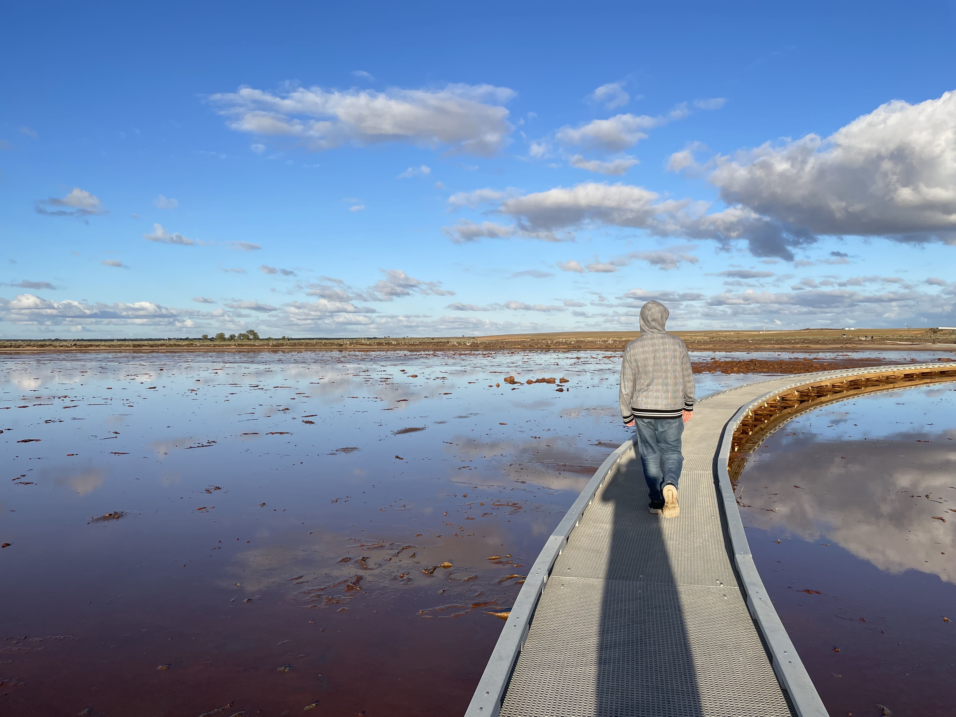
A lingering high over the east coast, has brought consistently calm weather conditions to most areas of QLD, NSW and VIC this long weekend, resulting in perfect conditions for picturesque photography to celebrate the holiday.

Lake Tyrrell, VIC at 4:21pm (EST): Calm conditions allow for the surface of the salt lake to have beautiful reflective properties.
High air moisture content, calm-to-light northerly-component winds and predominantly clear skies have led to most of us to wake up to beautiful white mornings, with fog being rife for many cities these past three days.
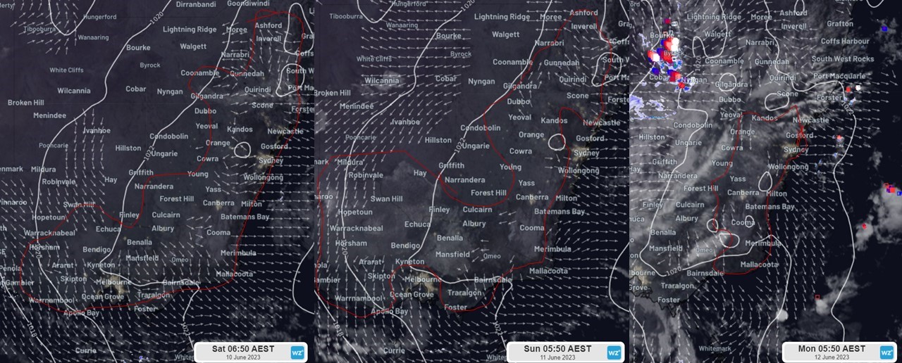
Following Saturday's story about the foggy morning experienced at the start of the weekend, today saw extremely foggy conditions along the interior of the east coast. This morning, visibility was reduced to the following values across some areas of NSW:
- Camden reaching a minimum visibility of 0m
- Maitland and Goulburn reaching a minimum visibility of 50m
- Canberra, Lismore, Richmond and Cooma reaching a minimum visibility of 100m
- Ballina, Port Macquarie, Moss Vale and Bathurst reaching a minimum visibility of 200m

Himawari Satellite images of the mornings of Sat 10th (6:50AEST), Sun 11th (5:50AEST) and Mon 12th (5:50AEST) with areas of fog detected outlined in red (Note: not the entire area inside the outline is fog, but fog patches are present which can be seen via satellite).
Further, these clear skies sapped the day's heat, resulting in chilly mornings on Saturday and Sunday. This morning high cloud rolled in from the west with a trough moving in from the interior, locking in the evening cold. Together with the weekend this resulted in a three-cold morning streak for many east coast cities:
- Brisbane (mins of 10.4,10.9 on Sat/Sun)
- Sydney Olympic Park (mins of 5.6, 4.3, 5.4)
- Canberra (mins of –1.6, -3.4, - 1.6)
- Bombala (mins of –1.5, -3.6, -5.5)
- Albury (mins of 2.4, 1.7 on Sat/Mon)
These conditions will not persist further into the week as a decaying front and trough will pass over the eastern states from tomorrow, bringing rain, strong winds and thunderstorms through VIC and NSW.