East coast rainband clears after stormy night
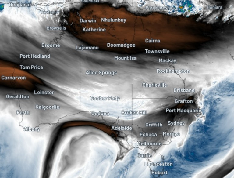
It was a dark and stormy night, as they say in the classics, but the rainband which brought heavy rain and storms to at least three eastern states has now moved out to sea, as you can see clearly on the Friday morning satellite image.

Numerous flood warnings are in place in NSW, Qld, Vic and Tas, with by far the most warnings in New South Wales after overnight rain which was heaviest in the Northwest Slopes and Plains forecast district.
- The heaviest NSW totals to 9 am Friday morning were all around the Tamworth area, with falls of around 50 to 60 mm at multiple locations. Falls of 20-30mm were recorded across the Northern Tablelands, with totals in the vicinity of 20 mm along large parts of the coast, including Sydney.
- Southern Queensland also copped some storms just before dawn, with the heaviest 24-hr totals to 9 am Friday up to 30 mm in the Maranoa and Warrego and Darling Downs and Granite Belt forecasts districts. Totals of up to 20 mm were recorded in the far southeast of the state.
- Northern Victoria also had overnight falls in excess of 10 mm at numerous centres, adding to already swollen river catchments.
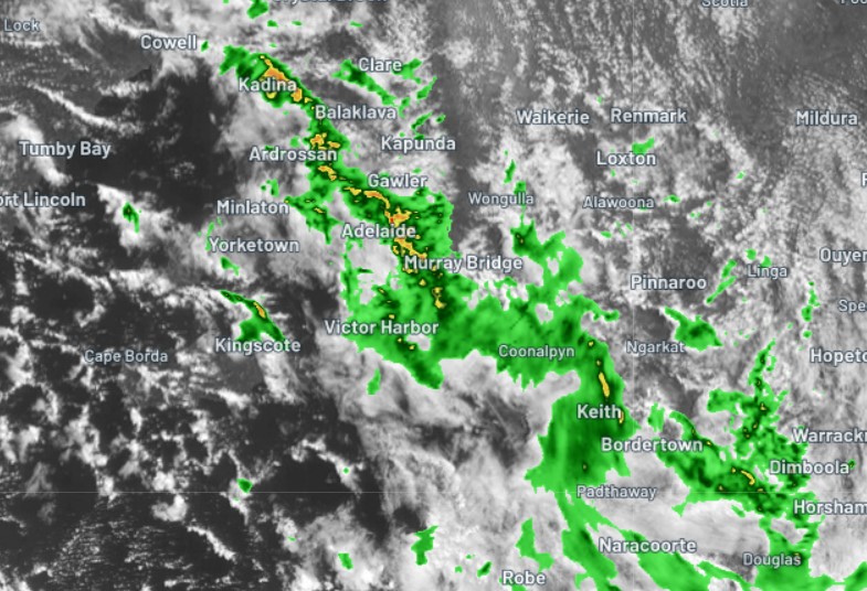
The national weather focus is currently on South Australia, as a cold front sweeps across southern parts of the state bringing brisk winds, cooler temps and persistent showers. Indeed a fairly significant line of storms is crossing Adelaide and surrounds as we write this story.

The system will head east into the weekend, bringing cooler temps and rain across several states, with the heaviest falls in Victoria and southern NSW. Unlike last night's system, most of the moisture won't make it to the east coast.
As we wrote yesterday, there's also the likelihood of a pretty decent mid-September snow dump in Victoria and New South Wales from this system.
Please be sure to check the latest flood warnings and watches for the most up-to-date information on riverine flooding on our warnings page as this weather event unfolds.