Dry Red Centre fuels fires near Alice Springs
Drying vegetation in central Australia has been fuelling a large fire near Alice Springs over the past week, with satellites capturing the blaze stretching across the Stuart Highway on Sunday.
Central Australia started 2023 with abundant vegetation on the ground following three successive La Niña seasons and an exceptionally wet January.
But after a few months of drier weather, this vegetation is now much drier than it was at the start of the year, which is fuelling several fires in the Red Centre.
The satellite image below shows a fire front stretching across the Stuart Highway to the north of Alice Springs on Sunday, August 13.

Image: Enhanced satellite image showing the location of the fire front on Sunday, August 13, 2023. Source: EO Browser / Sentinel-2
The darker ground to the west and southwest of the fire in the image above shows where the blaze has burnt over the past week. The animation below, which was published on the North Australia and Rangelands Fire Information (NAFI) website, shows how far the fire spread over the past seven days.
Video: Animation of satellite-derived fire hotspots over the 7 days ending on the morning of August 14, 2023. Source: NAFI
While fires are normal in central Australia during the winter months, the curing of above-average vegetation coverage in recent months has provided more fuel for fires than usual.

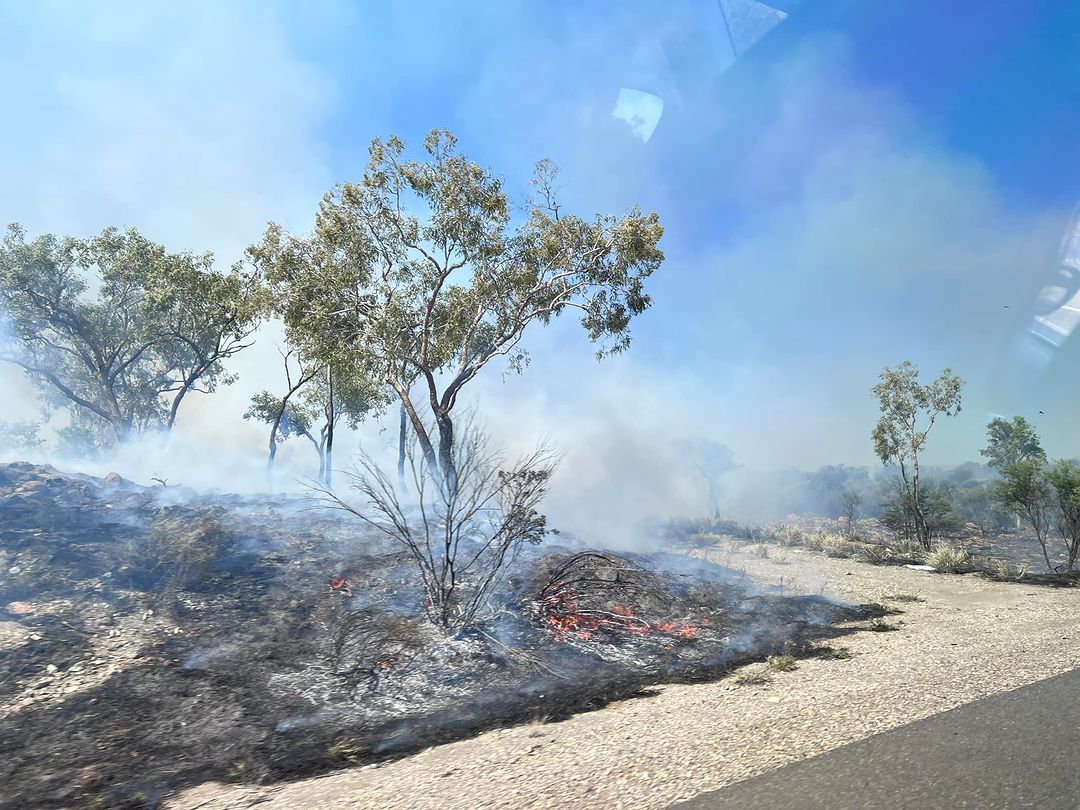
Image: Fire near the Stuart Highway, north of Alice Springs, on August 13, 2023. Source: @dylanhughjones / Instagram
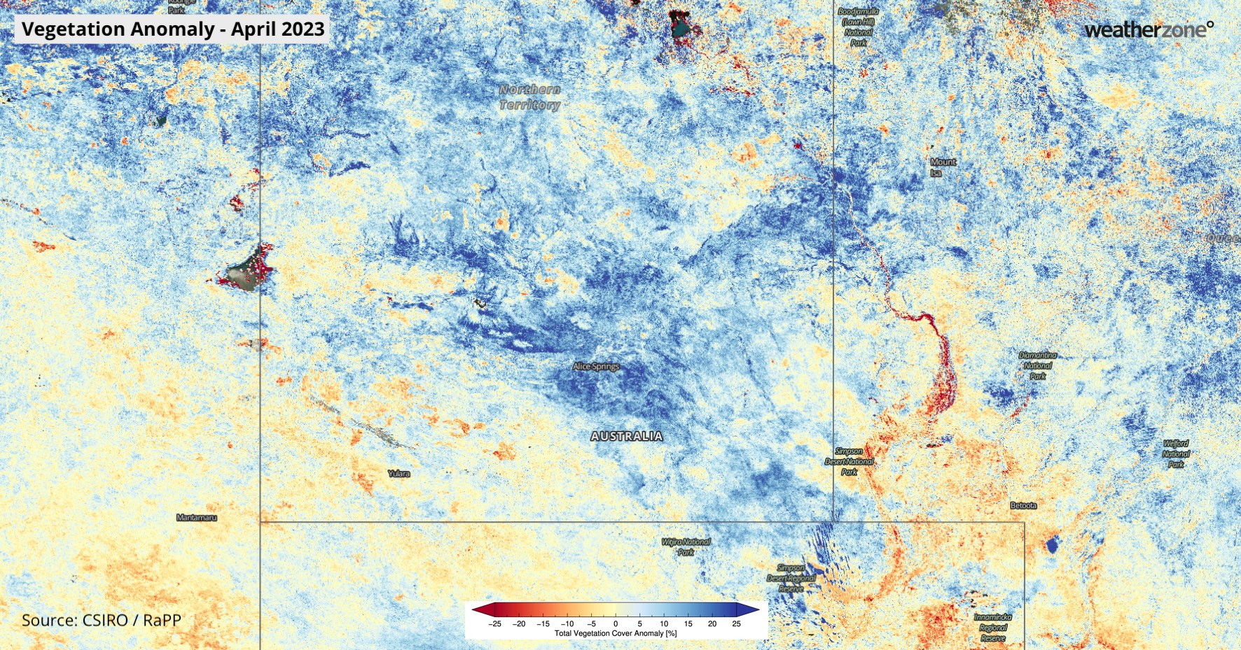
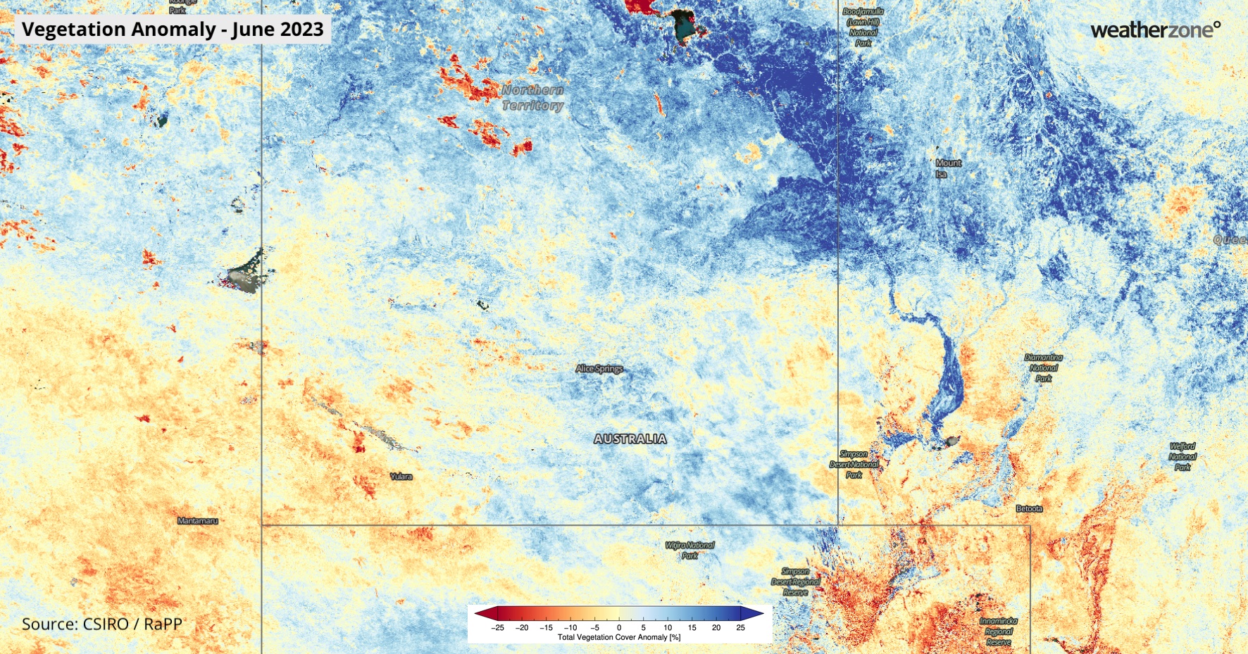
The maps below show the vegetation cover anomalies in April 2023, following an unusually wet start to the year, and in June 2023, after a run of drier months. The maps show that areas around Alice Springs had above average vegetation cover in April, before transitioning to below average vegetation cover in June.


Images: Vegetation cover anomalies in April and June 2023. Source: CSIRO/RaPP
With no rain on the immediate horizon, these fires will continue to burn in central Australia throughout the rest of this week and likely longer. You can find the latest NT fire information on the Northern Territory Fire and Rescue Service’s Fire Incident Map.