
Dry lightning outbreak sparks multiple fires
A trough crossing southern SA has sparked as many as 40 bushfires due to a combination of dry lightning and parched countryside experiencing ongoing severe rainfall deficiencies, with fires also sparked in Victoria.
The dry lightning outbreak started on Monday evening and has continued through to the middle of Tuesday before progressing eastwards into Victoria, with more than 400,000 lightning strikes recorded within 500km of Mount Gambier in southeastern SA between Monday morning and Tuesday lunchtime.
While a few SA locations were lucky enough to see falls of 10mm or more (including Coonawarra with 24.4mm), most locations saw barely a drop – and certainly not enough to negate the effects of a lighting strike.
A SA Country Fire Service spokesperson said that nearly all of the service's 68 brigades and trucks in the state's southeast have been actively responding to calls throughout the night and into the early morning.
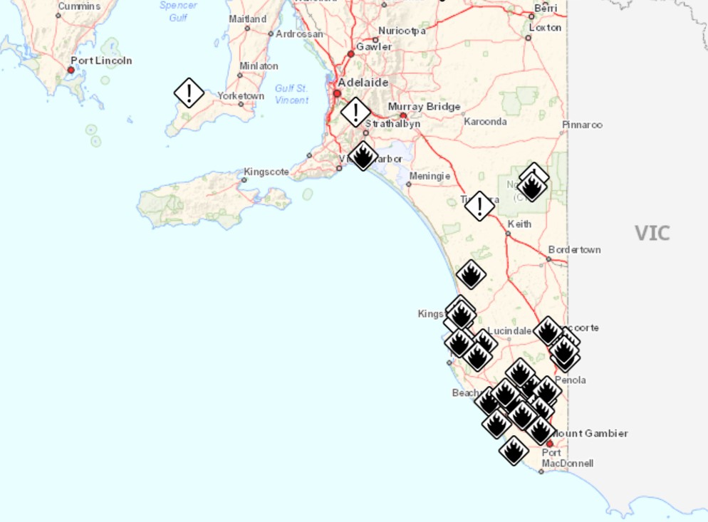
Image: Fire incidents in SA at 1:30pm on Tuesday, Mar 11, 2025. Source: SA Country Fire Service.
You can see how the lightning outbreak developed overnight on the combined radar and lightning loop below, where pink indicates areas of lightning.
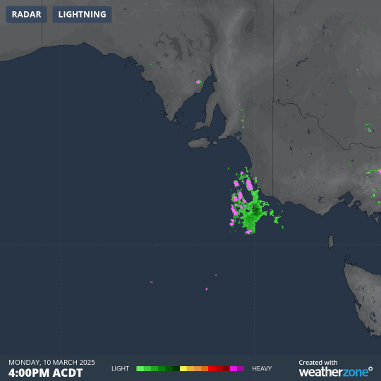
Image: Six-hour radar loop showing rain and lightning approaching and then crossing SE South Australia and SW Victoria from 4pm to 10pm on Monday. March 10.
READ MORE: KANGAROO ISLAND, THE ISLAND THAT RAIN FORGOT
Many parts of southern SA were also without power overnight due to thunderstorm activity.
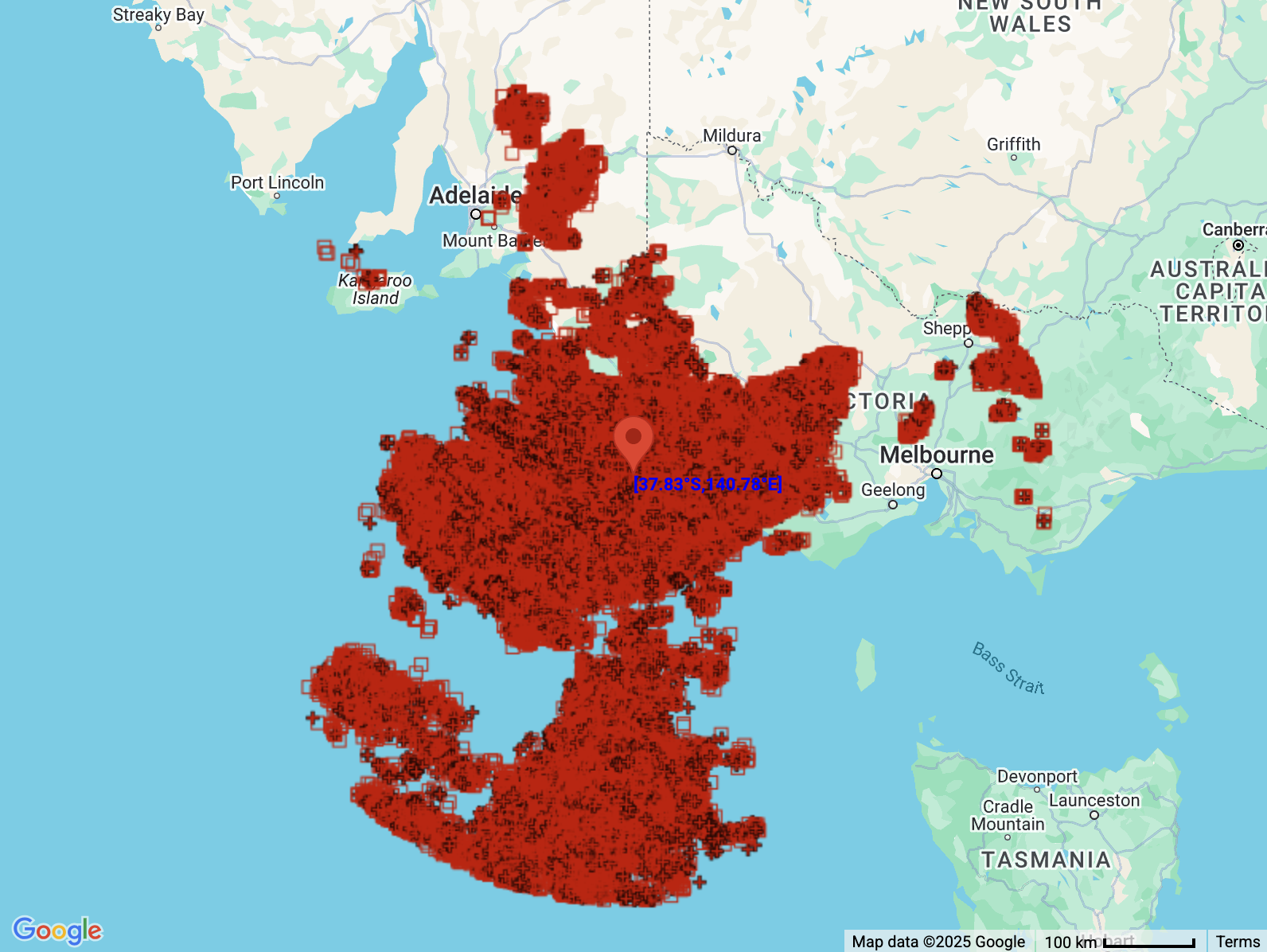
Image: Map of lightning strikes in SA and VIC on Monday, Mar 10 and the first half of Tuesday, Mar 11, 2025.
For firefighters currently tackling blazes in South Australia, the weather outlook is not positive heading into the second of the working week.
After a Wednesday and Thursday with max temps in the high 20s or low 30s across much of southeastern SA, maximums will rise sharply to the mid-to-high 30s with highs of 37°C and 38°C expected in Adelaide on Friday and Saturday respectively, as northerly winds strengthen.
Please check the latest fire info at the South Australian Country Fire Service or the Emergency Vic Incidents and Warnings page.