Dry and windy over central Australia
A strengthening high pressure system traversing the south of the continent over the next few days will create dry and gusty conditions over much of central and northern Australia over the upcoming week.
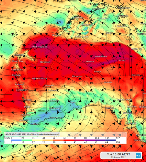
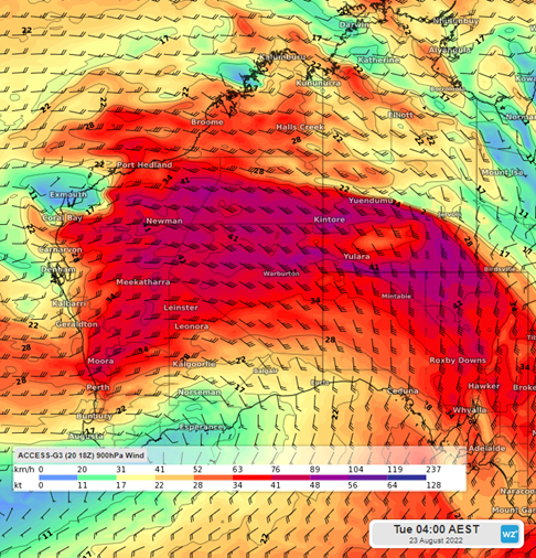
Clear skies and cool nights will lead to the formation of a nocturnal jet. Winds at the surface will remain light overnight and in the early morning until the inversion breaks. Then stronger winds aloft can then reach the surface. This will lead to some blustery conditions with gusts having the potential to reach up to 50km/h. Most of central Australia has been without precipitation so these winds may also raise dust, reducing visibility and air quality, and further drying out the landscape.

Winds gusts across western and central Australia. ACCESS-G Tuesday 10am.
What is a nocturnal jet?
A nocturnal jet is a fast-moving air current in the lower atmosphere during nighttime under clear skies. When strong radiational (surface) cooling leads to an inversion (a cool air mass at ground level with a layer of warmer air above), the winds above the inversion in the warmer air are no longer slowed by surface friction and get faster.
During the day as the surface temperature increases, the inversion breaks. The faster winds aloft then reach the ground bringing some gusty winds to the surface.

Winds at 900hPa above the inversion across western and central Australia. ACCESS-G Tuesday 4am.
A nocturnal jet will form each night over the upcoming days, with Tuesday likely to be the strongest. As the high pressure system slowly weakens as it moves east, the nocturnal jet will reduce in speed. Lighter winds are likely to return next weekend.