Dramatic drop in temperatures across Victoria
Sweltering conditions yesterday across Victoria lingered into the evening before a notably rapid wave of colder air brought much more agreeable temperatures into the early hours of Sunday.
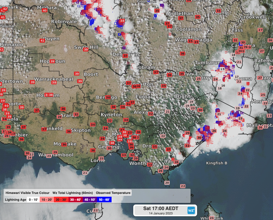
Satellite imagery below from yesterday afternoon shows largely clear skies with temperatures in the mid-to-high 30s across central and western Victoria, with some locations reaching the 40-degree mark in the Mallee region. These hot temperatures had been drawn into the state with northerly winds ahead of an approaching low pressure trough.

Himawari Visible True Colour imagery with observed temperatures at 5pm AEDT on Saturday
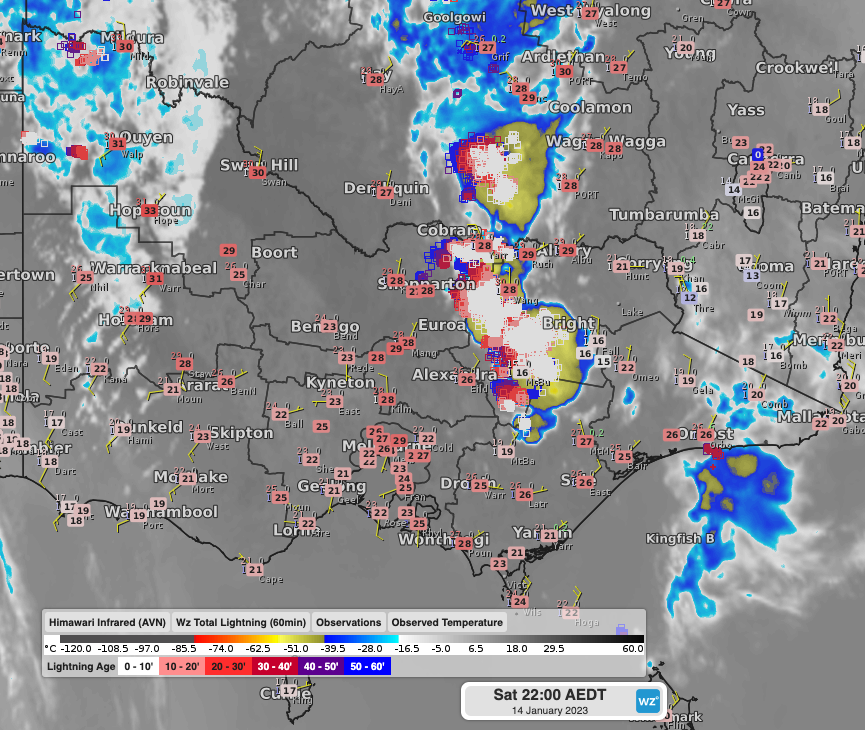
As the evening set in, a cold wind change began to march across the southwest, reaching into the remainder of the state overnight, bringing significant cooling, and much more appreciable sleeping conditions. Temperature drops of 12 to 17 degrees within 3 to 5 hours were recorded across parts of the state. The mercury dropped from the high-30s or near 40 degrees around sundown, to a much more comfortable low-to-mid-20s at midnight, with further cooling in the early hours of Sunday as a stronger burst of south-to-southwesterly winds made its way across.

Himawari Visible Infrared imagery with observed temperatures and winds at 10pm AEDT on Saturday showing the cool change crossing the southwest of the state, with warm near 30-degree temperatures remaining over northern and central parts of the state ahead of the cool change.
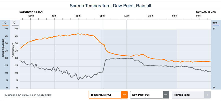
Kanagulk in central Wimmera dropped an astonishing 17 degrees in the 3 hours to 10:30pm, while Melbourne Airport saw the mercury drop 13 degrees over a similar time period. Melbourne (Olympic Park) itself dropped 11 degrees in the 2 hours to 9:40pm.

Observed Temperatures and Dew Point Temperatures at Melbourne (Olympic Park) with a notable drop in temperature from about 8pm.
A much milder day will come today under a persistent southerly airmass.
Maximum temperatures today (Sunday): low-to-mid-20s across southern parts of the state, and in the high-20s and low-30s in the north. 21°C and cloudy for Melbourne.
Heat will however return with strength on Monday and Tuesday as a low pressure trough deepens over the region, drawing hot northerly winds over the state.
Maximum temperatures tomorrow (Monday): mid-30s in the north and west of the state, and in the high-20s for more southern parts. 30°C and mostly sunny for Melbourne.
Maximum temperatures Tuesday: mid-to-high-30s, and into the low-40s over northwestern parts. 37°C and sunny for Melbourne.
Another cold change will come overnight into Wednesday, bringing another drop in temperatures after sundown, and leading to a more prolonged period of cooler temperatures, with temperatures in the low-to-mid-20s expected on Wednesday and Thursday.