
Double or nothing
Two low pressure systems spinning in the Tasman Sea have their arm-like fronts stretching across the Tasman, making it appear like they're giving one another a high-five. After the blistering cold weather they brought to Australia's east coast, our neighbours in New Zealand will also have a strong taste of winter.
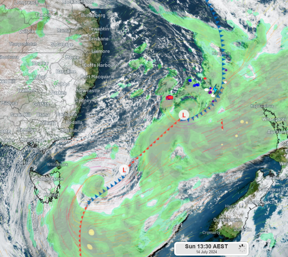
Fig. 1: Satellite image of the two lows in the Tasman Sea, with modelled winds (and strength), detected lightning strikes, and synthetic rain radar as of 1:30pm AEST on Sun 14th of July.
The system to the north is drawing in the dry Australian continental air, bringing increasingly brisk winds along the east coast (see Fig. 2), whilst its front arm looks to reach northwest New Zealand late this evening. The New Zealand MetService has already issued an orange warning for heavy rainfall for the Bay of Plenty coastline, with warnings for gale force marine winds having been issued at 1:11pm NZST.
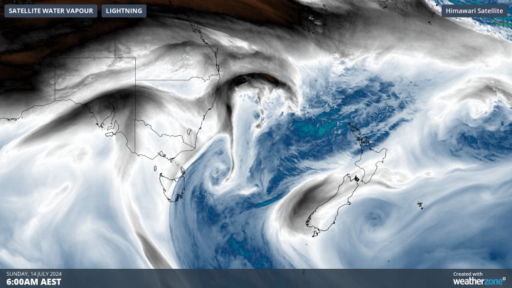
Fig. 2: Satellite water vapour over the 6hrs to 12:00pm AEST showing the dry continental air (black) and moist ocean air (blue)
With the system further offshore, clearing cloud and westerly component winds brough some chilly temperatures to the east coast this morning. (see Fig. 3).
Ahead of this system's large warm front, chilling southerly winds are pushing over Tasmania, Victoria, southern NSW and SA. These southerly winds contributed to this morning's single-digit and sub-zero temperatures in those areas.
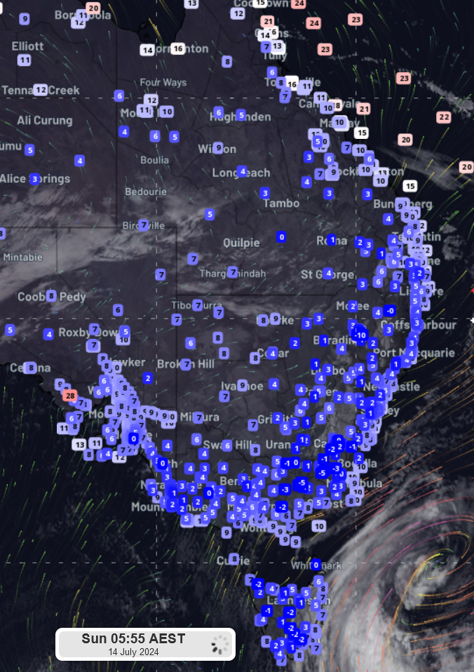
Fig. 3: This morning's recorded temperatures for different cities and centres across the country's east and southern coasts.
The southern low is heading for Tasmania on Sunday, warranting the Bureau of Meteorology's damaging wind warning along the east and west coasts, exposed islands (such as King Island) and the elevated centre.
As we mentioned yesterday, this system will move north to Victoria on Monday. Consequently, another warning has been issued for Victoria, as the low moves north in the next 24 hours.
The system will bring welcome snowfall over the Australian Alps before heading out to the Tasman Sea, where the double-trouble lows will come to an end. Though there is still some uncertainty about the movement of these lows, models currently indicate that the low will lose its momentum in the Tasman and will slowly merge with its predecessor (the northern low), lingering offshore till the end of the week. You can see this happening here.