Disappearing Tarn returns as heavy rain transforms Tasmania
The mysterious Disappearing Tarn has returned to kunanyi / Mount Wellington this week after a quintessential late-autumn state-wide soaking caused flooding in Tasmania.
August is Tasmania’s second wettest month with a state-wide monthly average of 148.2 mm. This sits just behind July (154.4 mm) and a smidgen ahead of May (135.7 mm) and September (134.9 mm).
So, it wasn’t surprising to see a processions of low pressure systems and cold fronts delivering frequent and heavy rain across the state during the past week. However, it was unusual for so much rain to fall in the state’s east, courtesy of a deep low pressure system in the western Tasman Sea.
The map below shows that most of Tasmania received around 50 to 100 mm of rain in the last seven days, with a few places exceeding 150 mm. This included 177.2 mm in one week at kunanyi / Mount Wellington, which is more rain than the mountain received during all of June and July combined.
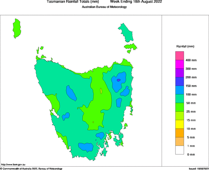
Image: Observed rainfall during the week ending on August 18, 2022. Source: Bureau of Meteorology
With this much rain in a short space of time, it also wasn’t surprising to see an elusive iridescent turquoise lake suddenly appearing on the rocky slopes of kunanyi / Mount Wellington.
The Disappearing Tarn
“Like tripping into paradise” is how The Guardian’s Natasha Cica described Tasmania’s Disappearing Tarn when she first laid eyes on it in November last year.
The Disappearing Tarn is a small lake that sometimes appears on the side of kunanyi / Mount Wellington after heavy rain. The Tarn’s water is strikingly clear and bitterly cold, and it usually only stays around for a few days before disappearing again.
While there is no guarantee that the Tarn will appear after any single rain event, this week’s wet weather was enough to bring the lake to life.
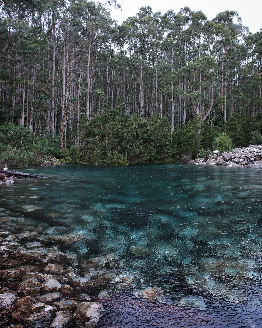
Image: The Disappearing Tarn appeared on kunanyi / Mount Wellington this week, following several days of heavy rain. Source: @0dansmith / Instagram
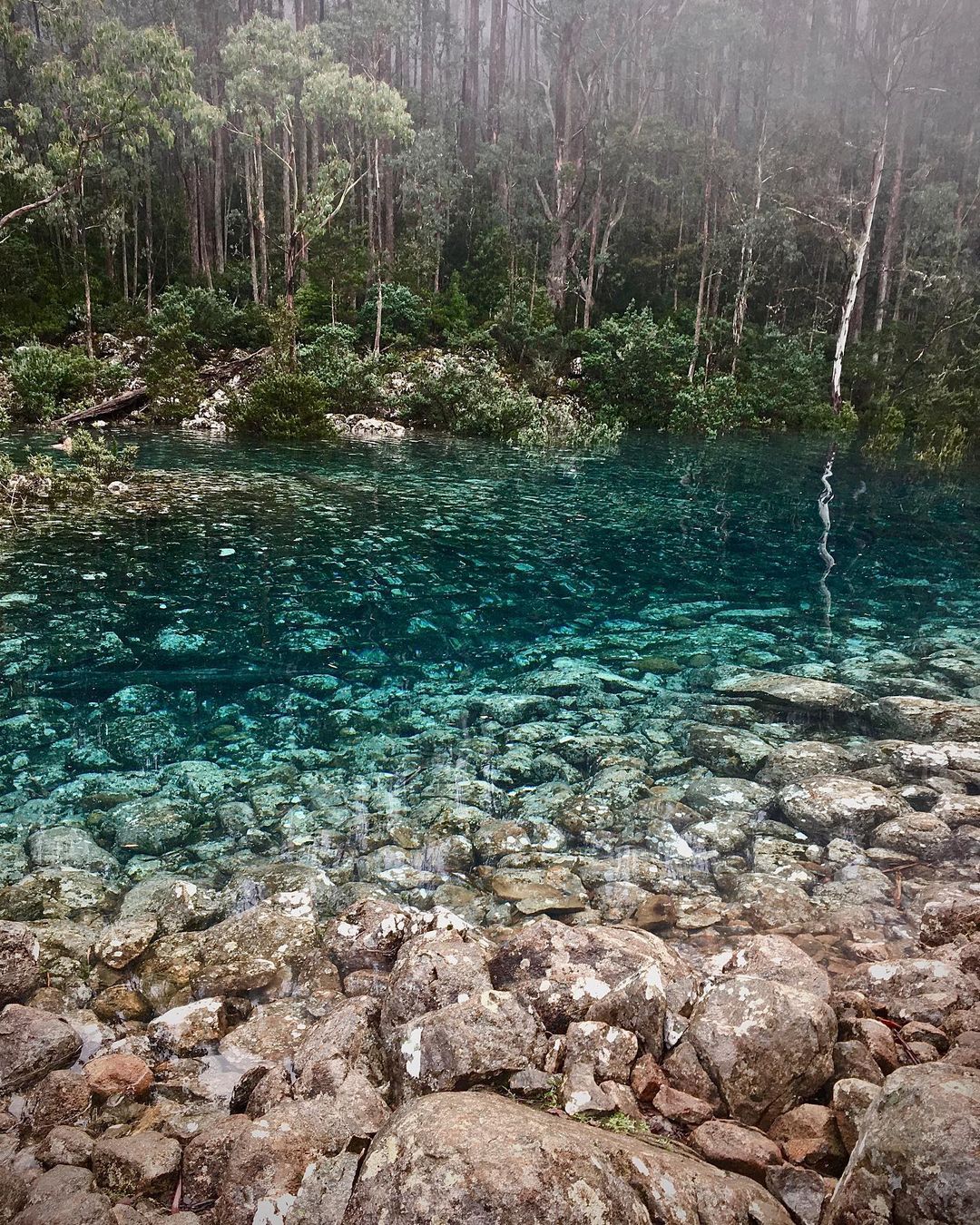
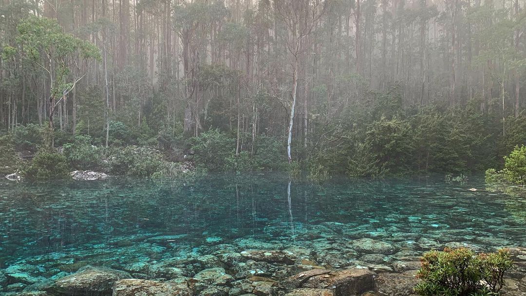
Images: The Tarn also filled up during a wet week last winter, seen here on June 14, 2021. Source: @jac_hittheroad / Instagram (top) and @allie_leech / Instagram (bottom).
Flooding Continues
This past week’s rain has also caused flooding in parts of Tasmania, including the Macquarie, North Esk, South Esk and Meander Rivers. Flood warnings were still in place for these four rivers on Friday, with strong and dangerous flows expected to persist over the coming days.
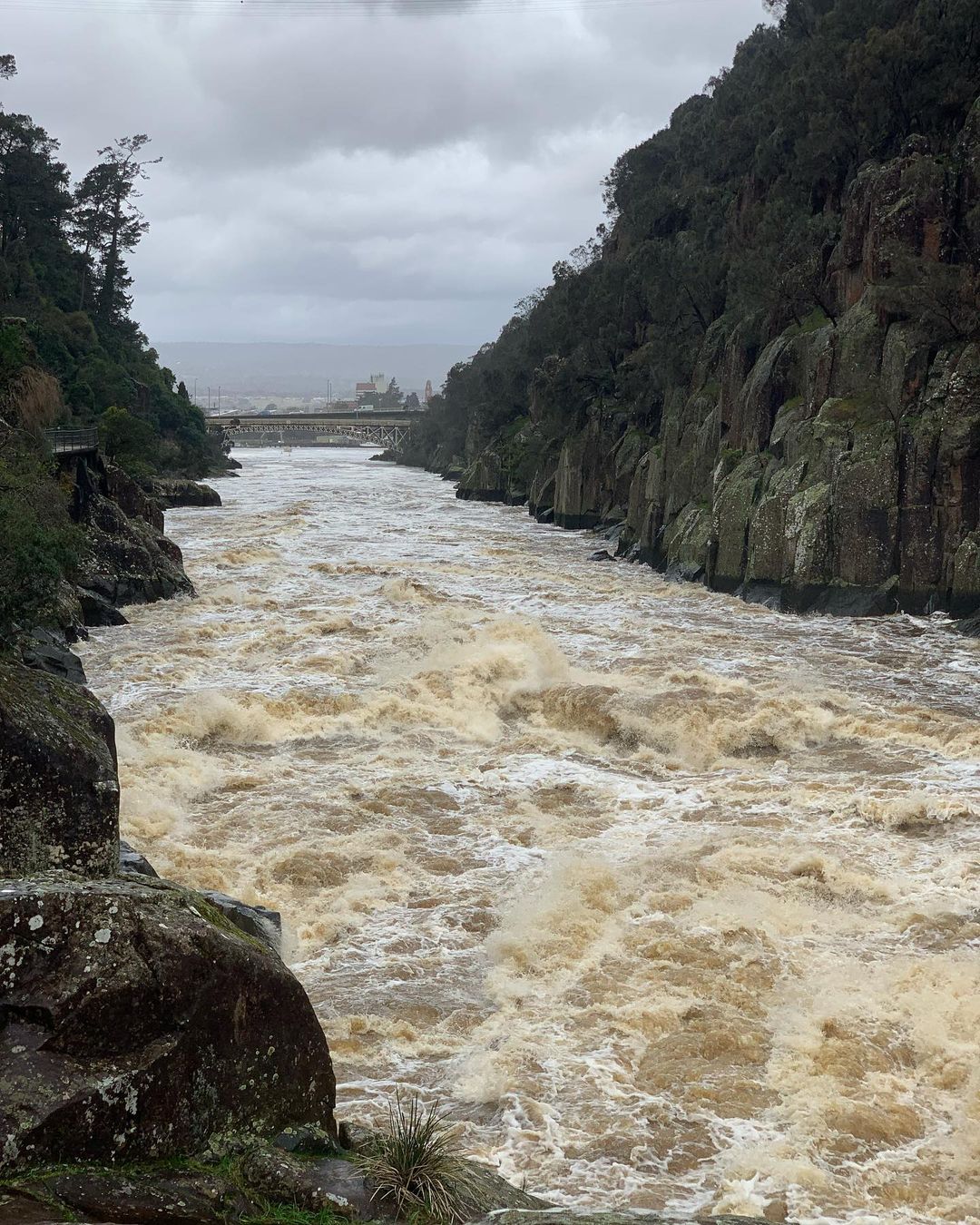
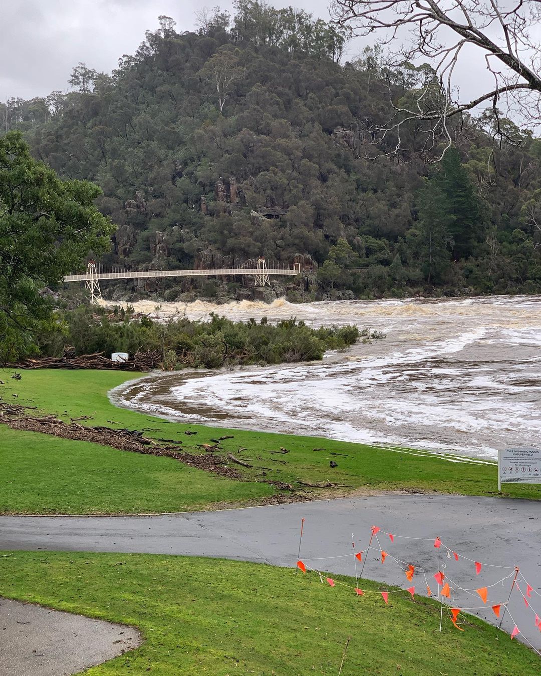
Images: Flooding in Cataract Gorge at Launceston on Thursday, August 18. Source: @tamaratimtamwebb / Instagram
Looking ahead, more rain is likely to fall over the coming week as two cold fronts cross the state on Friday night and on Monday.
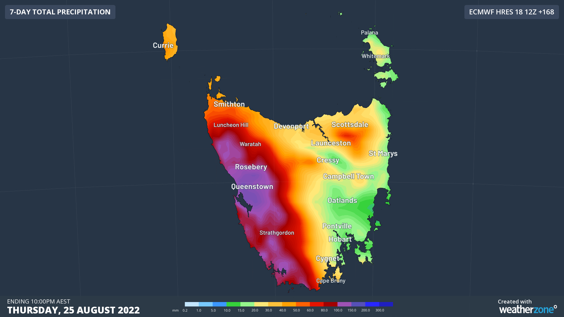
Image: Forecast accumulated rain during the next week (seven days ending at 10pm AEST on Thursday, August 25).
Check the latest flood warnings for the most up-to-date information on river heights and future flood risk.