Devilishly dry in Tasmania
Tasmania has had an exceptionally dry start to 2024, with rainfall deficiencies across the entire state as of mid-April.
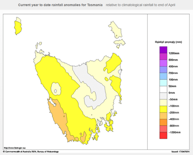
Take a look at the chart below. It shows the rainfall anomalies from January 1 to April 17 – or in other words, the amount of rainfall relative to the running average. As you can see, no part of the state has had more rain than the long-term average to date in 2024.

Source: BoM.
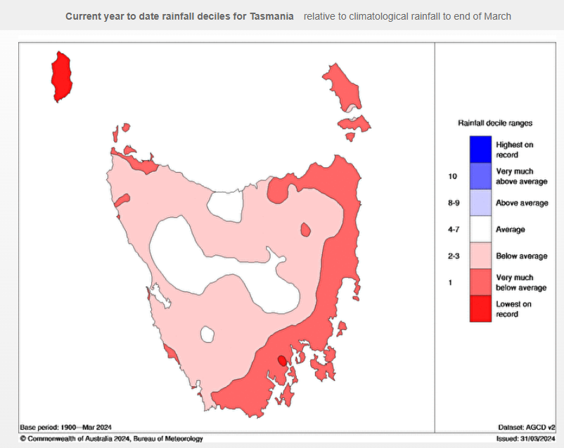
A quick glance at the map above might lead you to think that the southwest corner of the state has had the least rain. That's not true. It's actually one of the wettest parts of Australia, so while it is hundreds of millimetres down on the running average, the east has actually been drier both in real terms and relative terms.
That's illustrated in the rainfall deciles chart below which covers the period from January 1 to the end of March.

Source: BoM.
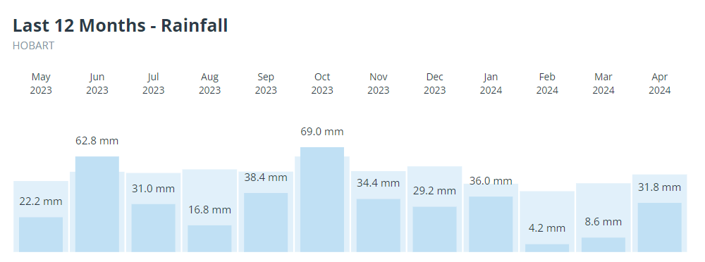
Hobart is very much in the red zone, and its monthly rainfall over the last 12 months is depicted in the graph below.
- Just two of the last 12 months exceeded the average rainfall, and not by much.
- February and March 2024 were exceptionally dry months, with less than 10 mm of accumulated rainfall in both months.

Why so dry?
The positive Southern Annular Mode (SAM) has led to consistent high pressure systems positioned over latitudes well south of Australia. This has kept cold fronts south of the mainland, and even south of Tasmania.
Turning of the Fagus? How passé. Down here in the Huon we’ve got the Turning of the Gums. ???? pic.twitter.com/JPQN4TVUem
— The Planker (@theRealPlanker) April 17, 2024
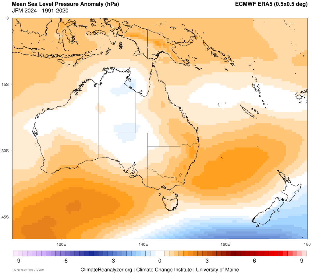
The chart below shows the mean sea level pressure (MSLP) anomalies from January through to the end of March.
Orange means higher pressure than the average, blue means lower pressure than the average. Long story short, the intense cold fronts south of Tasmania have been blocked from moving further north by the consistent highs.

Source: climatereanalyzer.org.
As for the week ahead, expect only very light showers here and there across the state with dry conditions prevailing in most places, although the west coast should see an increase in shower activity into the new week.