
Destructive winds lash Tassie yet again
As we mentioned earlier this week, a large and slow-moving low pressure system in the Southern Ocean would affect multiple states and territories in southeastern Australia until at least this coming Monday. That is indeed coming to pass now.
Despite being lashed with damaging to destructive winds only a few days ago, Tasmania has borne the brunt of the latest round of blustery conditions today, including in some of the state’s largest centres:
- 100km/h gusts with sustained 67km/h winds at Launceston
- 98km/h gusts with sustained 76km/h winds at Devonport
- 96km/h gusts with sustained 76km/h winds at Burnie
- 80km/h gusts at Hobart
Elsewhere in Tassie, wind observations have been even more remarkable than in previous days:
- 165km/h gusts with 141km/h sustained winds at Maatsuyker Island Lighthouse
- 156km/h gusts with 98km/h sustained winds at Luncheon Hill
- 150km/h gusts with 122km/h sustained winds at Low Rocky Point
- 148km/h gusts with 109km/h sustained winds at Scotts Peak
- 143km/h gusts with 106km/h sustained winds at Cape Grim
- 137km/h gusts with 107km/h sustained winds at kunanyi/Mount Wellington
- 135km/h gusts with sustained 72km/h winds at Strahan
- 130km/h gusts with 85km/h sustained winds at Mount Read
- 124km/h gusts with 98km/h sustained winds at Smithton
- 113km/h gusts at Swan Island and Hartz Mountain
- 109km/h gusts at Cape Sorrell and Flinders Island
But there’s more to come.
The Bureau of Meteorology has issued yet another severe weather warning, advising that the most significant cold front to come out of this Southern Ocean low pressure system will impact the state from late this afternoon and into Sunday morning, with another strong front impacting the state from Sunday evening to Monday morning. The most destructive winds will most likely affect western, northern and southern parts of the state tonight, easing on Sunday morning.
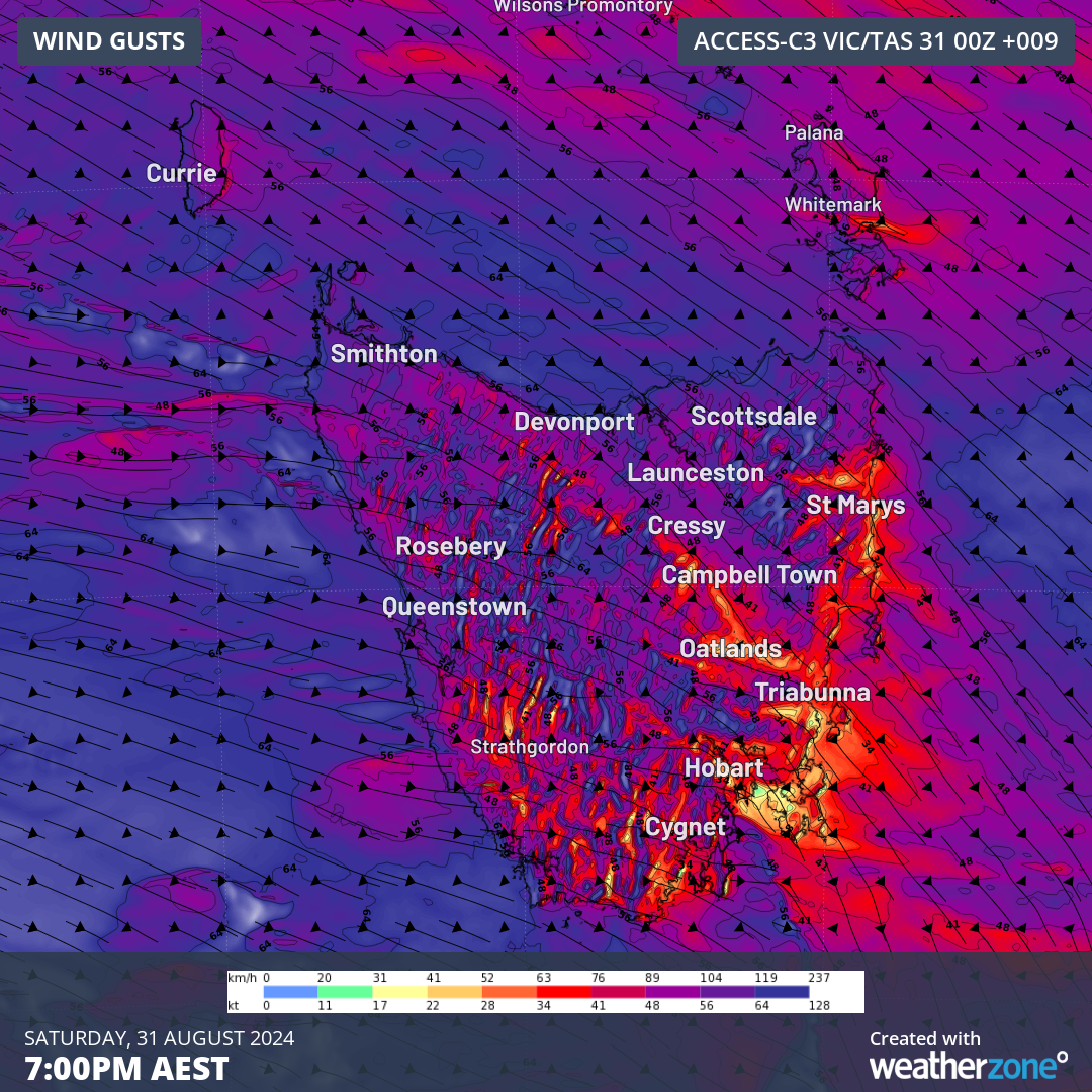
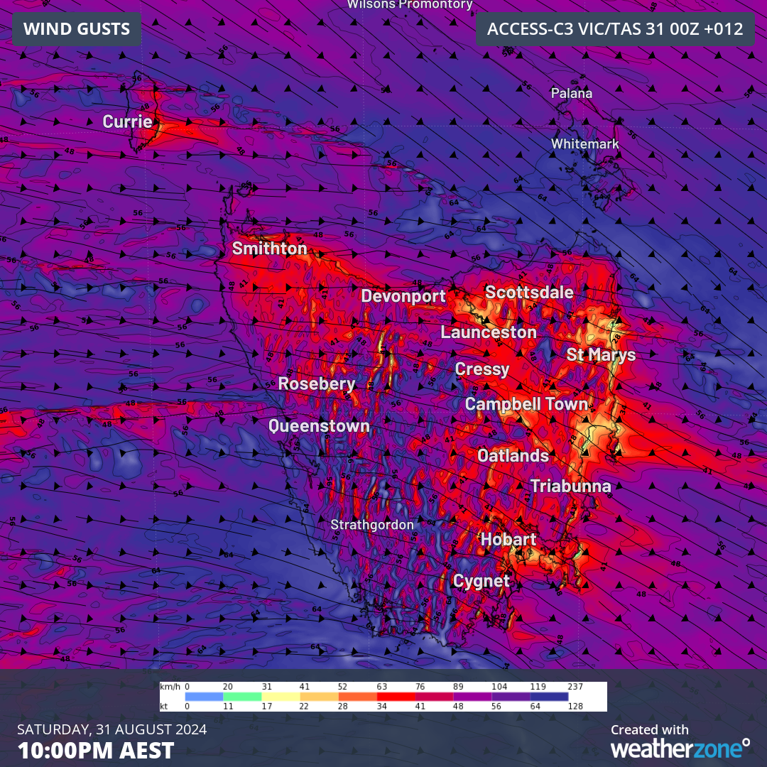
Images: Acc-C Vic/Tas forecast for 10m wind gusts over Tasmania tonight, Saturday, 31 August, at 7pm AEST (top) and 10pm AEST (bottom).
Meanwhile, these fronts and their associated vigorous westerly airstream will also continue to impact South Australia, Victoria, New South Wales and the ACT until at least Monday, with severe weather warnings issued for damaging to locally destructive winds in Victoria and damaging winds in remaining states and territories.
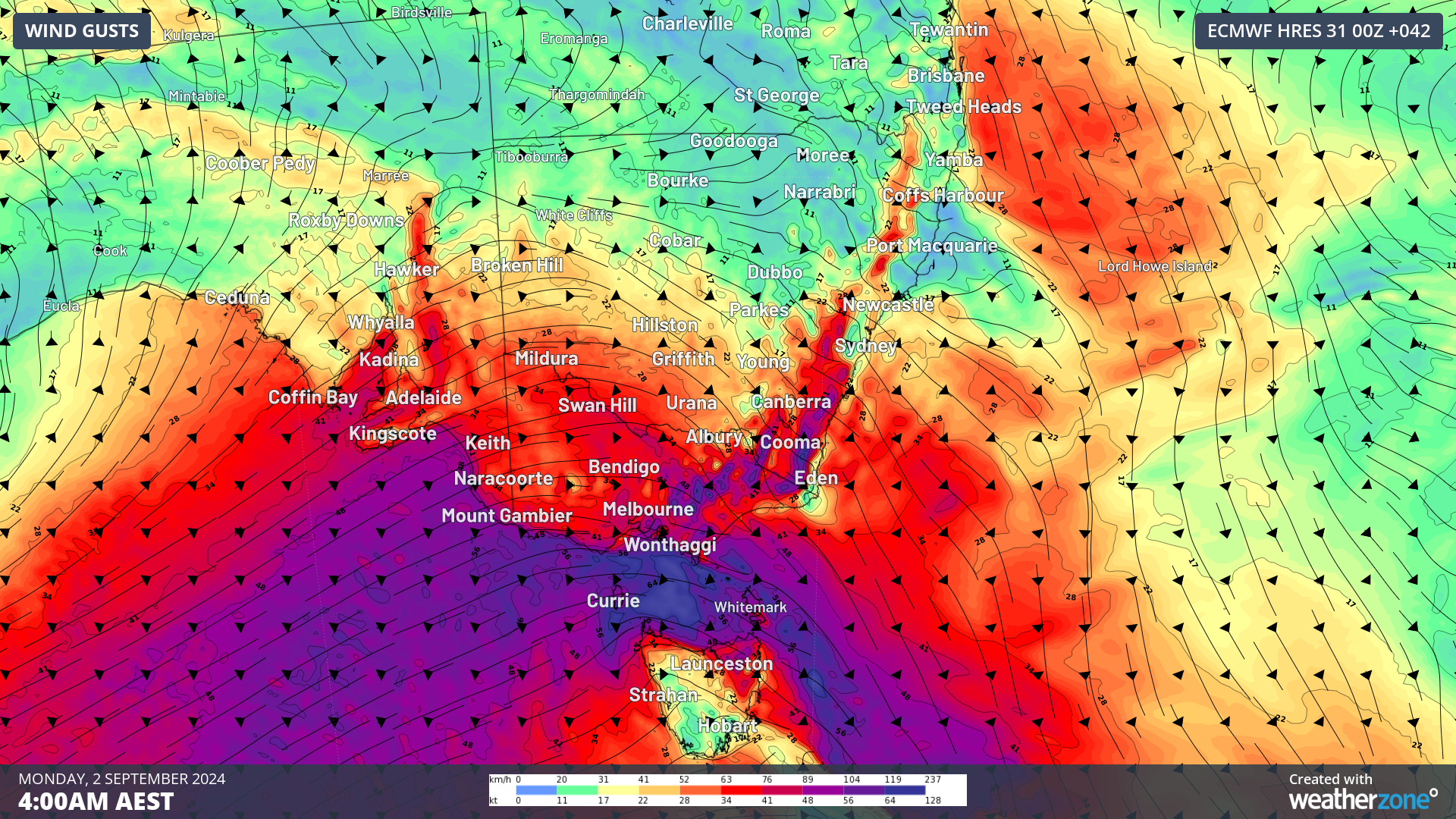
Image: ECMWF forecast 10m wind gusts over southeastern Australia at 4am AEST Monday, 2 September.
It’s going to be a hectic few days for the southeast, so make sure you stay up to date with the latest warning here.