Deep subtropical low rapidly approaching New Zealand
A rapidly deepening subtropical low is ominously approaching New Zealand’s North Island, with storm force winds and heavy rain already battering the Northland Peninsula.
This low has an interesting origin story; with Ex-Tropical Cyclone Lola colliding with a broad trough extending from the east Australian coast across the Tasman Sea towards NZ. The resulting low has since inherited the southward track from the remnants of Lola, while deepening quite rapidly on its approach to NZ.

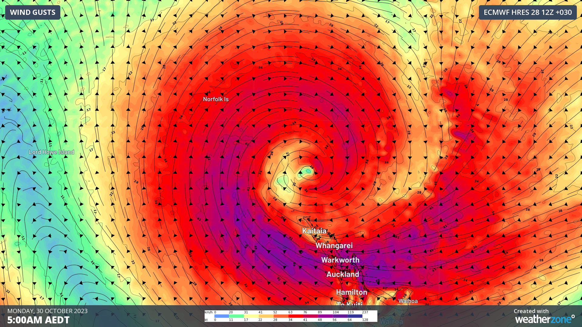
Image: ECMWF forecast wind gusts at 7am Mon 30th October NZDT
Cape Reinga, on the far northern tip of the North Island, has already seen wind gusts above 120km/h this morning with several other stations recording wind gusts exceeding 100km/h. NZ’s MetService warns that winds may exceed 130km/h for exposed coastal areas, and reach 100km/h elsewhere for areas stretching from Northland Peninsula across to the Gisborne region in the country’s northeast.
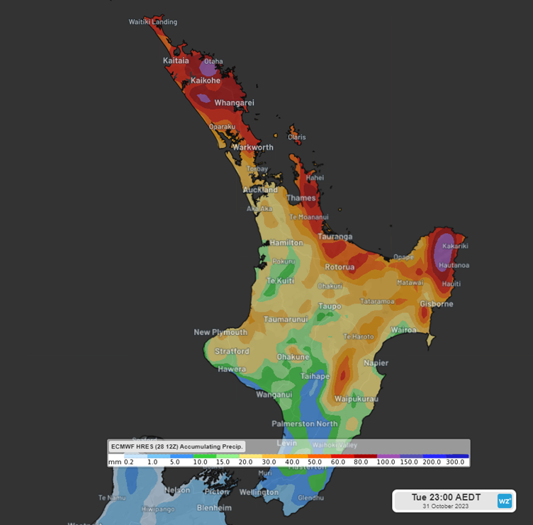
MetService also warns that rainfall totals may reach 100-140mm, possibly as high at 170mm for the Gisborne region as the low edges closer. Most of this rain will fall between Sunday afternoon and Monday afternoon in northern areas, and between early Monday morning and Monday evening in the Gisborne region. In addition, several strong wind and heavy rain watches in place for other northern and central districts of the North Island. Thunderstorms are also a chance north from, and including Auckland and western parts of the Bay of Plenty district.

Image: ECMWF Forecast accumulated precipitation to 1am NZDT Wed 1st November
Auckland itself won’t escape the treacherous conditions. Winds will increase during Sunday night, and peak Monday morning, potentially exceeding 100km/h for the exposed coast and islands. Rainfall thankfully looks to be less intense with 40-80mm likely across NZ’s biggest city until Tuesday evening.
Winds and rain will ease for northwestern areas late on Monday, and focus in on the northeast coast on Tuesday as the low weakens and slides to the east. By Wednesday, the low will dissipate ahead of the next cold front bringing another burst of heavy showers late in the week.