Dangerous weather spreading over southeastern Australia
A powerful cold front and low pressure system will cause a dangerous mix of weather across southeastern Australia during the next 48 hours.
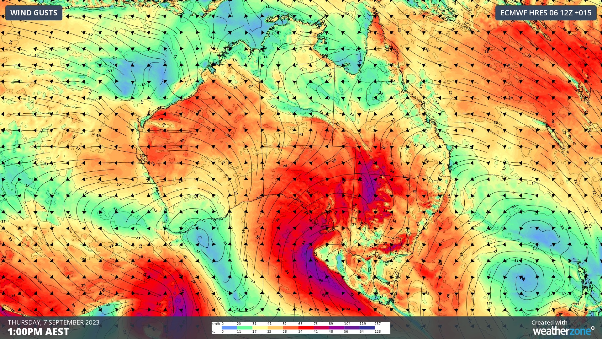
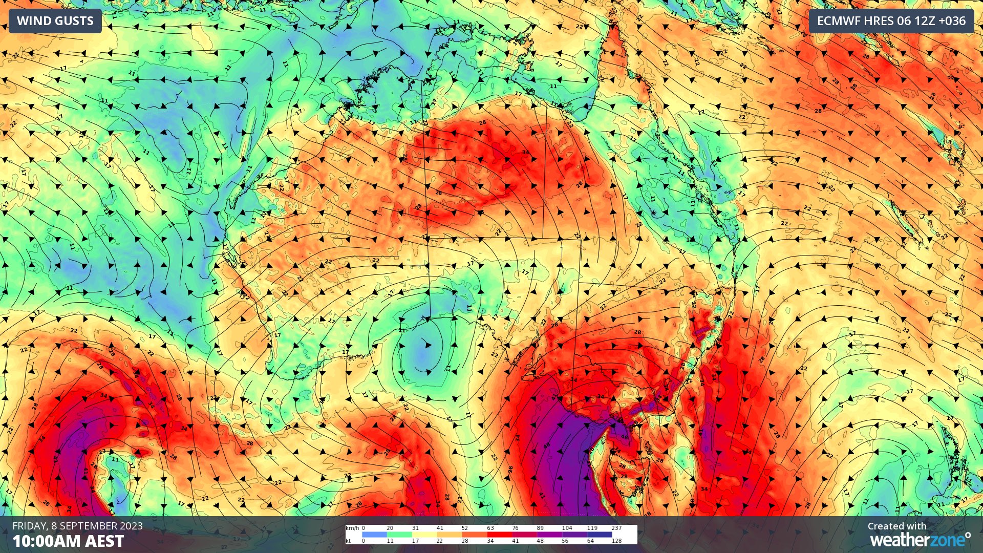
The front and low will barrel across southern and southeastern Australia on Thursday and Friday, causing a burst of showers, thunderstorms and blustery winds in SA, Tas, Vic, NSW, the ACT and southern Qld. Some areas will also see winterlike temperatures and low-level snow as a polar air mass moves in behind the front.
Image: Composite satellite, radar and lightning showing thunderstorms over parts of central, southern and eastern Australia before sunrise on Thursday.
As of 6am AEST on Thursday, severe weather warnings were in place for damaging winds in parts of SA, Vic, NSW and Qld. Sheep Graziers warnings, marine wind warnings and fire weather warnings were also in place for some areas.


Images: Forecast wind gusts (speed and direction) on Thursday and Friday, according to the ECMWF-HRES model.
Thunderstorms had already developed over inland areas of central, southern and eastern Australia before sunrise on Thursday. This thunderstorm activity will become more widespread throughout the day, with storms expected to become severe in some areas, most likely in western NSW.

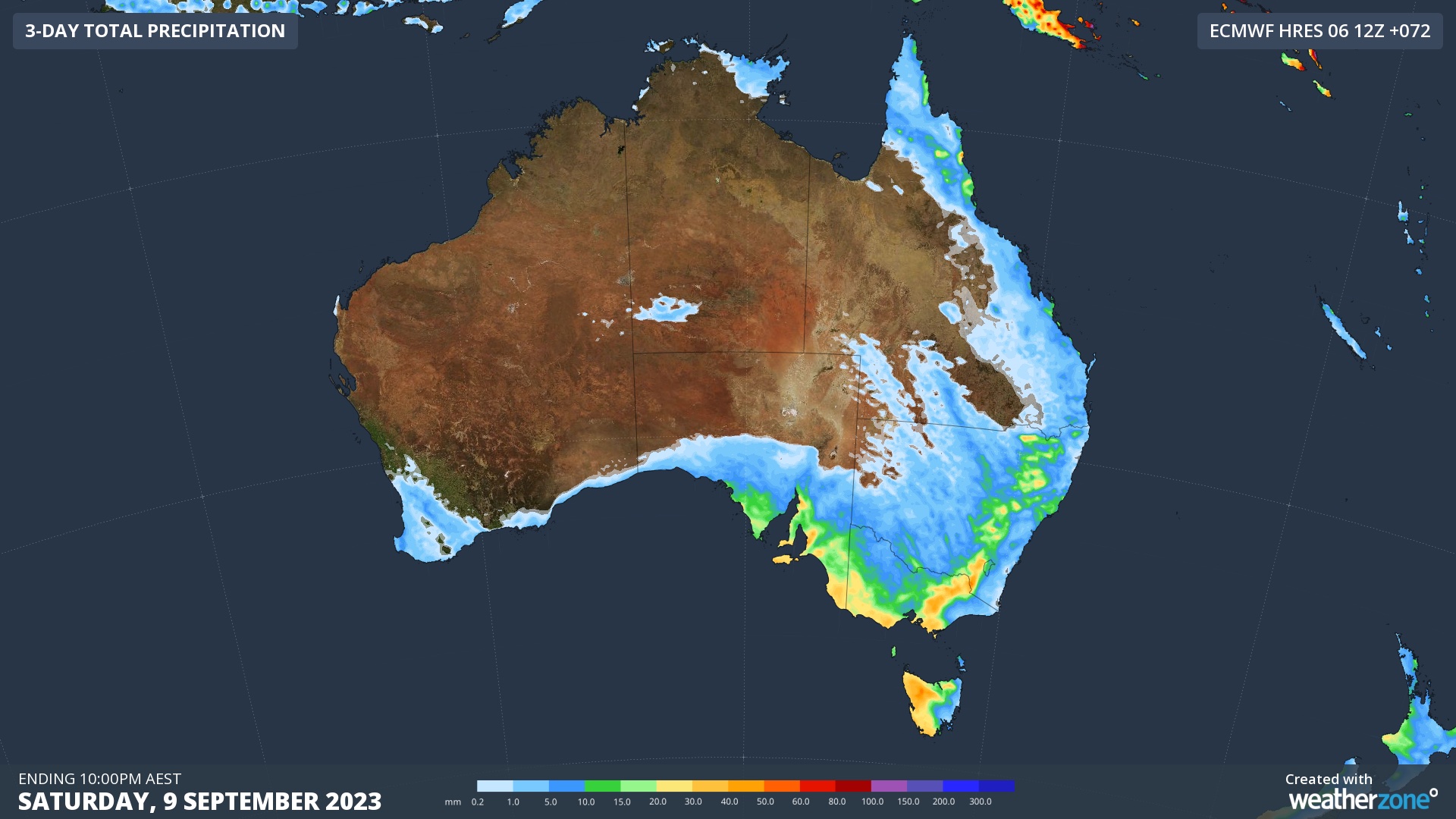
Image: Forecast accumulated rain between Thursday and Saturday, showing where showers or thunderstorms are expected to occur.
Warnings will be updated regularly during the next 48 hours, so be sure to check the latest warnings and forecasts in your area for the most up to date information.