
Dangerous rain looms for southeast QLD
Several hundred millimetres of rain could fall over parts of southeast Queensland and northeast NSW during the next 72 hours, with a dangerous period of intense rain possible on Thursday night.
A deepening low pressure trough interacting with a steady stream of moisture-laden easterly winds is causing dangerously heavy rain and storms in parts of southeast Queensland and northeast NSW this week.
Over the last 48 hours, rainfall totals of 100 to 400mm have been recorded in areas between Coffs Harbour in NSW and Gympie in Queensland. This included 425mm in the 24 hours to 9am on Wednesday at Mount Wolvi, near Grafton, and 240mm in the 24 hours to 9am on Thursday at Alstonville, near Ballina.
This rain has already caused flooding on both sides of the border. It has also saturated the ground and primed the landscape for further flooding in the next few days.
Forecast models suggest that heavy rain and storms will continue over southeast Queensland and northeast NSW during the next 2 to 3 days, as the low pressure trough lingers over the region.
The map below shows how much rain three different computer models are predicting over the next three days.
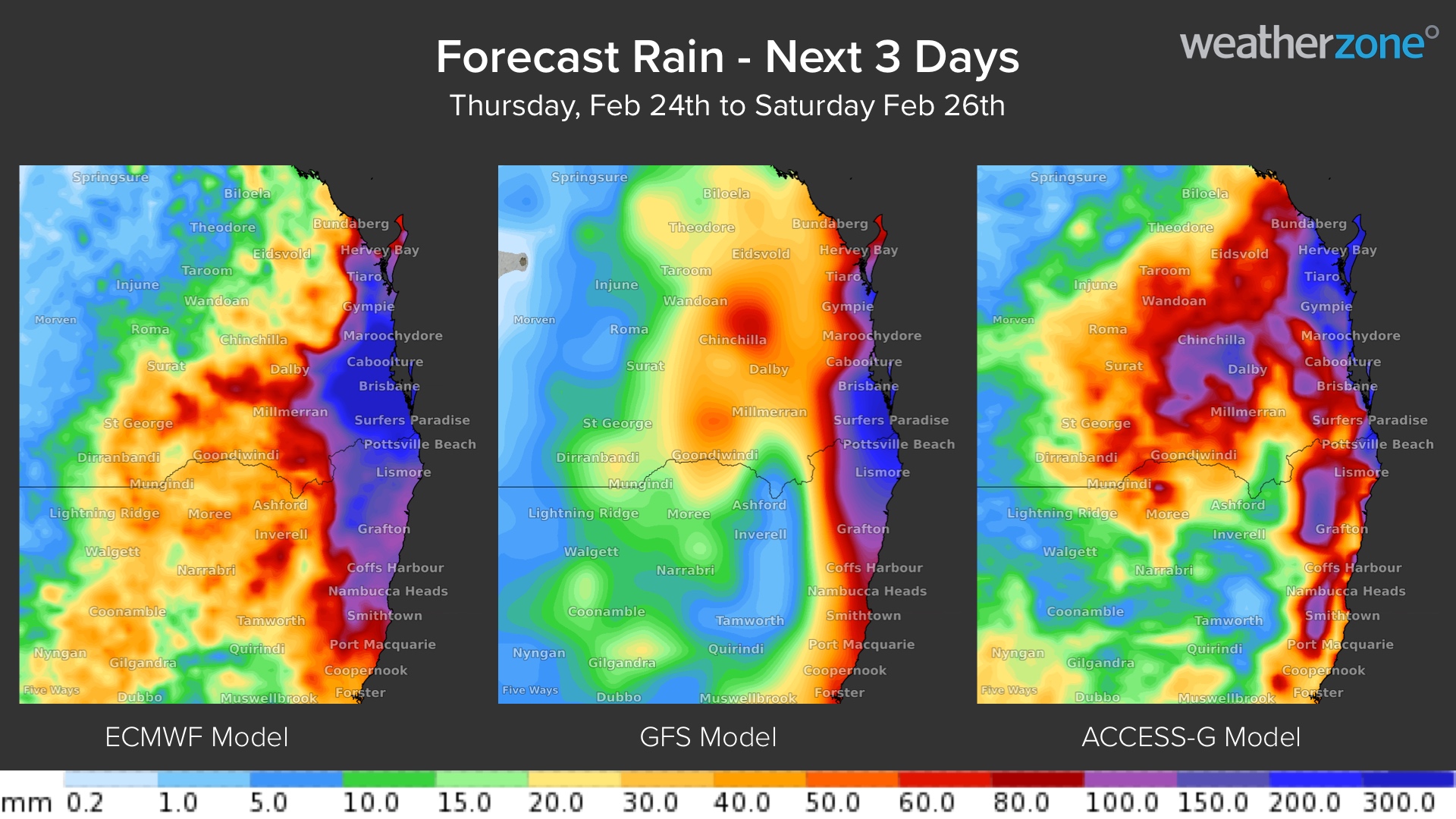
Image: Forecast accumulated rainfall between Thursday and Saturday according to the ECMWF, GFS and ACCESS-G models.
The period from Thursday afternoon to Friday morning will be particularly dangerous, with six-hourly rain rates possibly reaching 200 to 300mm in parts of southeast Queensland.
The maps below show the predicted rain during the 6 hours ending at 4am AEST on Friday.

Image: Forecast 6-hour accumulated rainfall ending at 4am AEST on Friday, February 25, according to the ECMWF, GFS and ACCESS-C models.
A number of flood, severe weather and severe thunderstorm warnings have already been issued for this event, and more will come out over the next few days.
Be sure to keep a close and regular eye on the latest warnings and forecasts in the coming days if you live anywhere in southeast Queensland or northeast NSW.