
Damaging winds rip through NSW coast
Residents of eastern NSW have not experienced great outdoor weather this weekend, but Saturday night turned it up a notch, as damaging winds and heavy rain pushed through coastal Sydney and Illawarra overnight into Sunday morning.
The culprit of this weather is a trough that moved offshore yesterday, with a low developing on its southern end, just off the Sydney coast. This wind was amplified by the synoptic forcing of the developing low as well as interaction with the nearby Great Dividing Range, allowing gusts to reach more than 100km/h for parts of the NSW coast.
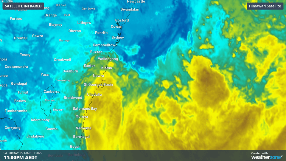
GIF: Infrared satellite showing development of the low off the NSW coast overnight
So far, Wattamolla, between Sydney and Wollongong, has the highest recorded wind gust of this event with 111km/h. Other significant wind gusts include:
- 103km/h at Kiama
- 98km/h at Port Botany
- 96km/h at Bellambi
- 91km/h at Ulladulla
- 82km/h at Kurnell
- 78km/h at Sydney Airport
The GIF above not only shows you the overnight development of the low offshore, but also the thicker clouds in yellow to brown shadings near the Illawarra and South Coast districts. Those were rain bearing clouds that brought about substantial rainfall along coastal areas, with widespread 24 hour totals of 50-100mm between Wollongong and Ulladulla, adding to moderate rainfall totals from between Friday afternoon and Saturday morning.
Some of the most significant 24 hour totals to 9am this morning include:
- 210mm at Currarong
- 107mm at Jervis Bay
- 93mm at Point Perpendicular
- 70mm at Ulladulla
- 61mm at Kiama
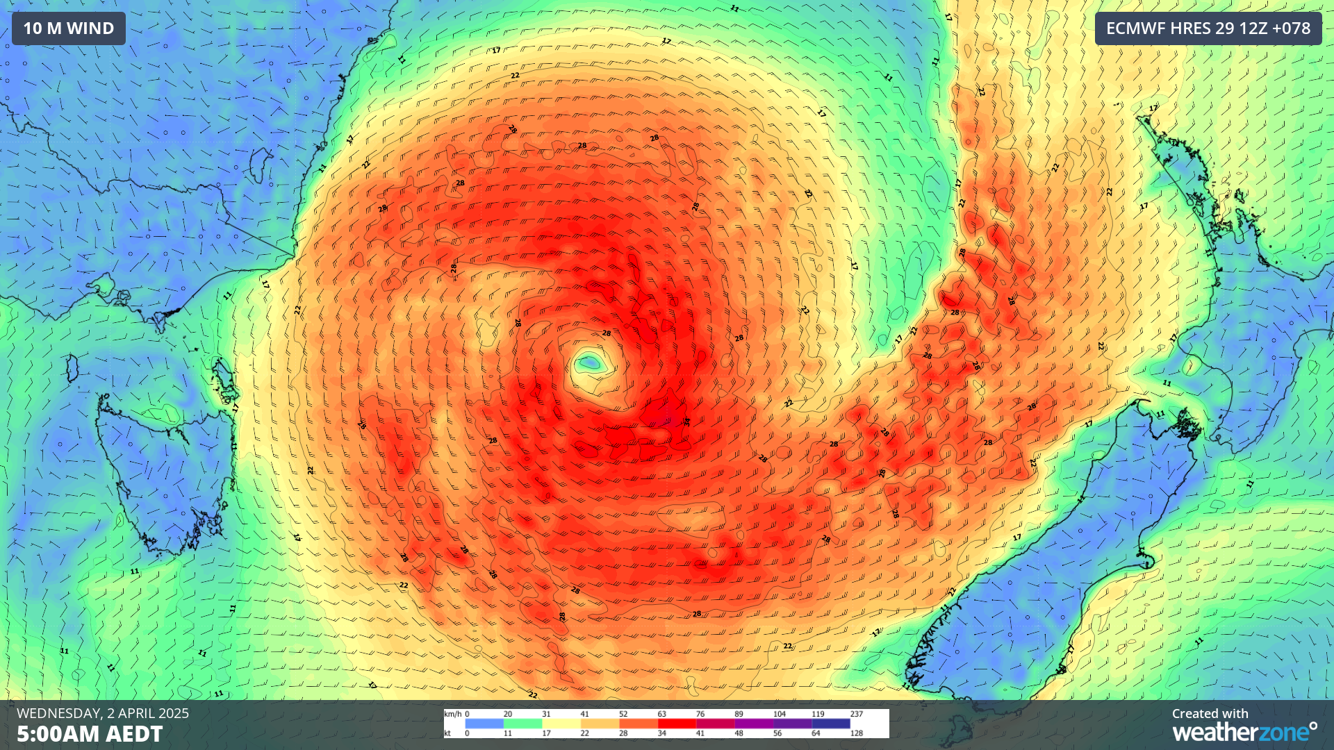
Image: forecast winds over the Tasman sea on the morning of Wednesday 2nd April
The low is expected to continue to develop in the coming days as it tracks southeast over the Tasman Sea. Damaging winds are likely for parts of the southern and central NSW coast through most of today, remaining strong into early next week. In addition, moderate rainfall totals of 20-50mm are expected for southeast NSW until Monday.
This type of weather can lead to various hazards such trees falling down, so make sure to take care if you are heading out in the area today and keep an eye on the latest warnings and information here.