Damaging winds returning to southeastern Australia
Another surge of powerful winds will spread across Australia’s southeastern states over the next two days, prompting warnings for damaging wind gusts in parts of Victoria, NSW and the ACT.
A vigorous northwesterly airstream and embedded cold fronts will cause damaging winds, rain and thunderstorms over southeastern Australia on Thursday and Friday. While this system won’t be as strong as the event that impacted Australia’s southeast last weekend, it will still be dangerous in several states.
Northwesterly winds increased on Thursday morning as the first in a pair of cold fronts clipped the southeast corner of Australia. This system produced wind gusts of 120 km/h at Thredbo Top Station, 102 km/h at Mount Buller, 95 km/h at Mount Hotham and 93 km/h at Mount William early on Thursday morning.
While winds have eased a bit into Thursday afternoon, they will pick up again overnight and into Friday with the passage of a second cold front.
Damaging wind gusts are likely to redevelop in some areas of Vic on Thursday night before becoming more widespread over southern, central and eastern Vic on Friday. The risk of damaging winds will also extend up through parts of southern and central NSW on Friday, including parts of the ACT and the Blue Mountains.
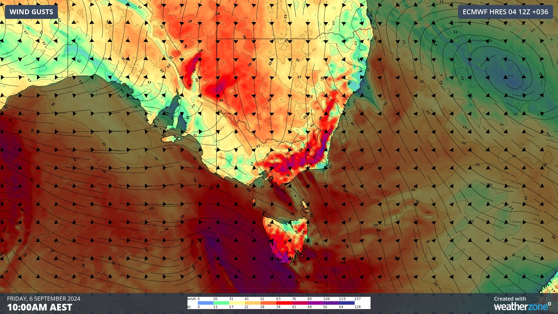
Image: Forecast wind gusts at 10am AEST on Friday, according to the ECMWF-HRES model.
In addition to the wind, a band of rain and embedded thunderstorms will also spread across southeastern Australia between Thursday and Saturday. Any thunderstorms that form in this period will have a risk of causing sudden damaging wind gusts.
Tasmania will also cop another surge of blustery winds and squally rainfall as the front sweeps across the state on Friday. This rain will be falling into already saturated catchments, so further river level rises and minor flooding are likely from late Friday into Saturday. A flood watch has been issued for parts of the state.
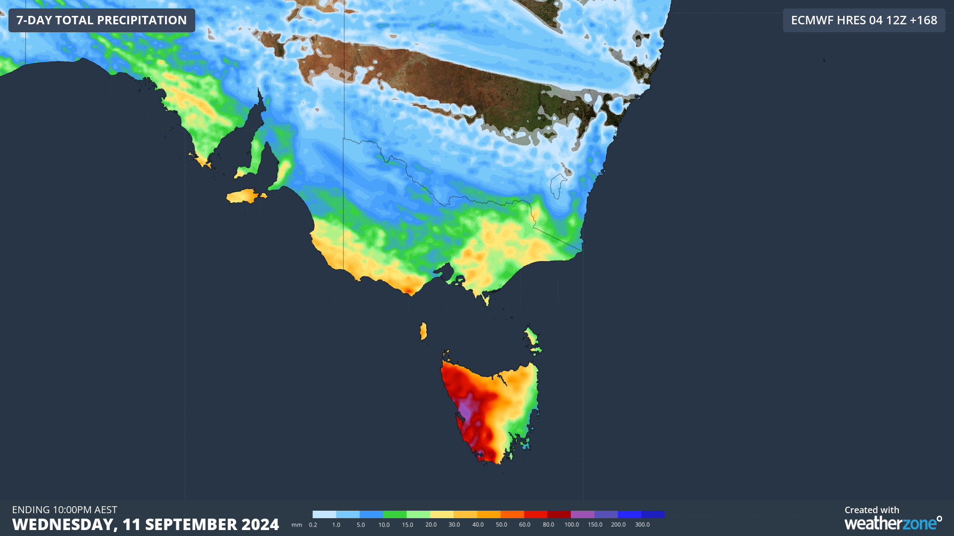
Image: Forecast accumulated rain during the next 7 days, according to the ECMWF-HRES model.
Wind will ease from Friday afternoon into Saturday as a high pressure ridge builds across southeastern Australia. However, another round of strong and potentially damaging winds will return to the region on Sunday with the arrival of another cold front..