Damaging winds, rain and storms lashing four states
Severe weather warnings have been issued in four states and territories as a series of strong cold fronts and low pressure troughs continue to charge across southern and southeastern Australia.
While cold, wet and windy weather is typical over the southern half of Australia in winter, this will be one of the strongest weather systems of the season in terms of how widespread its impacts are.
Earlier this week, damaging winds and heavy rain hit Western Australia and caused flooding in and around Perth. This resulted in the city's wettest start to July in 21 years.
As the system moved further east, the damaging winds, rain and storms spread into SA from Thursday. Wind gusts exceeding 90km/h caused damage to properties, trees and power lines in parts of SA on Thursday afternoon.
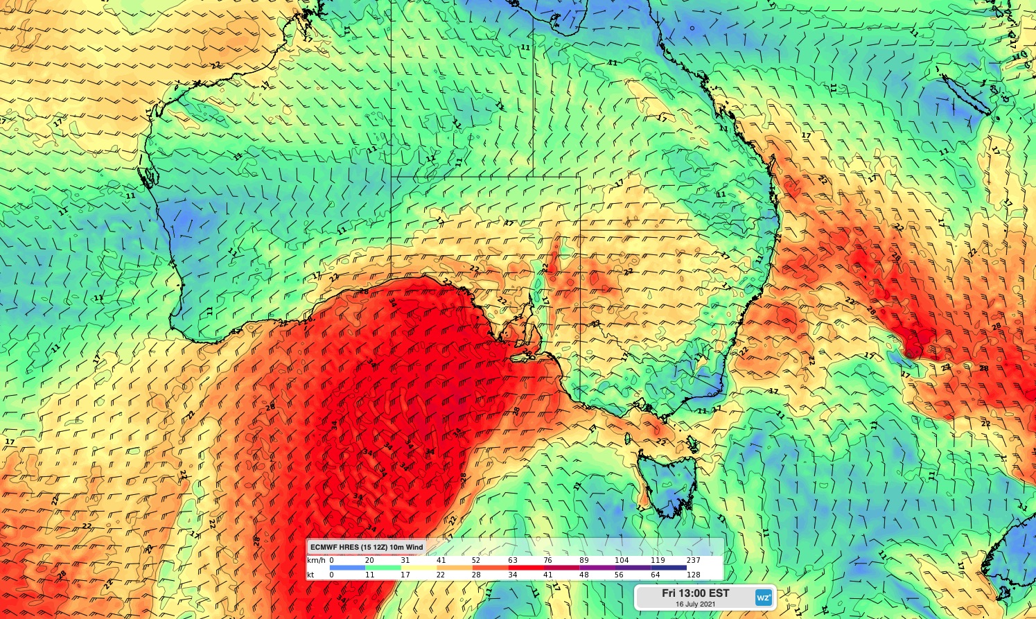
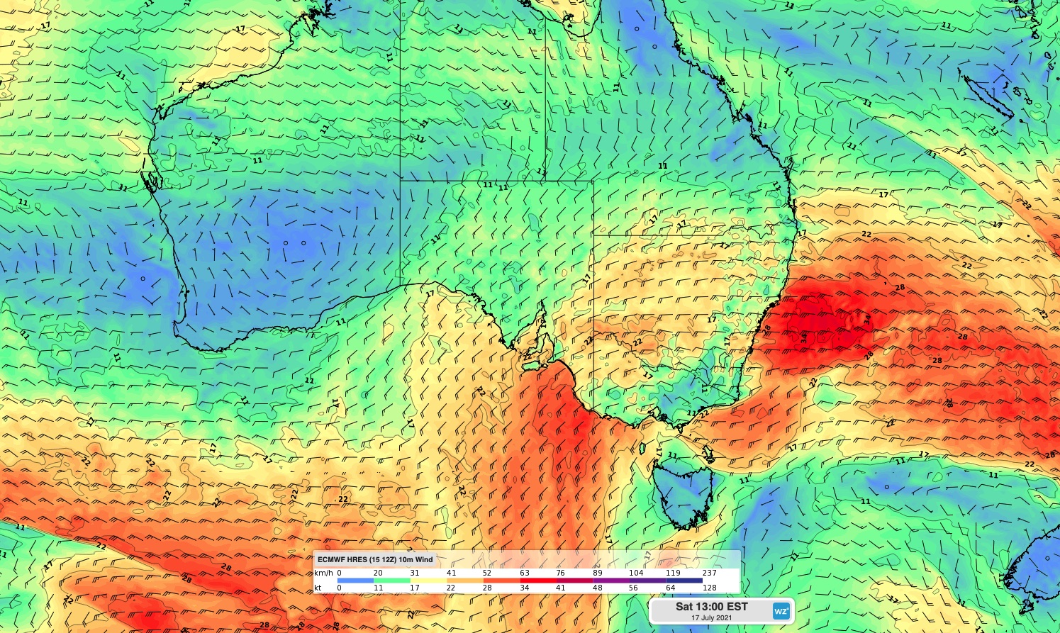
Now, this dangerous surge of windy, wet and stormy weather is spreading further east, prompting severe weather warnings in parts of SA, Victoria, NSW and the ACT.


Images: Forecast wind speed and direction at 1pm AEST on Friday (top) and Saturday (bottom).
Damaging wind gusts are likely to affect parts of these four states and territories on Friday or Saturday. In addition to the wind, some areas will also see heavy rain, thunderstorms, hail and snow.
Snow will be heavy in the alps and could reach low levels in Victoria and NSW by Saturday. It should even get cold enough for snow to settle in central NSW by Saturday.
Rain could also be heavy enough to cause flooding in southern NSW from Friday into Saturday, with a Flood Watch in place for the Tumut River.
While warnings didn't extend up into Queensland on Friday morning, squally winds and showers are likely to affect the south and southeast on Friday. There could even be a few thunderstorms in the mix for southeast Queensland.
Be sure to keep up to date with the latest warnings over the next few days.