
Damaging wind risk over parts of TAS, VIC and NSW
The Bureau of Meteorology have issued warnings for damaging winds for Sunday morning over parts of Tasmania with possible peak gusts up to 100-125km/h, eastern Victoria with possible peak gusts in excess of 90km/h and southeast NSW including the Central Tablelands and Illawarra, with possible peak gusts up to 100km/h. The cause of these damaging winds will be a cold front currently west of TAS which will cross later today into tomorrow.
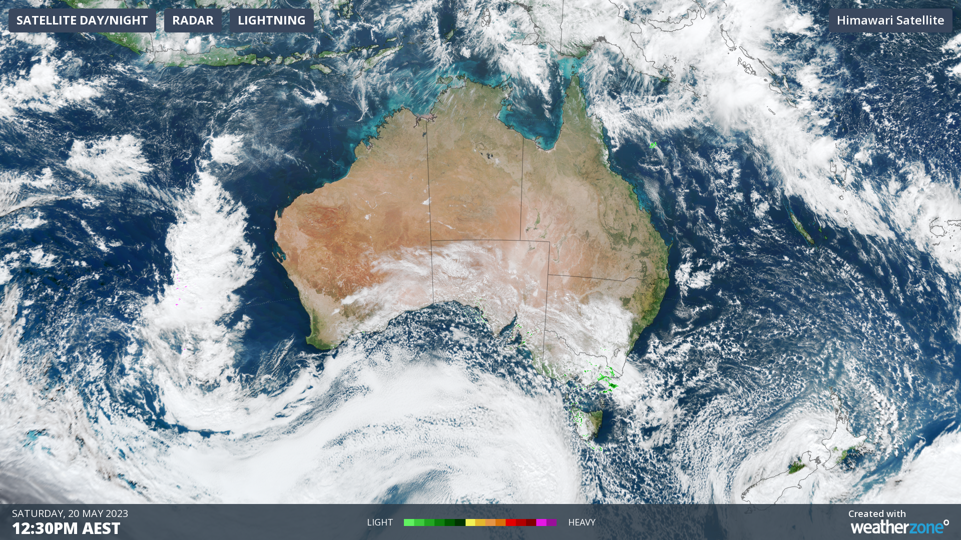
Image: Himawari-9 visible satellite imagery at 12:30pm AEST Saturday 20th.
The forecast chart for tomorrow morning (bottom left chart below) shows a high-pressure system over southern WA with a cold front to the east of Tasmania. Winds generally flow between the lines of equal pressure (isobars). So, the winds will generally be flowing from the west over southern NSW and from the southwest over VIC and TAS. When the isobars are close together, as you can see over the southeast of the country, it indicates a tight pressure gradient (change in pressure over distance), and this produces faster winds. Notice the tighter pressure gradient compared to Saturday 10am (top left chart).
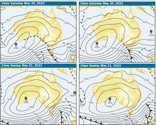
Image: Forecast synoptic charts from 10am Saturday 20th (top left) to 10pm Sunday 21st (bottom right). Source: Bureau of Meteorology
Winds are generally faster over higher terrain and exposed coasts, putting these locations at risk of damaging winds more often. There are also local topographic factors that influence the strength of winds. For example, the Illawarra, which is included in the current risk area, has a steep escarpment to the west which interacts with winds. When there are strong westerly winds and stable air near the height of the mountains, it forces the winds to flow down the escarpment, causing strong, gusty winds to reach the lower lying areas between the mountains and the sea. The Bureau’s highest resolution ACCESS-C models can predict how winds will interact with local topography as seen below.
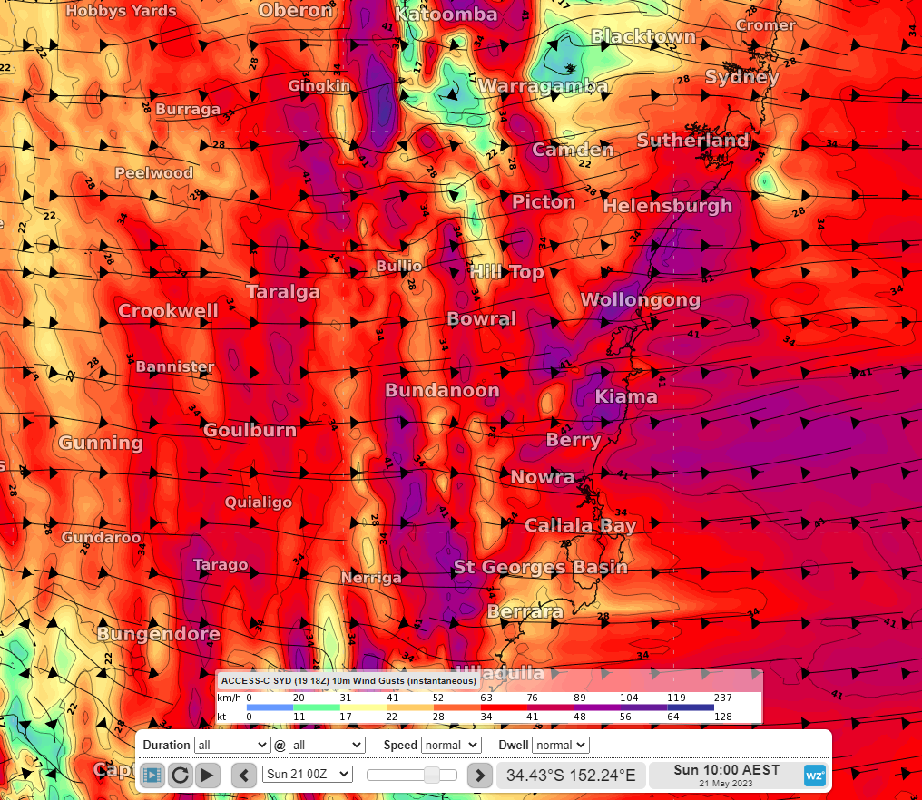
Image: 10m wind gusts at 10am EST Sunday 21st according to the ACCESS-C Sydney model.
Be sure to stay up to date with the latest warnings at https://www.weatherzone.com.au/warnings
Winds will ease during Sunday afternoon and evening as the cold front moves further away and high pressure takes over.