
Damaging surf and fierce winds lashing NSW
A Tasman low is whipping up blusterous southerly winds and large and powerful swell on Monday, likely impacting port operations in NSW.
Waves peaked at 6 metres offshore of Eden on the NSW south coast at 4am Monday morning as the low whipped up a long southerly fetch and swell.
Some other notable observations along the NSW coast Monday morning and early afternoon are:
- Sydney airport’s winds averaged 52 km/h or 28 knots, gusting to 70km/h (38 knots) at 12:32pm
- Wave heights of 5.1 metres and period of 13.8 seconds have been measured off Sydney at midday
- Port Kembla's wave height reached 5.5 metres at 11am
The images below show that strong southerly winds will continue to impact the NSW coastline until later Thursday into Friday.
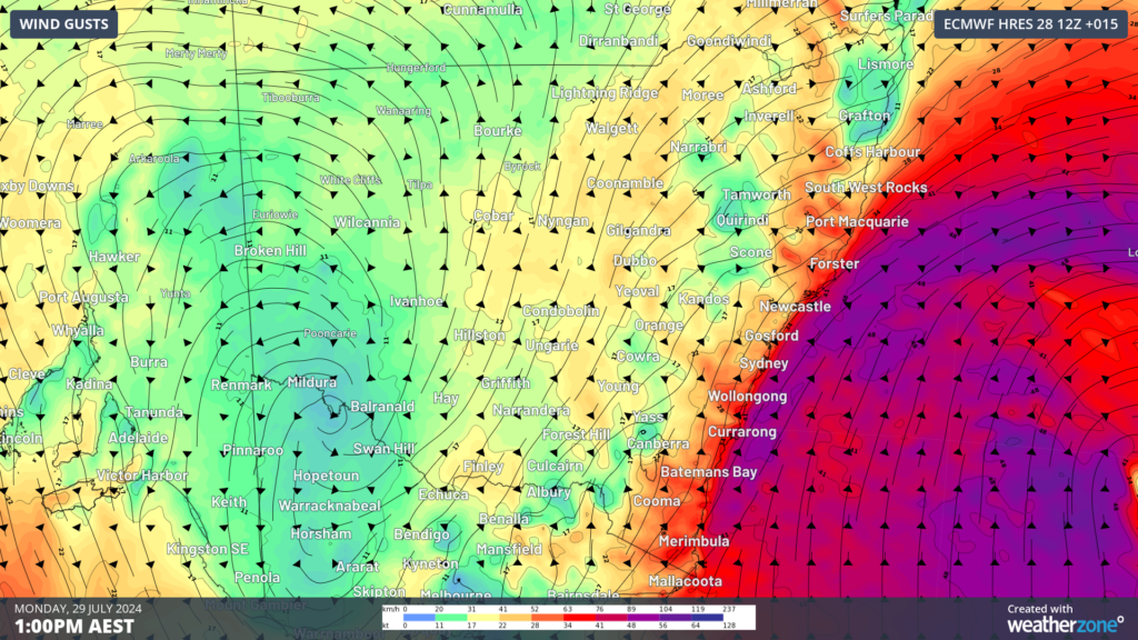
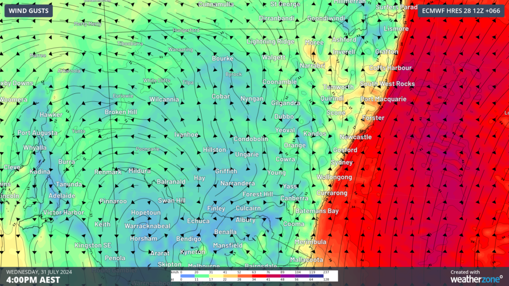
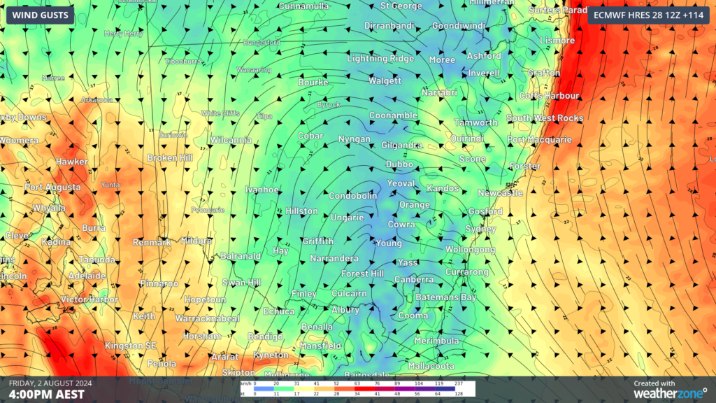
Images: Instantaneous wind gust forecasts for (top to bottom) Monday, Wednesday and Friday, August 2, according to ECMWF
You can see in the images above that the winds are strongest on Monday, with sustained winds exceeding 25 knots expected to continue throughout the day into Tuesday at Botany. On Wednesday and Thursday winds should ease slightly but still should remain above 20 knots.
Winds will ease on Friday as the low moves further east away from Australia.
A damaging surf warning is current as of Monday afternoon at 2pm, for parts of the central NSW coast in response to the large waves observed this morning. Waves should peak at around 5 metres on Monday afternoon in Sydney.
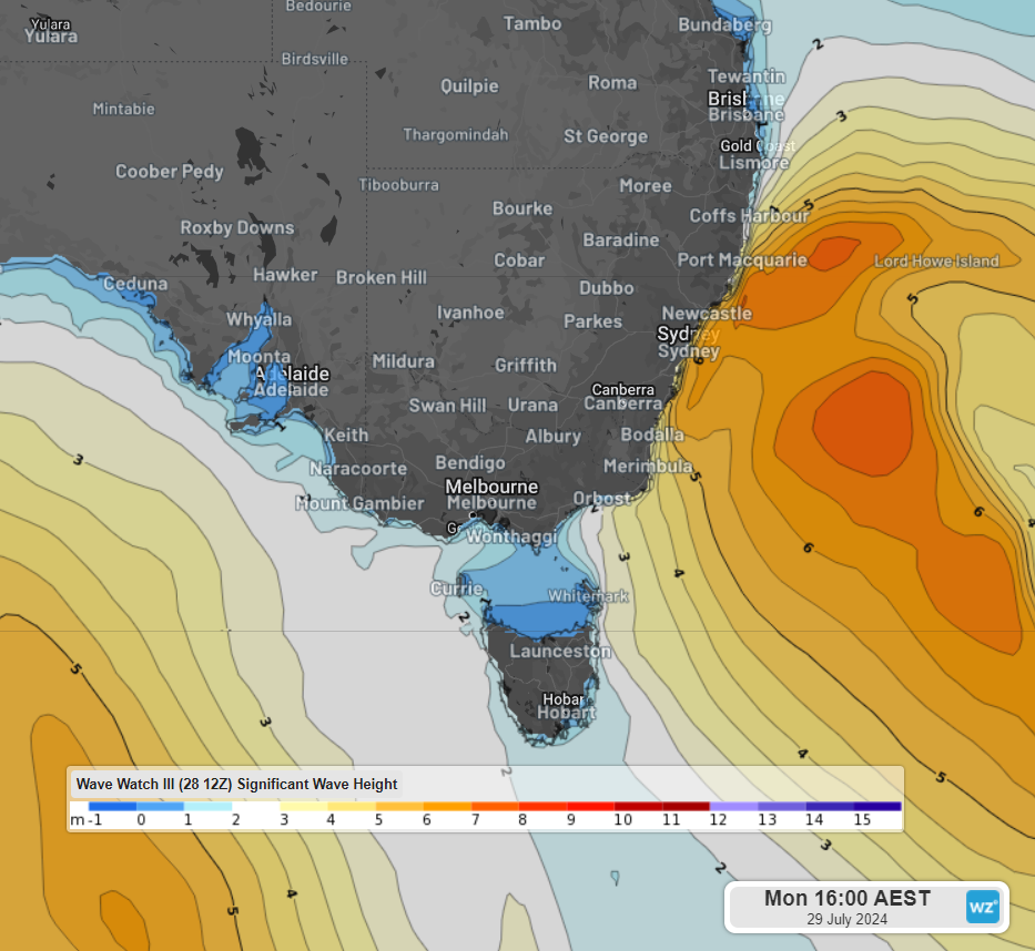
Image: Significant wave height forecast at 4pm on Monday, July 29, according to Wave Watch III
The surf should ease south of Jervis Bay during this evening before easing south of Sydney early Tuesday morning. However, waves off Sydney should remain between 5 to 6 metres between Tuesday and Thursday, before easing to around 2 metres late on Friday. These waves will tend to the southeast with a peak wave period of 14 to 15 seconds on Wednesday and Thursday, meaning these waves will be very powerful and have a lot of energy.
In addition to these large and powerful waves, high tides of around 1.6 to 1.7 metres will occur on Monday at 3pm AEST and again on Wednesday at 5pm. Beaches orientated to the south and southeast are at the highest risk of coastal erosion and inundation, particularly if high tide and peak swell occur at the same time.