Cyclone watch issued for WA coastline
A severe tropical cyclone could hit the north coast of Western Australia later this week, with a cyclone watch issued for parts of the Pilbara and Kimberley.
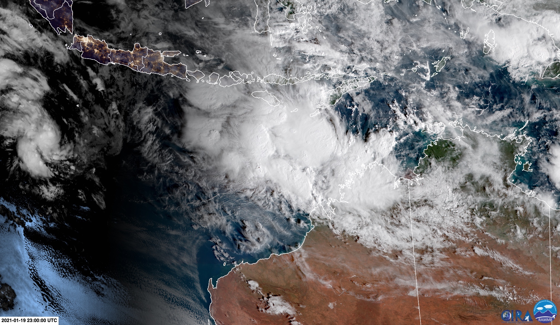
Wednesday's first light revealed large convective clouds bubbling away to the north of the Kimberley. This mass of storm clouds is likely to drift towards the west and consolidate into a tropical cyclone later this week.

Image: This mass of clouds to the north of Western Australia is liekly to become a tropical cyclone later this week. Source: CIRA / RAMMB
There is growing agreement between forecast models that the system will become a tropical cyclone on Thursday or Friday before approaching the coast on the weekend. However, there is still some uncertainty regarding exactly when and where it will cross the coast and how strong it will be if it does.
The Bureau of Meteorology issued its first cyclone watch for this system at 9am WST on Wednesday. A cyclone watch is put out when gale force winds are expected to develop on land in Australia within the next 48 hours.
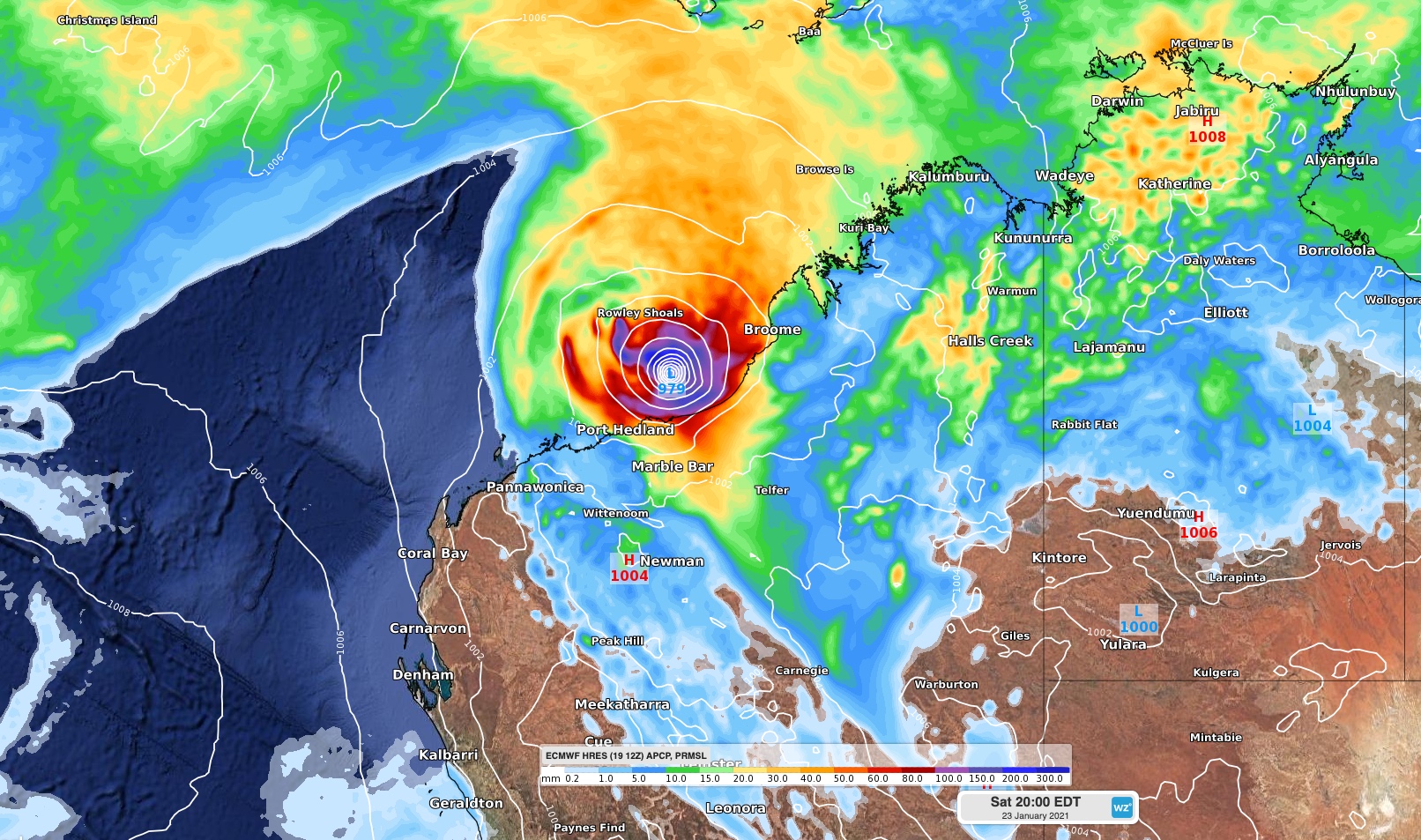
The Bureau's official track map suggests that this system will approach the coast between Roebourne and Bidyadnaga as a category three severe tropical cyclone on Saturday. Most computer models indicate that it will make landfall to the east of Port Hedland, but west of Broome.

Image: Forecast rain and MSLP on Saturday evening according to the ECMWF model.
Communities living in the Pilbara, Kimberley and Interior of Western Australia should prepare now for tropical cyclone impacts and monitor the latest warnings and forecasts in the coming days.
The next tropical cyclone to form in the Australian region will be called Lucas.