Could Friday's cold front save the snow season?
Snow is coming later this week to the snow-starved ski resorts of NSW and Victoria. The only question is how much, and whether it'll be to enough to breathe life into a disappointing season.
One resort – Selwyn Snow Resort in NSW – is putting so much faith in the cold front due on Friday that it is already pledging to reopen on Saturday, having been closed for the best part of two weeks due to lack of snow.

You might recall that Selwyn is the resort that was destroyed in the 2019/20 Black Summer fires that burned a third of Kosciuszko National Park – the largest national park in NSW.
Its owners totally rebuilt all buildings including the main ski centre, as well as plenty of other infrastructure. This was the resort's first season back in business. But after the ski slopes and dedicated toboggan park opened for a while this winter, the resort closed in early August due to lack of snow.
Quick summary of the 2023 snow season to date:
- The 2023 snow season started slowly with virtually no natural snow coverage on the traditional June long weekend opening
- That soon changed, with decent falls in late June and early July enabling most lifts to open at all mainland ski resorts
- But July soon turned warm. Indeed, it was the warmest July on record for large parts of Australia, with temps significantly above average at all ski resort weather stations
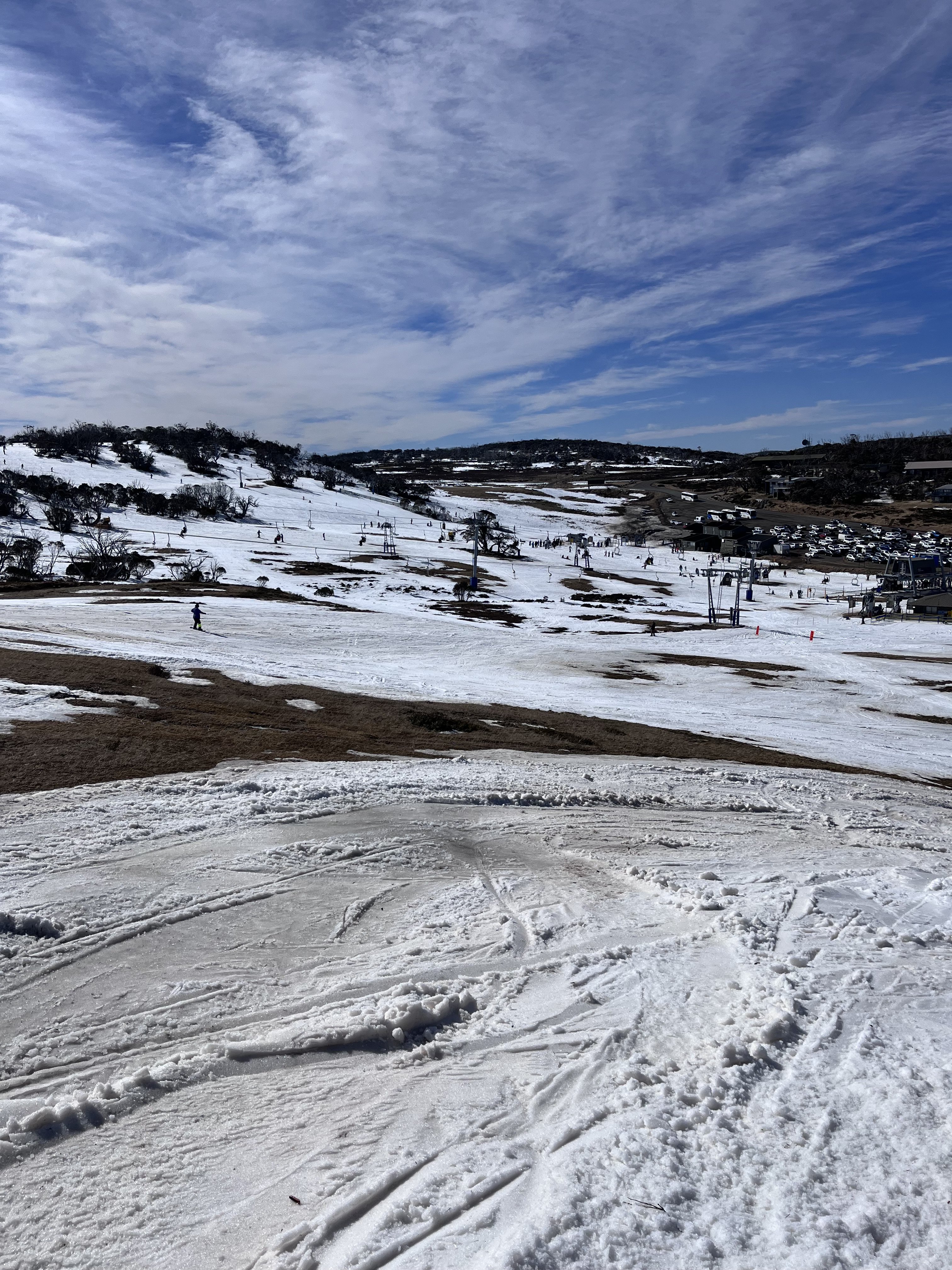
- By early August, huge grassy patches had appeared across the mountains, with lower resorts like Selwyn Snow Resort forced to close
- A brief burst of heavy snow fell last Thursday, but not enough to make much difference
How much snow will Friday's cold front deliver?
On Saturday, Weatherzone meteorologist Jess Miskelly wrote about a pair of cold fronts that had the potential to deliver half a metre of snow in two bursts – with a little early in the week and the bulk on Friday into Saturday.
To completely resuscitate the 2023 snow season, you'd need the half-metre of fresh snow that Jess mentioned – although lower resorts like Selwyn and Mt Baw Baw in Victoria could open lifts with less, as their slopes are grassy, not rocky and bushy like the higher resorts.

Image: Smiggin Holes, one of the lower altitude sections of Perisher resort, has not exactly been at its snowy best this August, although at least most lifts there have stayed open. Source: "Golds70" @ ski.com.au.
Overnight the first light burst of fresh snow arrived, with higher resorts like Thredbo and Perisher in NSW, and Mt Hotham in Victoria, reporting around 4 cm of fresh flakes on the ground. That freshened the snow surface but hasn’t made a huge difference to overall depth.
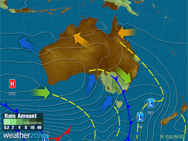
Friday is now the big hope. At this stage, we expect falls of 20-40 cm from Friday through to Saturday, with the heaviest falls kicking in later on Friday. Our predicted synoptic chart for Friday evening shows the cold front crossing the southeast of the country.

There's more info here on our snow page and please be careful if you're driving to the mountains for the weekend on Friday night, as conditions could be treacherous on the roads.
You can also check conditions at mainland ski resorts by clicking on the links for Thredbo, Perisher, Charlotte Pass, Selwyn (NSW) and Mt Buller, Hotham, Falls Creek and Mt Baw Baw (Vic).