Clouds clear to reveal immense scale of Queensland flooding
Satellites have captured spectacular images of the massive floods currently affecting southwest Queensland, revealing water stretching thousands of kilometres across the Australian outback.
After multiple rounds of heavy rain over the past fortnight, clear skies on Thursday allowed satellites to capture high-resolution images of the flooded landscape.
While breaks in cloud allowed glimpses of the flooding late last week and earlier this week, Thursday offered the clearest view yet of the immense flooding stretching across Queensland’s vast Channel Country.
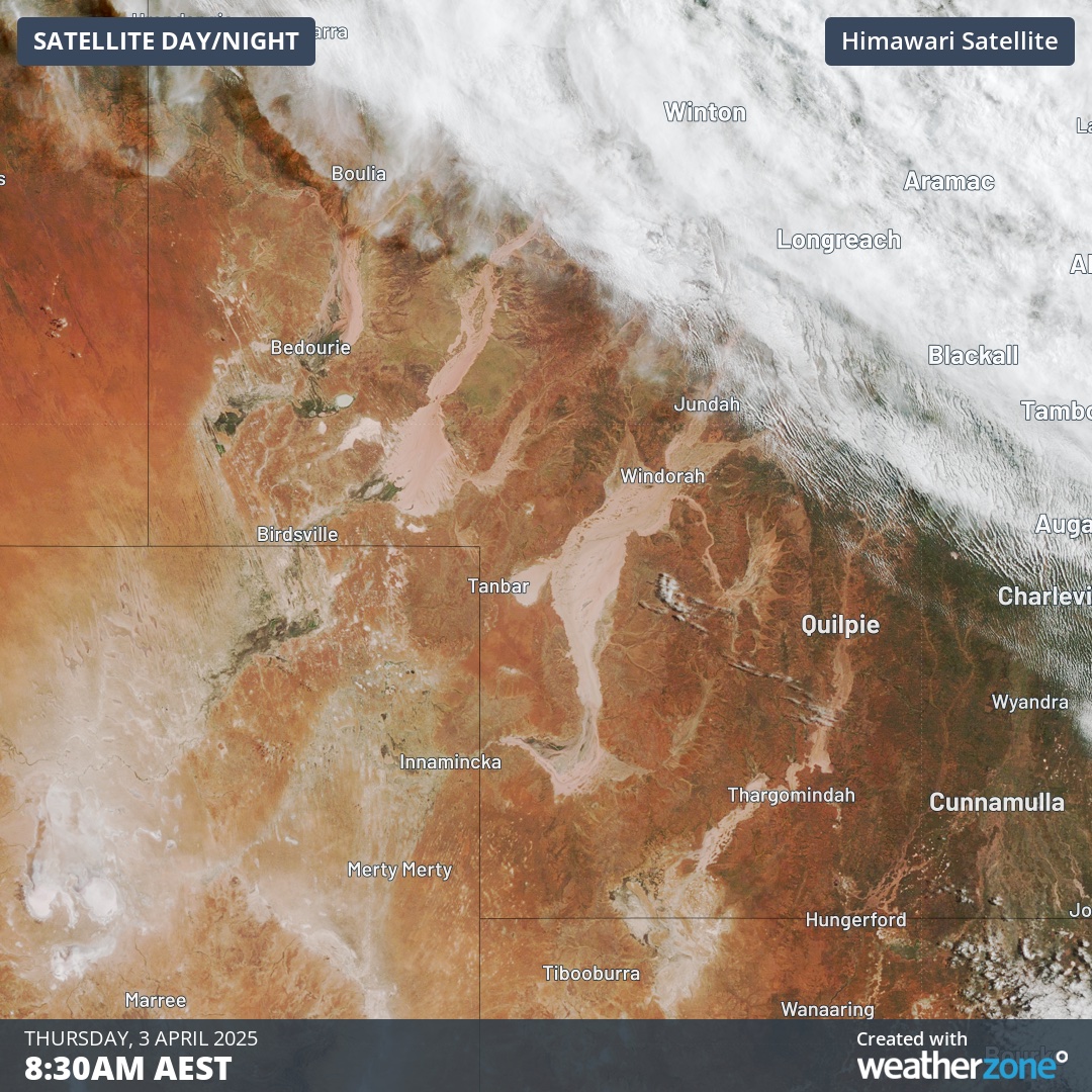
The image below is a natural ‘true colour’ satellite image of the landscape on Thursday morning, offering a clear view of the earthy floodwaters in southwest Qld.

Image: Visible true colour satellite image captured at 8:30am AEST on Thursday, April 3.
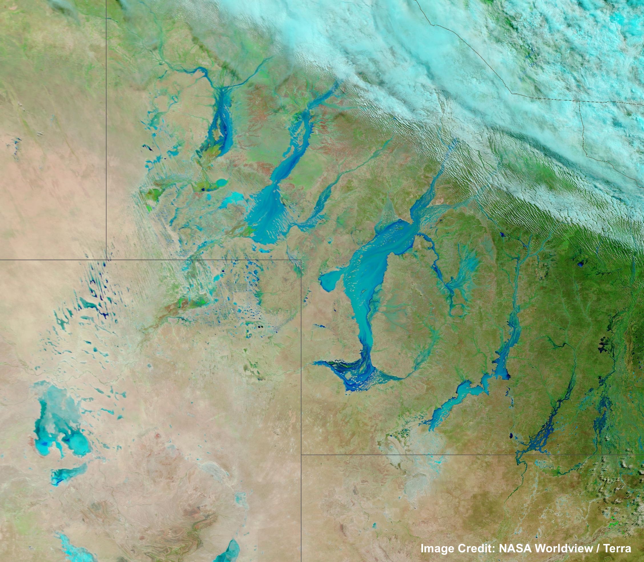
While the floodwaters are easy enough to make out on the image above, they are better highlighted using false colours that help distinguish water from the surrounding landscape.
The image below uses false colours that enhance floods by making liquid water on the ground appear blue, with sediment-heavy water appearing darker blue.

Image: Corrected reflectance image captured by the Terra satellite on Thursday, April 3. Source: NASA Worldview
The video below also uses this technique to show the immense scale of the flooding, with the flooded rivers clearly standing out against the Australian outback.
Video: Himawari-9 satellite image using corrected reflectance to show flooding in southwest Queensland on Thursday, April 3.
The main rivers that can be seen in the images and video above are the Georgina, Diamantina and Bulloo Rivers and the Cooper Creek. Some sections of these rivers have bulged to about 70 km in width as the floodwater inundates the notoriously flat landscape of Queensland’s Channel Country.
These flatland floods will continue for weeks to months as the water slowly drains through the landscape. Some of this water will eventually reach Kati Thanda-Lake Eyre, although that’s not going to happen until late-April into May.