
Climate change in Australia - State of the Climate 2022 report
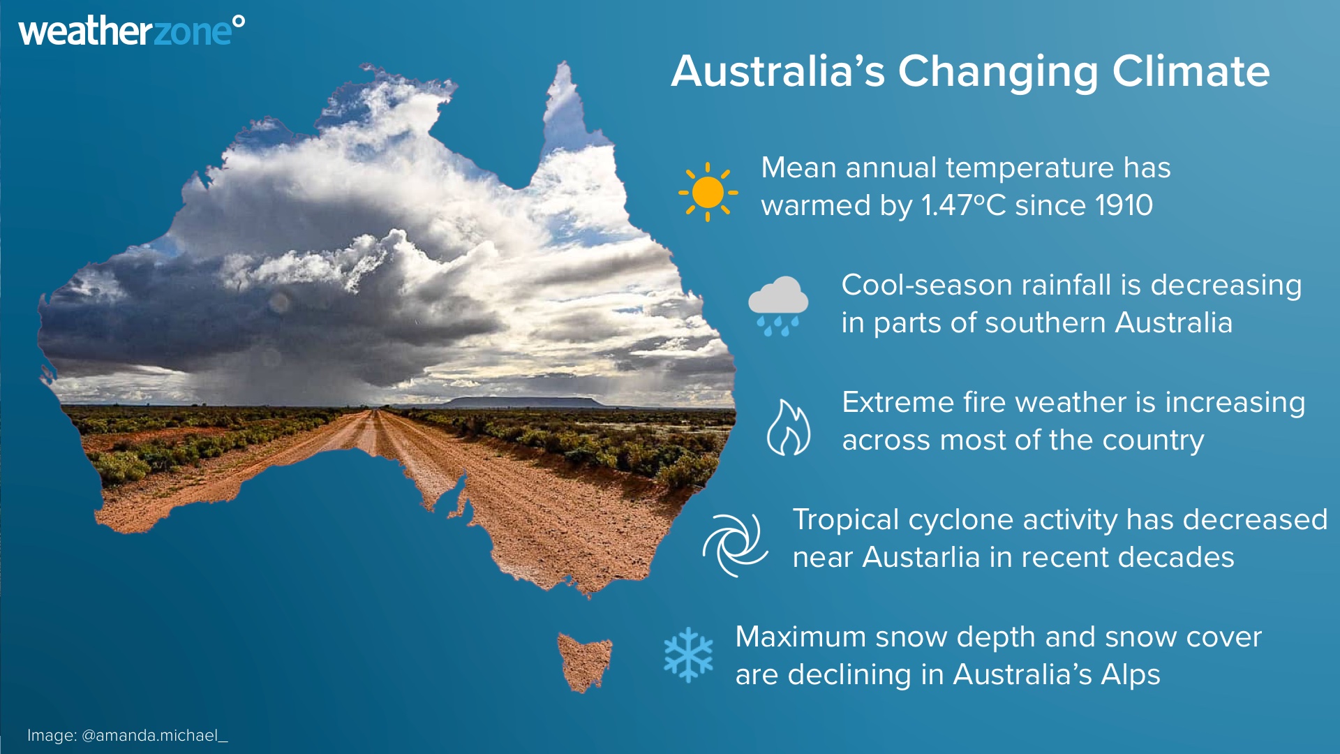
Australia’s climate is getting warmer and long-term changes are occurring in rainfall, extreme fire weather and tropical cyclone activity across the country, according to a new State of the Climate report published this week.
The Bureau of Meteorology and CSIRO release a State of the Climate report every two years. This biennial report takes a deep dive into the latest science on Australia’s changing climate, including research, observations and future projections.
You can read the full State of the Climate 2022 report here. But if you don’t have time to pore over the whole report, we have summarised some of the main points below.
Temperature
Australia’s climate has warmed by 1.47ºC since 1910. Most of this warming has occurred since 1950 and the last nine years were all warmer than every year between 1910 and 1980.
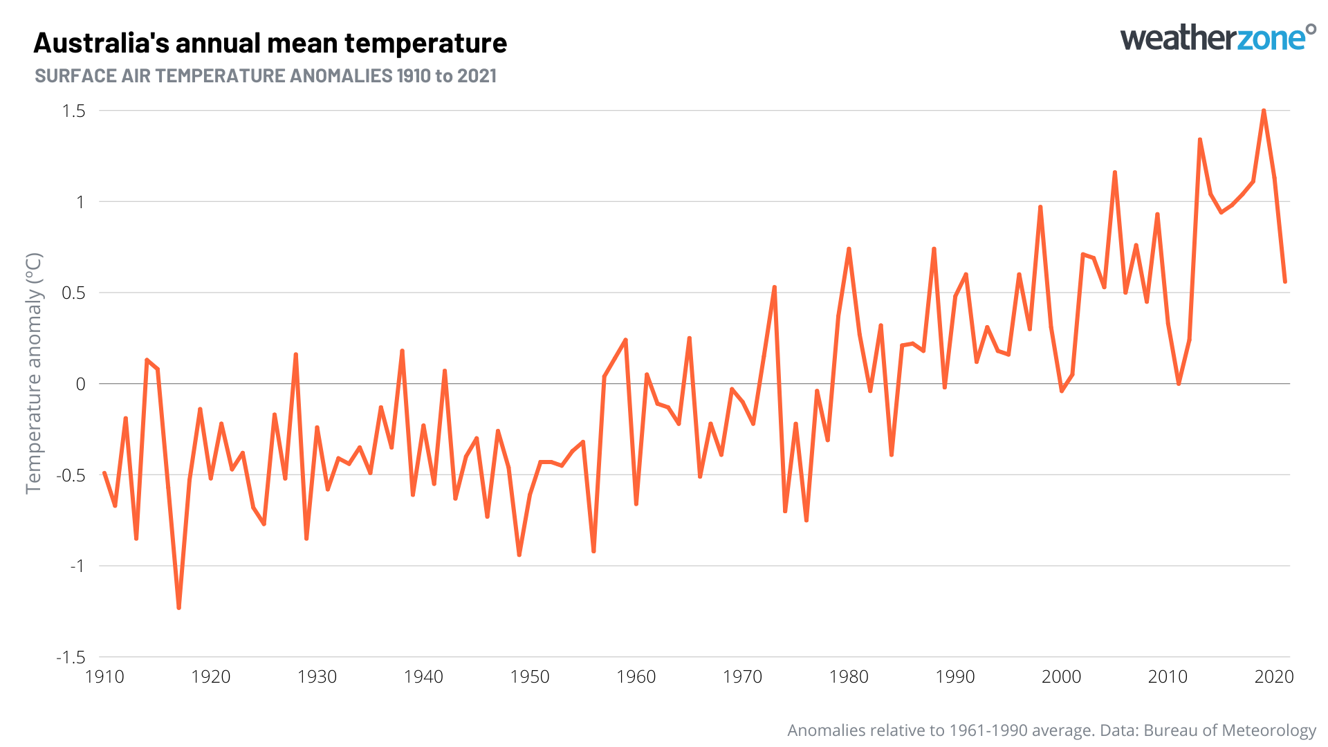
Image: Australian mean annual surface air temperature anomalies between 1910 and 2021. The anomalies shown in this graph are relative to the 1961-1990 30-year baseline.
There has also been an increase in the frequency of extreme daily heat events in Australia. In 2019, there were 41 days where Australia’s mean surface air temperature ranked in the top one percent of historical records. Prior to 2000, the highest number of days per year in the top one percent of historical records was only 14.
Rainfall
While rainfall in Australia varies a lot from year-to-year, there has been a clear declining trend in cool-season rainfall over large areas of southeastern and southwestern Australia.
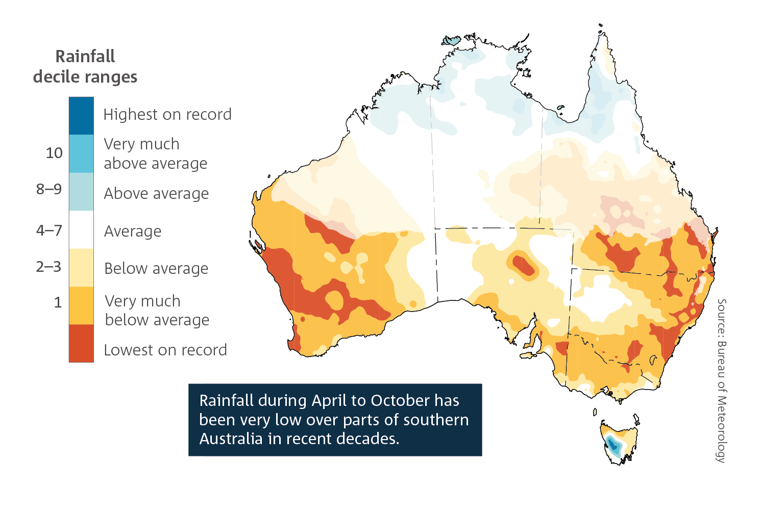
Image: April to October rainfall deciles for the 22-year period from 2000 to 2021. These deciles show how rainfall in this 22-year period compares to the average of all years between 1900 and 2021. Source: Bureau of Meteorology/CSIRO.
By contrast, rainfall has increased over much of northern Australia in recent decades, particularly during the wet season.
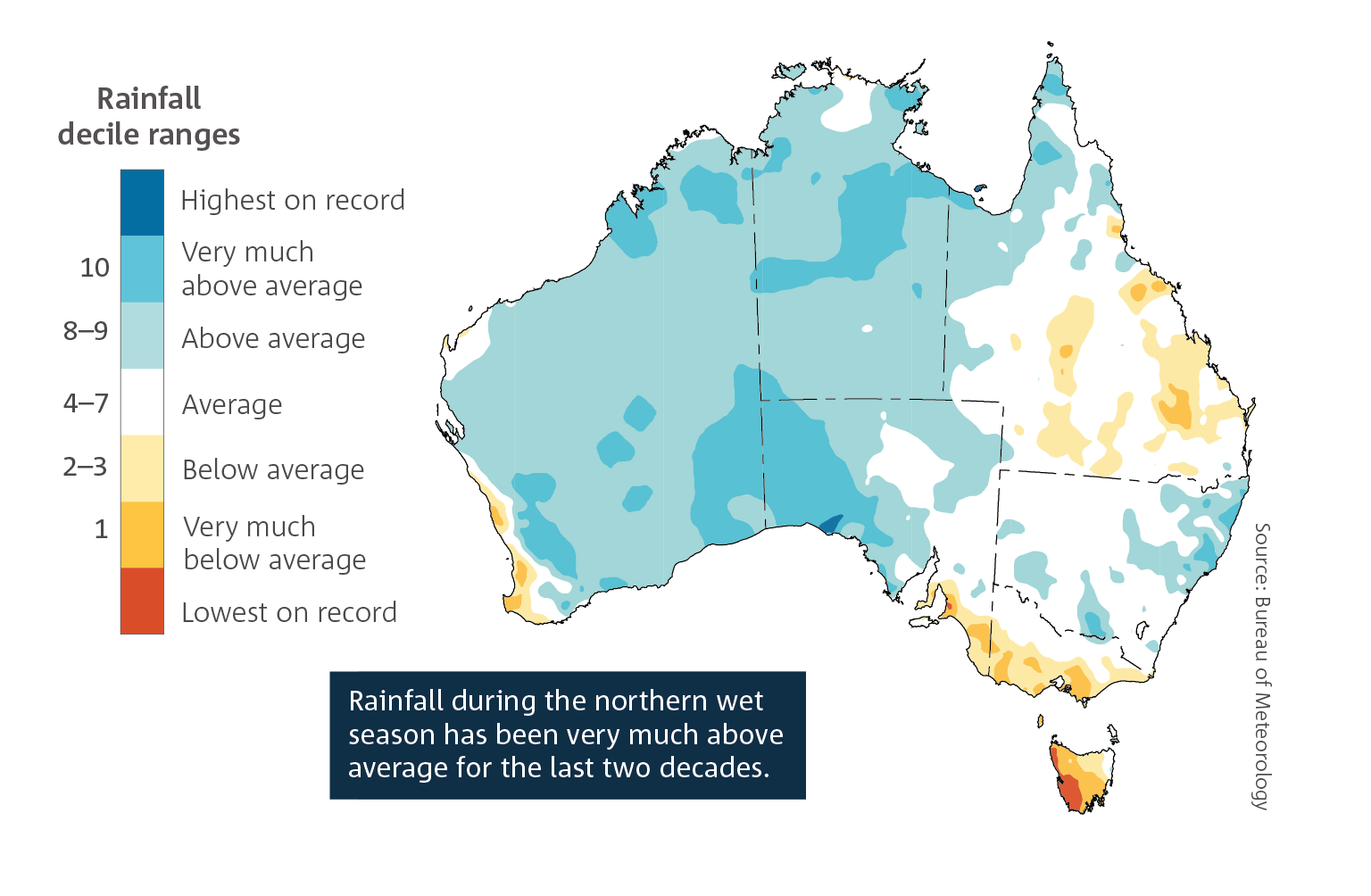
Image: October to April (northern wet season) rainfall deciles for the 22-year period from 2000 to 2021. These deciles show how rainfall in this 22-year period compares to the average of all years between 1900 and 2021. Source: Bureau of Meteorology/CSIRO.
Heavy rainfall events are becoming more intense, with the intensity of short-duration (hourly) extreme rainfall events increasing by about 10 percent in some areas over recent decades.
Fire Weather
Rising temperatures and declining rainfall have both contributed to an increase in extreme fire weather across much of Australia, particularly during summer and spring. There has also been an increase in the length of the fire season in Australia in recent decades.
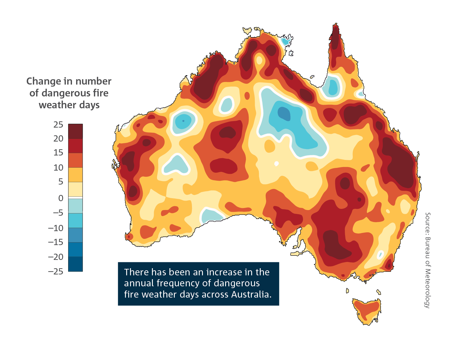
Image: Change in the annual number of dangerous fire weather days between two 36-year periods: July 1950 to June 1986 and July 1986 to June 2022. In this map, dangerous fire weather days are defined as the number of days where the Forest Fire Danger Index (FFDI) exceeds the 90th percentile. Source: Bureau of Meteorology / CSIRO
Snowfall
There has been a decline in Australian snow over recent decades. This includes an observed downward trend in the average annual maximum snow depth, the temporal and spatial extent of snow cover, and the overall number of annual snowfall days.