Clear signs of drought in western NSW

The prospect of El Nino forming during the second half of 2018 is troubling for parched western NSW, where some places are experiencing their driest year to date in more than five decades.
Many areas in northern and western NSW received less than 20 per cent of their average annual rainfall during the first five months 2018.
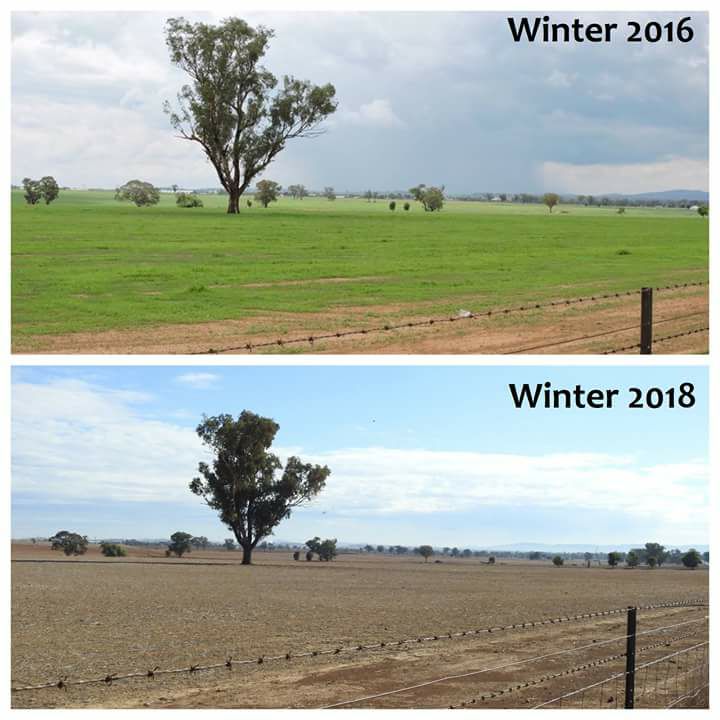
This prolonged spell of dry weather during the last several months has left the state's slopes and plains looking barren and brown at the start of winter.

Image: Tamworth by Dave Farrenden via Weatherzone Weather Photography Group on Facebook
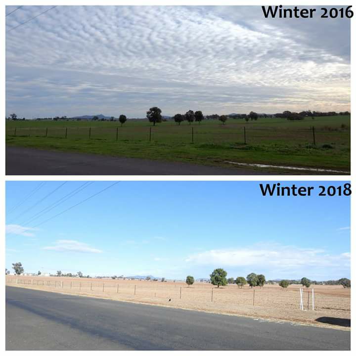
The Tamworth region is an example of how much rainfall has been lacking in western parts of NSW so far this year.

Image: Tamworth by Dave Farrenden via Weatherzone Weather Photography Group on Facebook
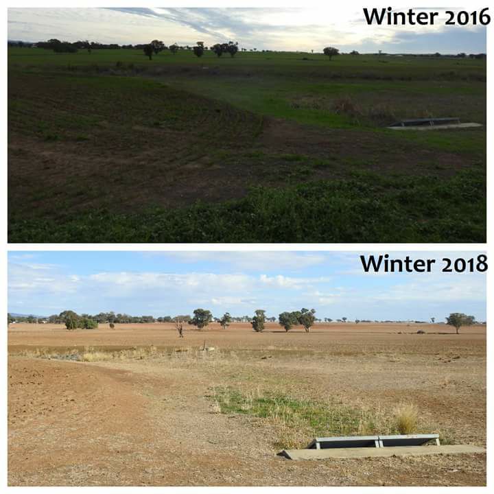
As of 9am on Wednesday, Tamworth Airport had only registered 84mm of rain so far during 2018. This is close to 600mm shy of its long-term annual average and makes this their driest year to date since 1965, and the second driest on record.

Image: Tamworth by Dave Farrenden via Weatherzone Weather Photography Group on Facebook
The near-record dry start to 2018 has been made even more concerning by the recent warming of waters in the equatorial Pacific Ocean. This warning may indicate that El Nino is in its early stages of development.
On Tuesday, the Bureau of Meteorology increased the likelihood of El Nino forming during the second half of 2018 to 50 per cent, officially placing Australia on El Nino Watch.
El Nino is known to increase the chance of below average rainfall in eastern Australia during winter and spring.
While it's too early to know definitively if El Nino will actually take shape later this year and how strong it may be, the prospect of such an event is tough to contemplate for farmers living in already parched areas of western NSW.