Christmas tropical cyclone threat looms
A tropical cyclone could threaten parts of northern Australia as early as Christmas Day, with Darwin currently in the zone that could be at risk of dangerous holiday weather from this developing system.
Earlier this week, forecast models were hinting at the prospect of tropical cyclone activity somewhere in the Australian region between Christmas and New Year's Eve.
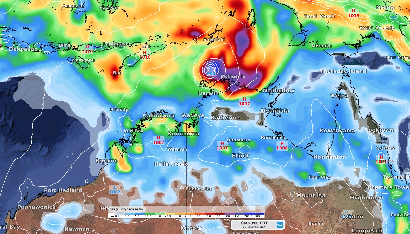
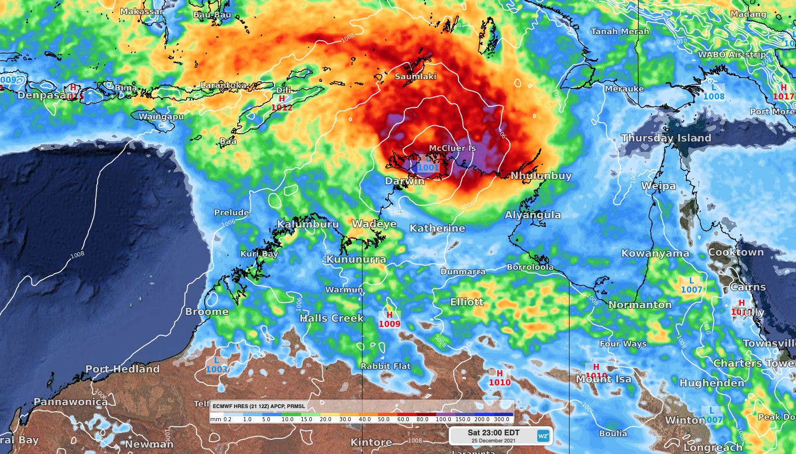
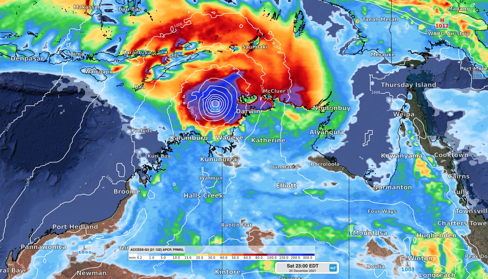
Now, several of these models agree that a tropical low is likely to develop over or near the Timor Sea later this week. While the movement of this low is hard to predict beyond Friday, several forecast models suggest that it could develop into a tropical cyclone over the weekend.
At this stage, the low or tropical cyclone will most likely move towards the south or southwest from Saturday, causing it to pass over the Top End of the NT on the weekend or the Kimberley district in WA early next week. There's even an outside chance that it will head further east and cross the Gulf of Carpentaria early next week.


Image: Forecast 24-hour accumulated rain and mean sea level pressure (MSLP) on Saturday night (Christmas night) according to the December 21, 12Z run of the GFS (top), ECMWF (middle) and ACCESS-G (bottom) models.
If the system stays over water long enough, it has a good chance of developing into a tropical cyclone and the longer it remains over open water, the stronger it can get.
If it reaches land too quickly, the system will become cut off from the warm seas that it uses for fuel and may not reach cyclone strength. However, even as a landfalling tropical low, the system could still produce severe weather.
Anywhere from Cape Yorke Peninsula across to the Kimberley should closely monitor forecasts and tropical cyclone advisories from now on and throughout the holiday period.
Take time now to prepare for the holidays being disrupted by a tropical cyclone and make sure you have a plan in place to cope with the impacts of severe weather.