
Catastrophic fire danger for Western Australia districts
Catastrophic fire danger is expected over large parts of Western Australia today, as dry, gusty winds mix with very hot air ahead of a cold front.
A very hot and dry air mass is trapped in western WA, between a high pressure near Tasmania, a trough to the north and an approaching cold front and trough. Temperatures will soar well into the forties over large areas of inland WA. Of the 37 fire districts in WA, 11 are rated as catastrophic and another 4 districts as extreme.
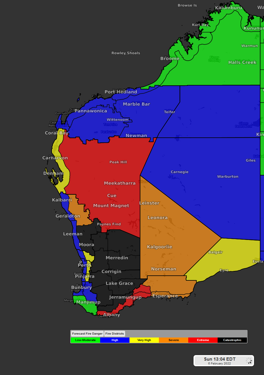
Image: Fire danger rating in Western Australia for Sunday 6th
Winds are playing a large role in these greatly elevated Fire Danger Ratings (FDRs). A cold front is crossing the southwest coast this afternoon. The approaching front is squeezing against the stubborn high pressure in the east, causing winds to increase. Wind gusts over 80km/h will occur over parts of this catastrophic area.
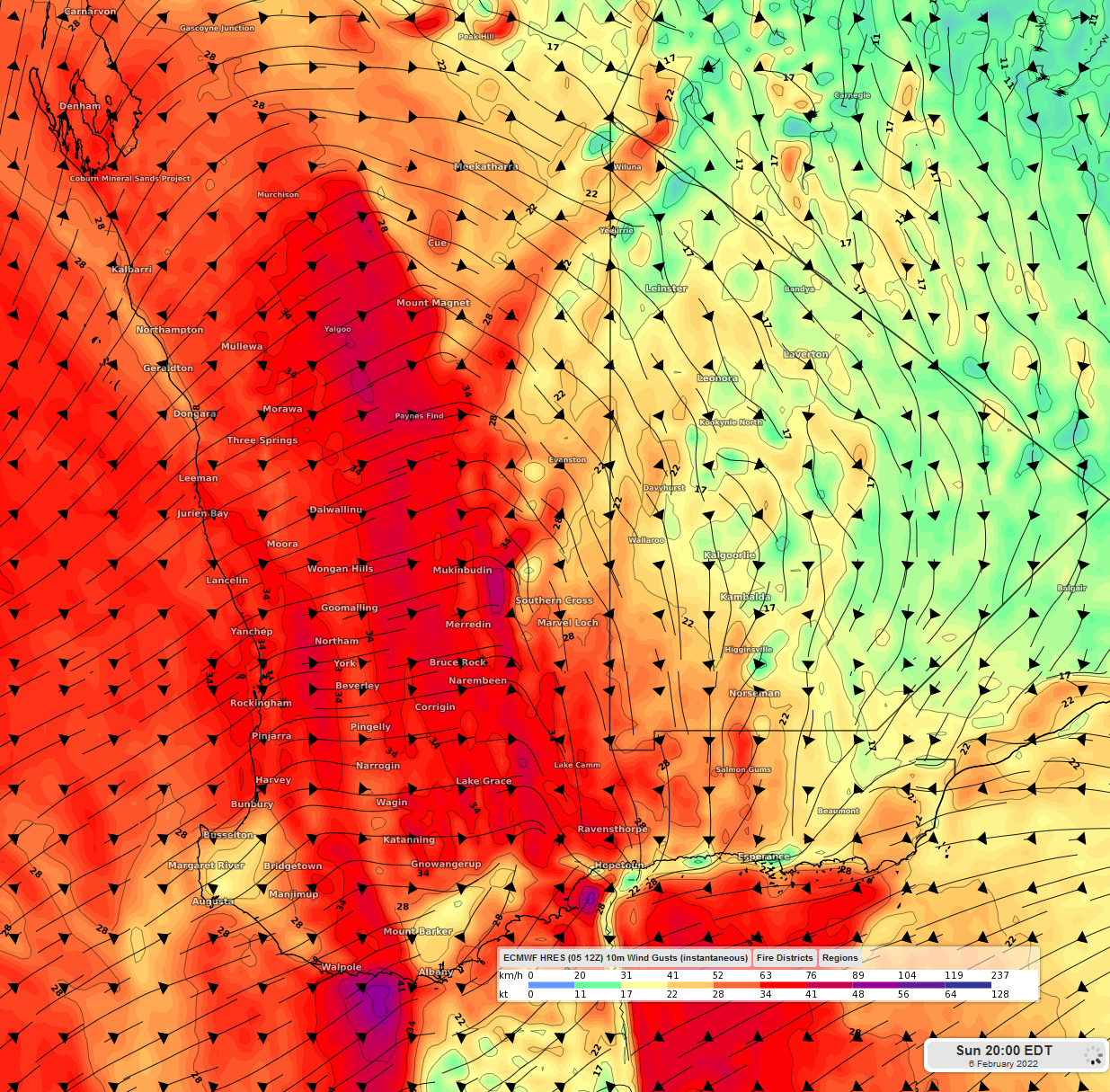
Image: Wind gusts over Western Australia on Sunday 6th at 2000EDT using ECMWF model
This hot dry air mass is producing a relative humidity of 5% in some areas. Lack of significant rainfall, low humidity and high temperatures in previous weeks has contributed to increased fire fuel in the region.
When this cold front moves through, showers can be expected along the coast. Unfortunately, the of lack of substantial rain from this front will prevent FDRs from lowering drastically. The cooler temperatures and lighter winds will reduce the risk, however fires will still be a concern. The next substantial rain for this region should occur on Friday 11th and Saturday 12th, as tropical moisture is drawn in from the north.