Brisbane's warmest spring on record
In 75 years of records, Brisbane's east is on track to having its warmest average (daytime and nighttime) spring temperature, at a touch above 21.5ºC, almost 1ºC above the long-term average.
This comes after a mid-season maximum temperature spike, followed by heatwave conditions and a run of warm minima affecting the city and broader areas of Queensland.
The major contributor to the record has been the minimum temperatures, which averaged 17.2ºC over the spring season for the site, and were elevated by cloud cover, precipitation, and most notably, humidity.

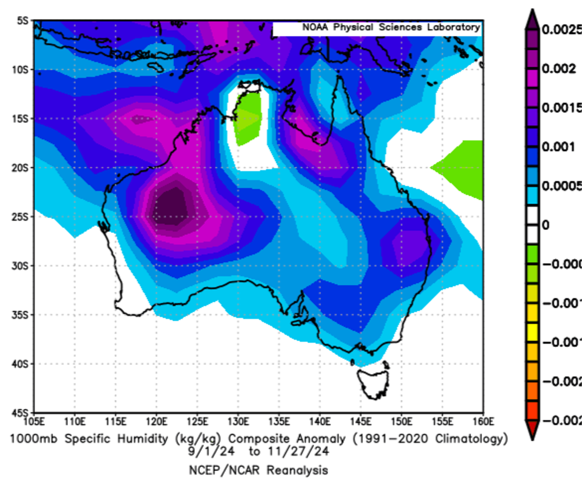
Image: Near-surface specific humidity anomalies across Australia for spring (September to November) 2024. Source: NOAA Physical Sciences Laboratory
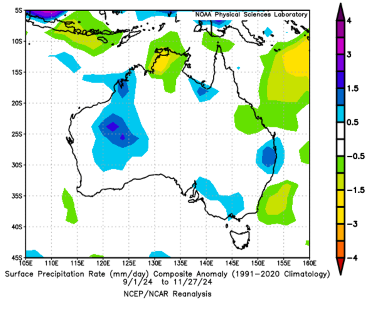
The above figure shows the enhanced specific humidity anomalies, which were the highest in Brisbane of all capital cities for the spring season. The values shown equate to an average dewpoint depression of 3.87ºC, bringing the most humid spring for the airport since 2004. Rainfall rates were also anomalously high for the city, as shown in the figure below.

Image: Surface precipitation rate anomalies across Australia for spring (September to November) 2024. Source: NOAA Physical Sciences Laboratory
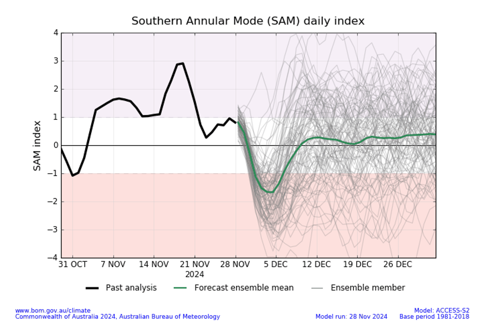
Most of the enhanced minimum temperature signal for spring has come from the month of November, which is also set to see the highest overall average (23.8ºC) and minimum (20.5ºC) temperatures since 2014. The other major driver was a dominant positive phase of the Southern Annular Mode (SAM), which tends to enhance onshore flow and rainfall, particularly during the warmer months.

Figure: A predominantly positive SAM during the month of November has influenced humidity and rainfall throughout the month. Source: Bureau of Meteorology
The first day of summer is expected to remain rainy with possible storms accompanying high humidity and minimum temperatures. After a brief ease in showers early week, rain should return about Thursday.

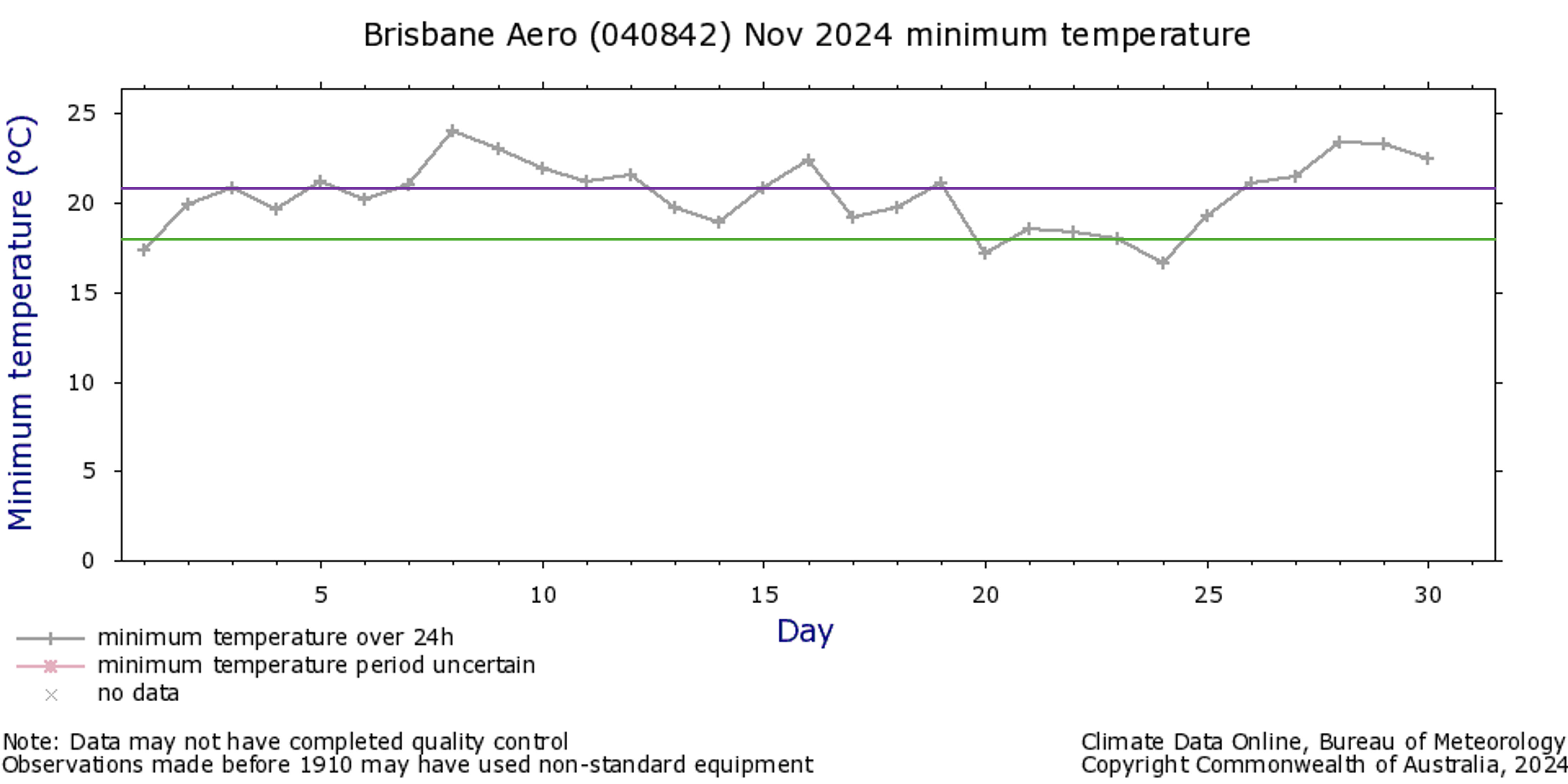
Figure: Brisbane airport's minimum temperature observations for November 2024, including the monthly average minimum (20.5ºC, purple line) compared to the average of all monthly minima for the site (18.3ºC, green line). The most recent cloud band has elevated temperatures above the average since early week.
Be sure to keep an eye on our forecasts, and be mindful of the UV index ratings, regardless of cloudy and rainy conditions, as we move into the summer season.