Brisbane sweating in tropical heat as QLD braces for severe storms
When it already feels like 37ºC at 9am and you’re outside the tropics, you know it’s going to be a hot day.
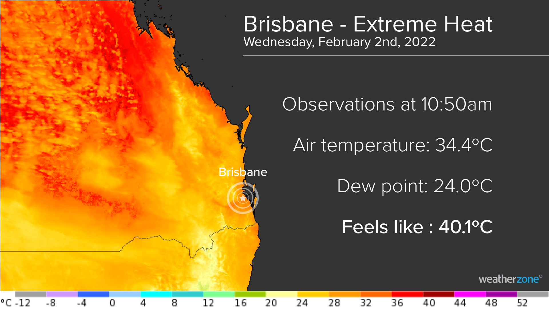
The ‘feels like’ temperature in Brisbane this morning had already hit 35.4ºC at 8:30am. By 9am, it was feeling warmer than 37ºC and at just before 11am it was feeling like 40.1ºC.
This sweaty start to Wednesday is part of a short but intense heatwave that’s gripping southeast Queensland this week, which ramped up yesterday and will peak today.
Why is it so hot?
A hot air mass is combining with high amounts of atmospheric moisture to produce sweaty weather across most of Queensland today.
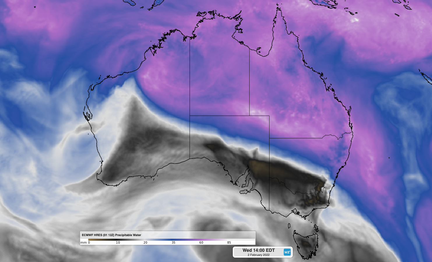
The map below shows modelled precipitable water, which is a measure of how much moisture is available in the atmosphere. Most of central and northern Australia, including all of Queensland, is being covered by this moisture-laden air mass on Wednesday.

Image: Forecast precipitable water on Wednesday afternoon, according to the ECMWF model.
The moisture in the map above is teaming up with hot air, and it is this combination of heat and moisture that’s creating such oppressive conditions in Queensland today.
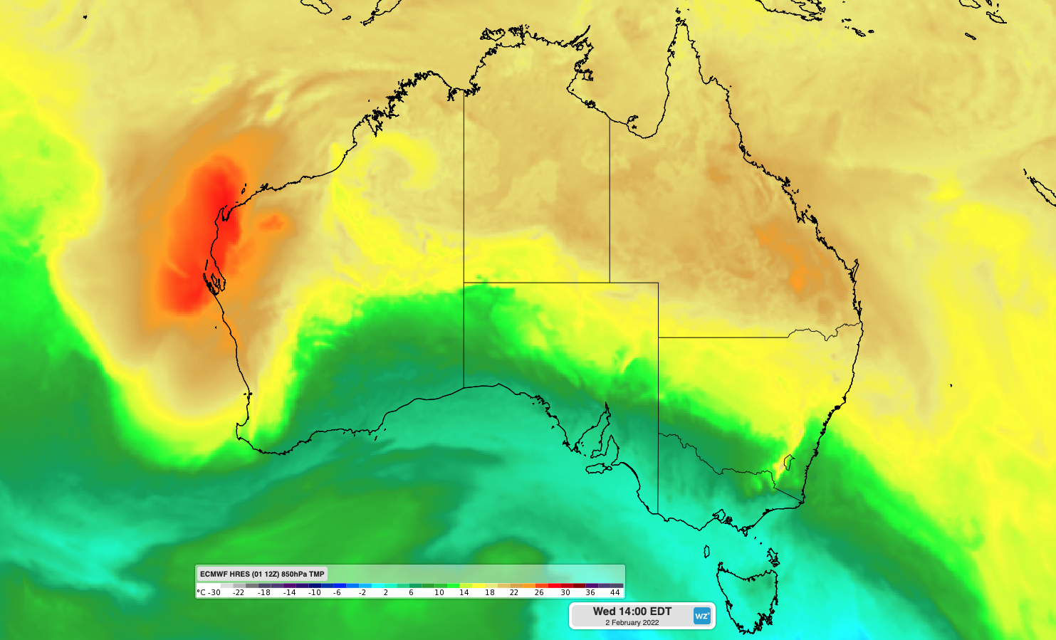
The map below shows the air temperature around 1.5 km above the surface, with a large and hot air mass extending across Queensland.

Image: Forecast 850 hPa temperature (around 1.5 km above sea level) on Wednesday afternoon, according to the ECMWF model.
What is feels like temperature?
The air temperature that you see reported in apps, on computer screens and on TV is an observation measured by a thermometer inside a louvered box called a Stevenson Screens. These Stevenson Screens are used around the world to help standardise temperature observations by keeping the thermometer protected from the wind and out of direct sunlight.
But in reality, there are a number of factors that can affect how hot or cold the temperature actually feels to our bodies.
Wind, relative humidity and direct sunlight can all make it feel hotter or colder than the temperature being observed by a thermometer inside a Stevenson Screen.
On hot days, light winds and high humidity will make it harder for sweat to evaporate from your skin. Because the process of evaporation has a local cooling effect, hot and humid days will limit how efficiently your body can lose heat by sweating.
Today’s warm air in southeast Queensland is coinciding with a perfect cocktail of high relative humidity (lots of moisture in the atmosphere), direct sunshine and light winds. This has been making it feel about 5ºC warmer than the official air temperature on Wednesday morning.

Severe storms in the mix
The abundant atmospheric moisture that’s making Queenslanders sweat today will also provide fuel for thunderstorms.
Showers and storms are possible in every district in Queensland on Wednesday, mainly during the afternoon and early evening.
Severe storms are possible over a broad area of southern, central and northern Queensland on Wednesday, most likely in the southeast. Heavy rainfall with locally intense rain rates will be the main threat with any severe storms, thanks to the huge amounts of moisture in the atmosphere, while damaging winds are also possible.
Be sure to stay up to date with the latest thunderstorm warnings throughout Wednesday if you live in Queensland.