
Boomerang Errol: tropical system could have Kimberley homecoming
A tropical low which developed over the Timor Sea late last week is forecast to intensify into Tropical Cyclone Errol tomorrow, Monday 14th. Over the next few days, Errol will remain offshore, moving west to southwesterly into the Indian Ocean.
While coastal areas of WA's Kimberley region could be affected by winds and showers, most of Errol's impacts should remain offshore.
That is until later this week. Models are picking up a drastic change in Errol’s trajectory from Thursday. The narrative that most models are telling is that Errol will make a 180 degree turn and move back east towards the Kimberley, possibly making landfall over northern WA or ending its journey in the Gulf of Joseph Bonaparte, only a few kilometres away from where the tropical low first started.
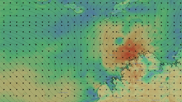
Fig. 1) Animation of Errol’s movement from Sun 13th to Sat 19th, according to ECMWF Sat 12 12Z
This change in direction is due to an upper-level trough forecast to develop later this week. Weather systems, like tropical cyclones, are steered by upper-level winds. As shown in the image below, a stream of strong upper-level winds is likely to push north on the western side of the cyclone. If this happens, it will cut off the cyclones ability to venture further west without being ripped up by the strong winds. Taking the path of least resistance, if the scenario shown in the models plays out, Errol will make a u-turn, pushed along by these upper-level winds and move back towards the Australian shore.
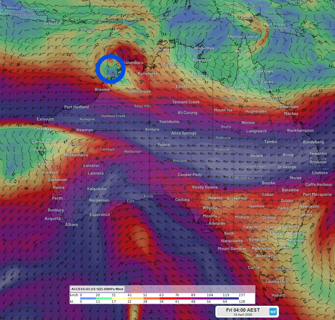
Fig. 2) Forecast of the upper-level winds (300hPa) on Friday 18th 2:00am AWST with a blue ring around the area where Tropical Cyclone Errol is forecast to be, according to ACCESS-G Sat 12 12Z.
As mentioned by Ben Domensino on Friday, tropical cyclones are very difficult to predict and with the changes in tropical lows trajectory being late in the week, there is a high level of uncertainty associated it. However, there is good model consensus with Errol over the next few days, as seen in the image below.
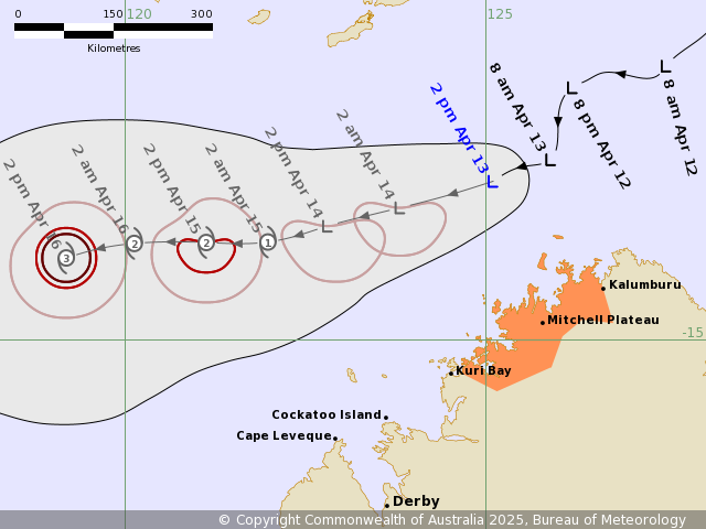
Fig. 3) Current forecast track for Tropical Low 29U by the Bureau of Meteorology (BoM) updated at 2:56pm AWST
For further information about the lows development and associated warnings, please visit here or the BoM’s latest advice.