
Blustery winds blast the southeast
The wild winds we wrote about yesterday have continued to whip through multiple states with some exposed and elevated locations eclipsing 100km/h. Severe Weather Warnings for damaging winds are in place across four states and territories on Sunday afternoon, including the major cities of Sydney, Melbourne, Adelaide, and Canberra.
As is often the case, the tallest peaks and most exposed coastal parts have recorded the highest gusts so far. Below are some of the more notable recorded gusts between Saturday night and early Sunday afternoon:
- Thredbo (NSW) - 114.8km/h
- Mount Buller (VIC) - 113.0km/h
- Neptune Island (SA) - 107.4km/h
- Mount Hotham (VIC) - 107.4km/h
- Hogan Island (VIC) - 105.6km/h
There were some impressive wind gusts outside of the usual suspects as well, with widespread 70km/h gusts recorded. For example, Camden (a suburb in southwestern Sydney), had an 85km/h gust on Sunday morning, which was the highest recorded in over two years.
These strong and potentially damaging winds will continue for southeast South Australia, much of Victoria, southeast New South Wales and Tasmania for the remainder of Sunday. Monday is likely to be the windiest day across much of the southeast, though winds will ease in South Australia throughout the day. Wind gusts of more than 100km/h are likely over elevated and exposed coastal locations once again.
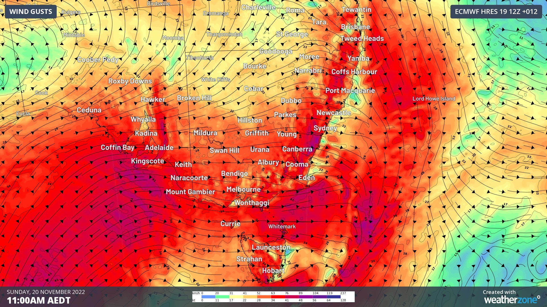
Image: Wind gusts over southeast Australia on Sunday morning according to ECMWF model
There will be an easing trend for the mainland states on Tuesday, though this is likely be the windiest day for Tasmania. Wind gusts exceeding 120km/h are a good chance for peaks and islands around the Apple Isle.
A high-pressure system will begin to assert its dominance over the southeast from Wednesday, allowing conditions to continue to ease.