
Big patches appearing in the snowpack
Two very spring-like weeks in the alpine regions of Victoria, Tasmania and New South Wales have left significant holes in the snowpack, ahead of a potential top-up at higher elevations this weekend.
This was the Friday scene halfway up the Summit T-Bar at mainland Australia's lowest ski area, Mt Baw Baw near Melbourne – and that was before rain arrived later in the afternoon.
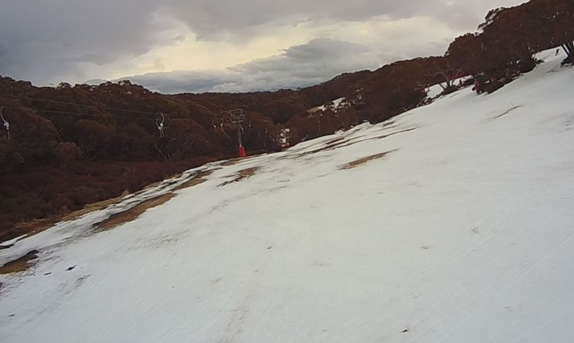
Source: ski.com.au snow cams.
Perisher Valley in NSW recorded two days which topped 10°C this week, and at least three nights where the mercury stayed well above zero overnight – and bear in mind the long-term August average minimum is –3.5°C.
That left slopes at the Guthega part of the resort (below) looking decidedly patchy; Guthega is the only one of the four interlinked resort areas of Perisher that has no snowmaking.
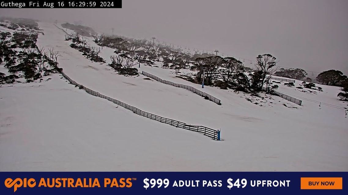
Source: ski.com.au snow cams.
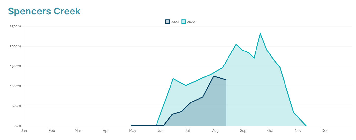
The graph below shows the latest snow depths at Spencers Creek, at an elevation of 1830m roughly halfway between Perisher and Thredbo.
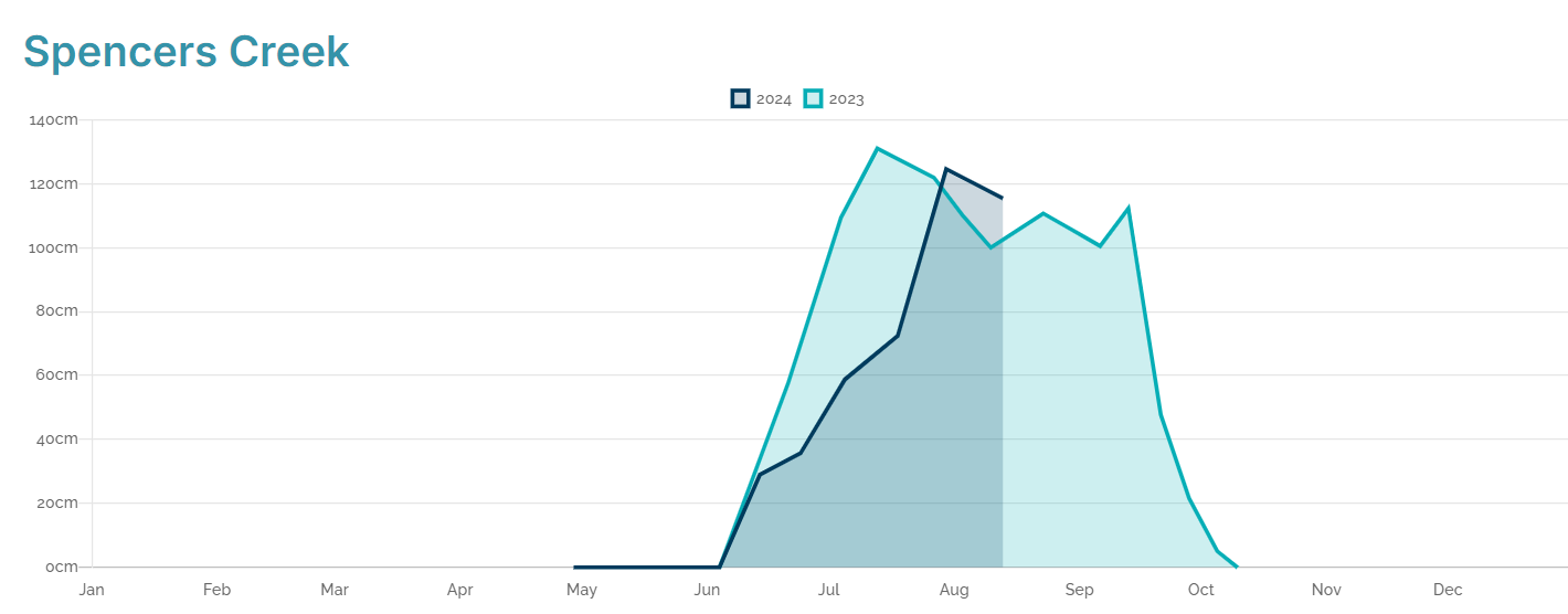
Source: Snowy Hydro.
After a season peak depth to date of 124.6 cm on July 30, the latest reading on August 13 was 115.4 cm. It's likely that around 10 to 20 cm would have been lost since then due to warm temperatures.
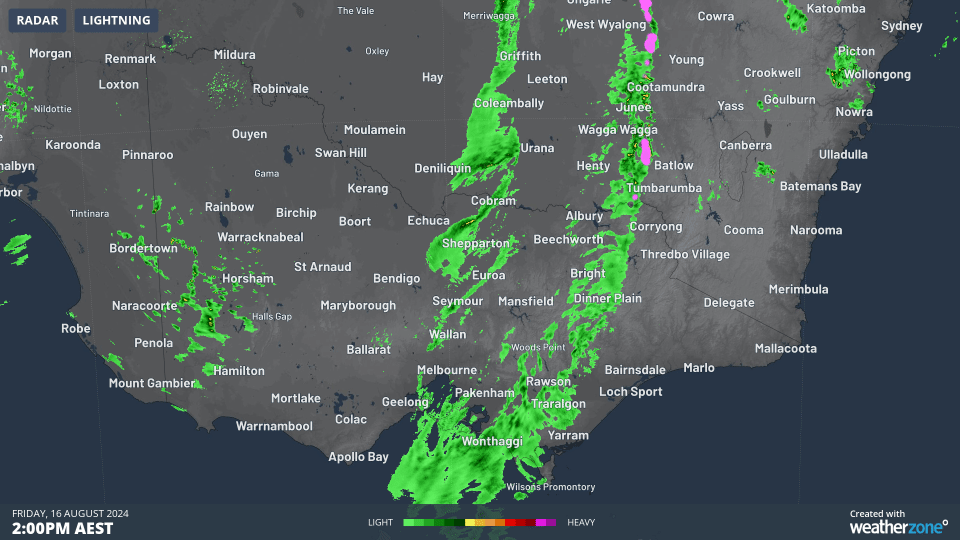
That quick burst of rain on Friday afternoon wouldn't have helped. The two-hour loop below to 4 pm Friday shows the rainband with embedded storms crossing the southeast of the mainland. Temps were several degrees above zero across the mountains as it passed through.
But the news for snow lovers is not all bad.
Snow is expected to fall down to about 1500 or 1600 metres on Saturday with a weak cold front, with rain at lower elevations. That means higher resorts like Thredbo, Perisher and Charlotte Pass (NSW) and Mt Hotham in Victoria can expect a top-up on the higher slopes.
Looking further ahead, another marginal system appears likely to arrive later next week, and there is always the chance the models could upgrade the system.
Despite what has been a disappointing August to date in 2024, it’s worth remembering that peak snow depths in Australia can occur well beyond August. Indeed, as recently as 2022, the healthy season peak of 232 cm was recorded on September 20.
The graph below compares 2024 to date (dark blue) vs 2022 (light blue). There is still time for this season to reach those lofty heights, but the clocking is ticking.
Source: Snowy Hydro.
As ever, please check the latest forecasts, snow cams and more on the Weatherzone snow page.