Australia's heat engine firing up early
Northern WA is sometimes referred to as Australia’s heat engine because of the hot air that develops there when the sun beats down on cloudless deserts and is transported across the country by troughs and cold fronts. Last year we were writing about this in the beginning of summer after a relatively cool spring. What a difference a year can make in Australia!
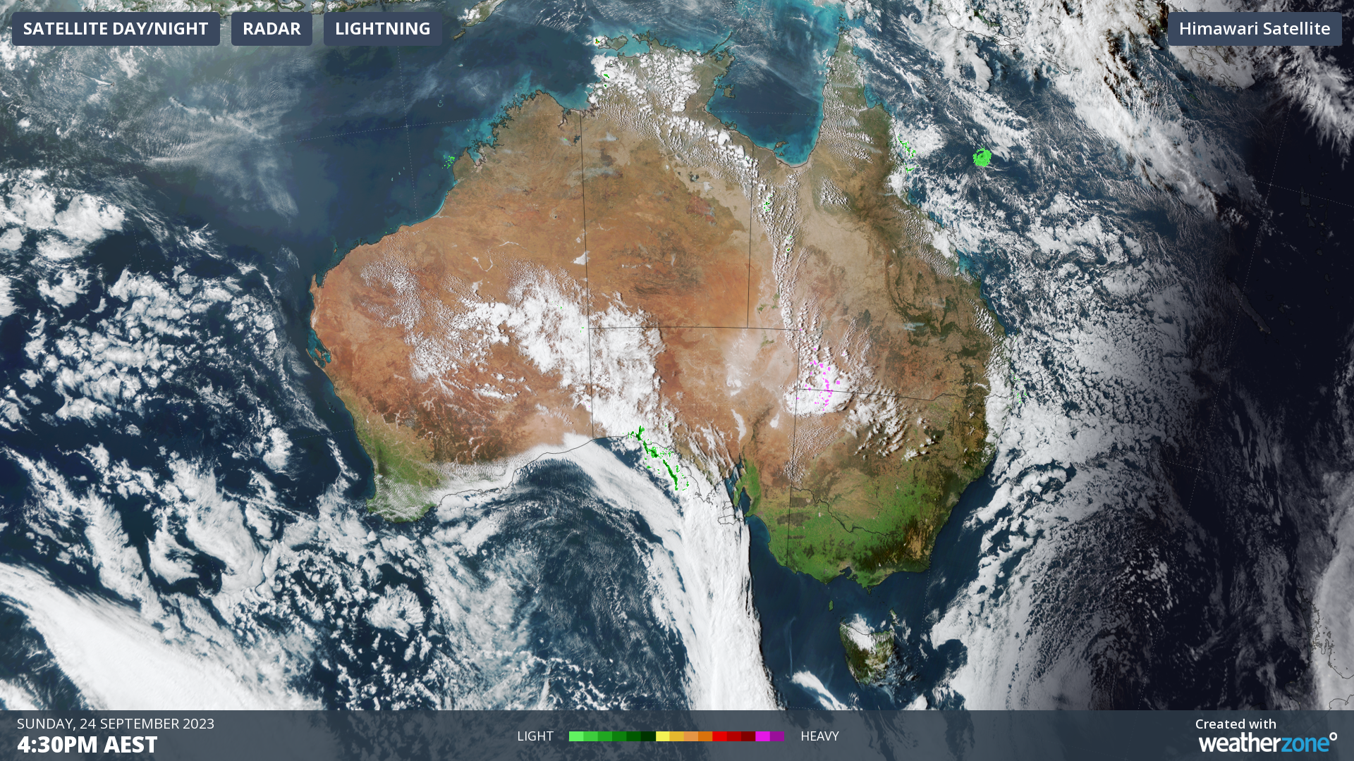
Heat is building over northern WA with several locations exceeding 40°C on Sunday, including Port Hedland and Marble Bar in the Pilbara, which both had their hottest September days in 17 years.

Image: Himawari-9 visible satellite image at 4:30pm AEST Sunday 24th
One of the factors contributing to this difference is the amount of cloud cover. Last year, it was cloudier over much the country including WA during winter and spring due to cloudbands. Much of this year has been lacking in cloud cover compared to average, allowing the ground and air to heat up easier.
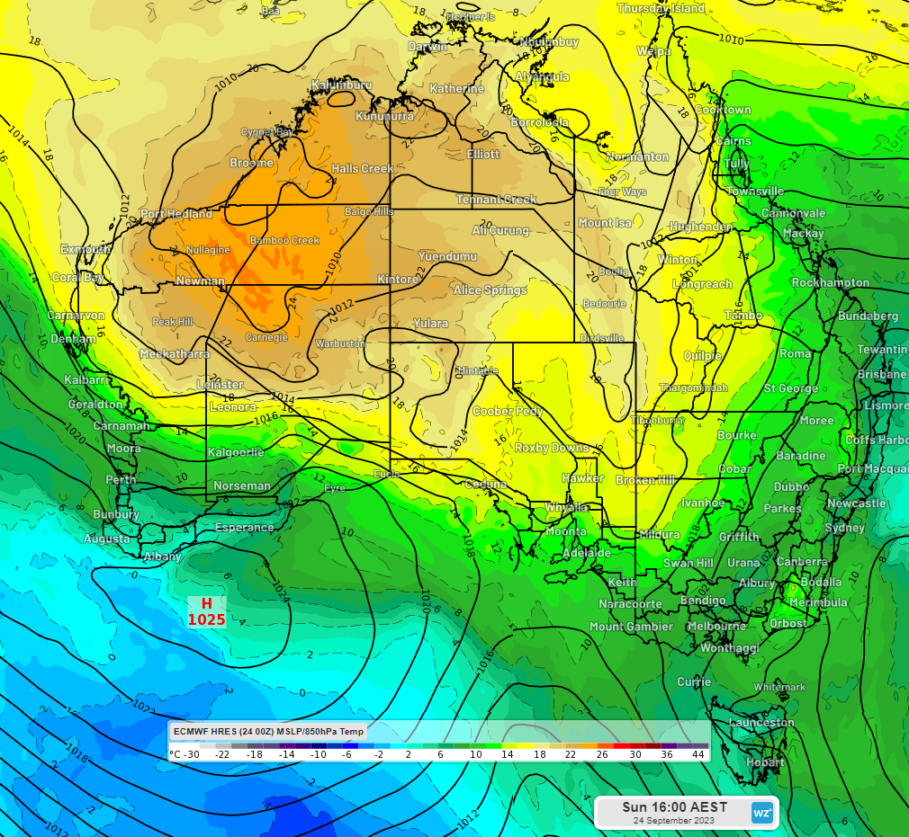
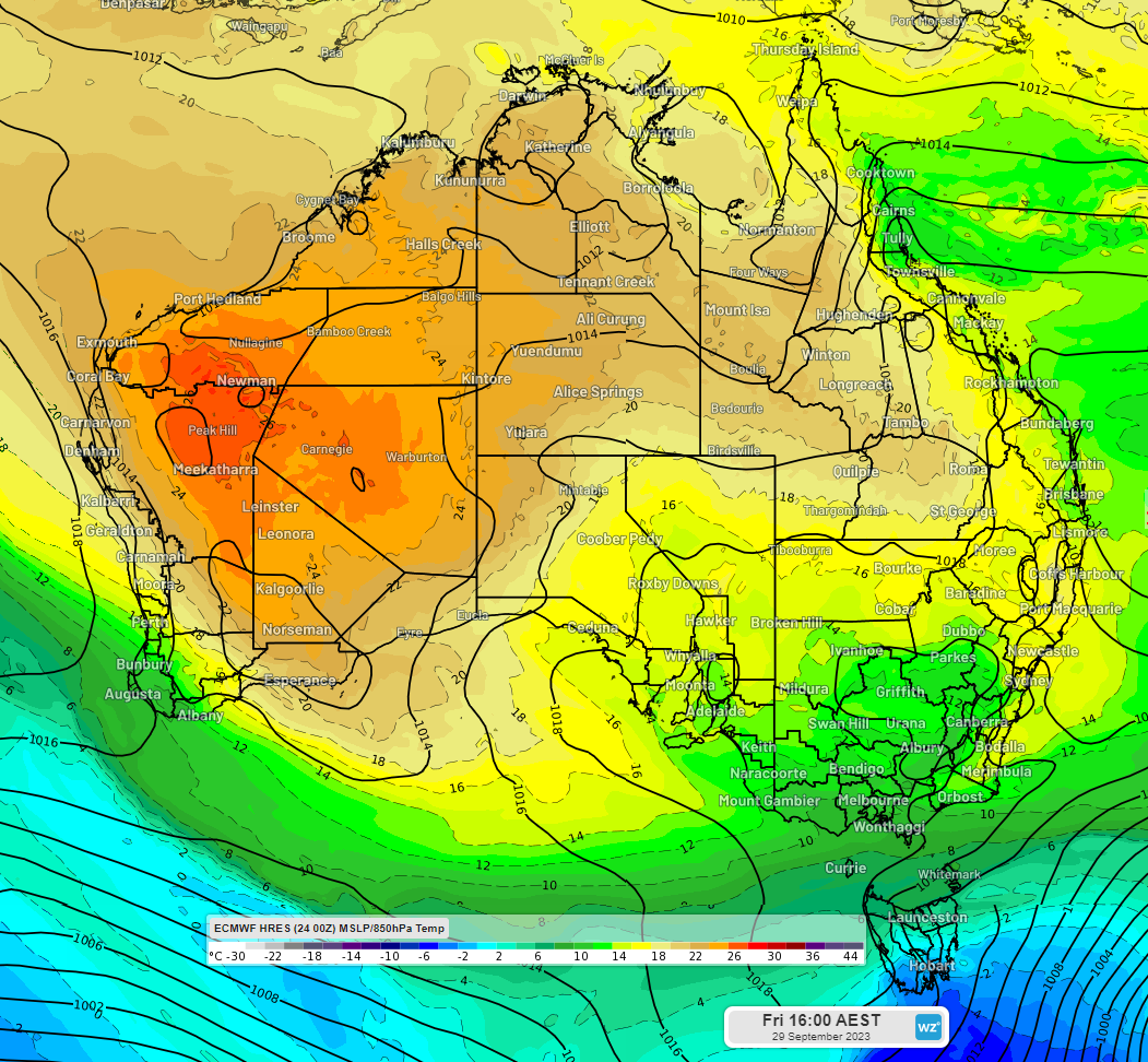
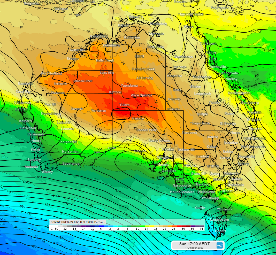
A very hot mass of air will continue to develop over the cloudless deserts of northern WA this week and will spread across the country. The following images show the air temperature at the 850hPa pressure level, or about 1500m above the earth’s surface, for this afternoon, Friday afternoon and next Sunday afternoon.
Notice the mass of hot air over northern WA this afternoon:

Image: Air temperature at 850hPa (about 1.5km) on Sunday 24th at 4pm AEST (ECMWF model)
It will become hotter, and a trough will pull it southward by Friday 29th:

Image: Air temperature at 850hPa (about 1.5km) on Friday 29th at 4pm AEST (ECMWF model)
A trough and a cold front (see the blue in the bottom left) will drag the hot air to southeast Australia next weekend:

Image: Air temperature at 850hPa (about 1.5km) on Sunday 1st at 5pm AEST
As this heat spreads across the country, September and October temperature records may be challenged, and fire weather danger will increase. So please stay up to date with the latest forecasts and warnings.